


Rod Library Maps
This collection contains maps owned by the Rod Library at the University of Northern Iowa.
There are three subcollections:
| Iowa Maps | United States Maps | World Maps |
-

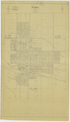
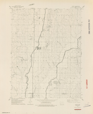
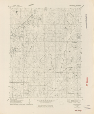
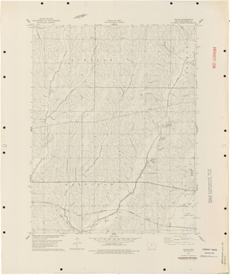
Tama Iowa drawn by F. O. Nelson 1926
1926
Map of Tama showing streets, plats, railroads, rivers, landmarks, and wards.
-

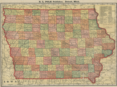
State of Iowa comparative area of the counties & larger cities 1926
1926
Map of the state of Iowa with cities and counties redrawn to compare their relative population size.
-

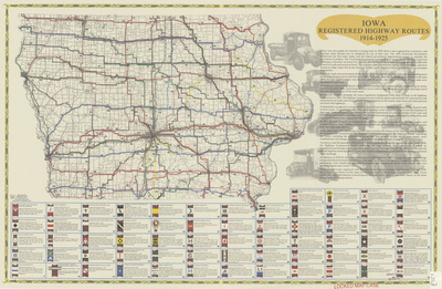
Hammonds auto route distance map Iowa 1925 side 1
1925
Map of the state of Iowa showcasing cities, rivers, highways, and roads. Cities and major intersections highlighted with red squares. Distance between red squares marked in red. Side one.
-

Hammonds auto route distance map Iowa 1925 side 2
1925
Blank side of map with the cover for the map booklet attached to the right. One side of the cover features a drawing of a road and car, and the other advertises the National Surety Company. Side two.
-

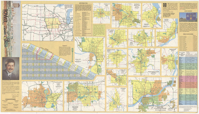
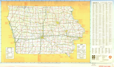
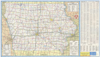
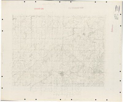
Official map primary road system 1925
1925
Map of the state of Iowa showcasing counties, cities, rivers, railroads, and major roadways. Major roadways are highlighted in red. Several expanded city road maps surround the main map.
-

Nystrom international trade desk map wheat 1924
1924
Map of the world showing lines of import in blue, lines of export in red, and regions of productions. Below the map are charts comparing exporting and importing counties.
-

Fort Madison Iowa 1923
1923
Map of Fort Madison showing streets, railroads, rivers, landmarks, and districts.
-

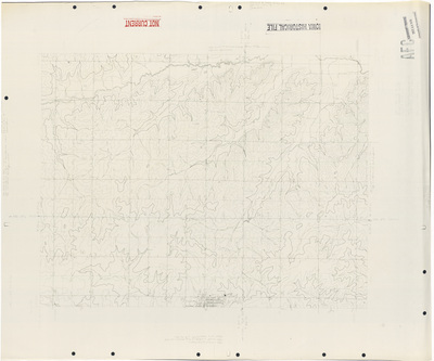
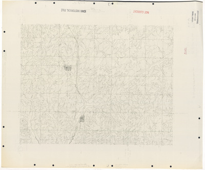
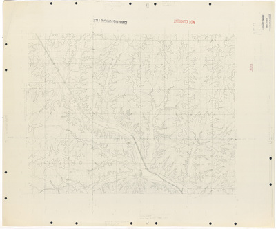
Soil map Harrison County 1923
1923
Map of Harrison County, Iowa showcasing cities, roads, railroads, rivers, landmarks, and soil profiles. Different soil profiles are highlighted different colors.
-

Soil map Plymouth County 1923
1923
Map of Plymouth County, Iowa showcasing cities, roads, railroads, rivers, landmarks, and soil profiles. Different soil profiles are highlighted different colors.
-

Soil map Appanoose County 1923
1923
Map of Appanoose County, Iowa showcasing cities, roads, railroads, rivers, landmarks, and soil profiles. Different soil profiles are highlighted different colors.
-

Soil map Delaware County 1922
1922
Map of Delaware County, Iowa showcasing cities, roads, railroads, rivers, landmarks, and soil profiles. Different soil profiles are highlighted different colors.
-

Soil map Floyd County 1922
1922
Map of Floyd County, Iowa showcasing cities, roads, railroads, rivers, landmarks, and soil profiles. Different soil profiles are highlighted different colors.
-

Soil map Jefferson County sheet 1922
1922
Map of Jefferson County, Iowa showcasing cities, roads, railroads, rivers, landmarks, and soil profiles. Different soil profiles are highlighted different colors.
-

Soil map Winneshiek County 1922
1922
Map of Winneshiek County, Iowa showcasing cities, roads, railroads, rivers, landmarks, and soil profiles. Different soil profiles are highlighted different colors.
-

Soil map Worth County 1922
1922
Map of Worth County, Iowa showcasing cities, roads, railroads, rivers, landmarks, and soil profiles. Different soil profiles are highlighted different colors.
-

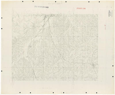
Primary road system State of Iowa 1922
1922
Map of the state of Iowa showcasing counties, cities, rivers, railroads, and major roadways. Major roadways are highlighted in red.
-

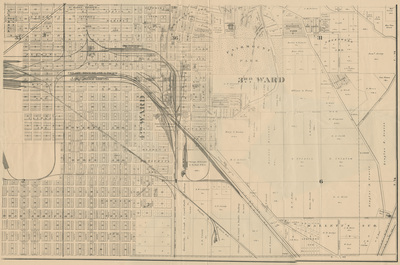
Map of Boone 1921
1921
Map of Boone showcasing rivers, railroads, streets, plats, buildings, wards, and various landmarks. Different areas highlighted different colors.
-

Soil map Des Moines County 1921
1921
Map of Des Moines County, Iowa showcasing cities, roads, railroads, rivers, landmarks, and soil profiles. Different soil profiles are highlighted different colors.
-

Soil map Greene County 1921
1921
Map of Greene County, Iowa showcasing cities, roads, railroads, rivers, landmarks, and soil profiles. Different soil profiles are highlighted different colors.
-

Soil map Grundy County 1921
1921
Map of Grundy County, Iowa showcasing cities, roads, railroads, rivers, landmarks, and soil profiles. Different soil profiles are highlighted different colors.
-

Soil map Jasper County 1921
1921
Map of Jasper County, Iowa showcasing cities, roads, railroads, rivers, landmarks, and soil profiles. Different soil profiles are highlighted different colors.
-

Soil map O'Brien County 1921
1921
Map of O'Brien County, Iowa showcasing cities, roads, railroads, rivers, landmarks, and soil profiles. Different soil profiles are highlighted different colors.
-

Soil map Page County 1921
1921
Map of Page County, Iowa showcasing cities, roads, railroads, rivers, landmarks, and soil profiles. Different soil profiles are highlighted different colors.
-
 Benton County 1921 by United States. Bureau of Soils")
Soil map (2) Benton County 1921
1921
Map of Benton County, Iowa showcasing cities, roads, railroads, rivers, landmarks, and soil profiles. Different soil profiles are highlighted different colors.
-

Soil map Benton County 1921
1921
Map of Benton County, Iowa showcasing cities, roads, railroads, rivers, landmarks, and soil profiles. Different soil profiles are highlighted different colors.
-

Soil map Boone County 1920
1920
Map of Boone County, Iowa showcasing cities, roads, railroads, rivers, landmarks, and soil profiles. Different soil profiles are highlighted different colors.
-

Soil map Dallas County 1920
1920
Map of Dallas County, Iowa showcasing cities, roads, railroads, rivers, landmarks, and soil profiles. Different soil profiles are highlighted different colors.
-

Soil map Dickinson County 1920
1920
Map of Dickinson County, Iowa showcasing cities, roads, railroads, rivers, landmarks, and soil profiles. Different soil profiles are highlighted different colors.
-

Soil map Dubuque County 1920
1920
Map of Dubuque County, Iowa showcasing cities, roads, railroads, rivers, landmarks, and soil profiles. Different soil profiles are highlighted different colors.
-

Soil map Emmet County 1920
1920
Map of Emmet County, Iowa showcasing cities, roads, railroads, rivers, landmarks, and soil profiles. Different soil profiles are highlighted different colors.
-

Soil map Hardin County 1920
1920
Map of Hardin County, Iowa showcasing cities, roads, railroads, rivers, landmarks, and soil profiles. Different soil profiles are highlighted different colors.
-

Soil map Mills County 1920
1920
Map of Mills County, Iowa showcasing cities, roads, railroads, rivers, landmarks, and soil profiles. Different soil profiles are highlighted different colors.
-

Soil map Woodbury County 1920
1920
Map of Woodbury County, Iowa showcasing cities, roads, railroads, rivers, landmarks, and soil profiles. Different soil profiles are highlighted different colors.
-

Fort Madison Iowa 1919
1919
Map of Fort Madison showing streets, railroads, rivers, landmarks, and districts.
-

Soil map Adair County 1919
1919
Map of Adair County, Iowa showcasing cities, roads, railroads, rivers, landmarks, and soil profiles. Different soil profiles are highlighted different colors.
-

Soil map Cedar County 1919
1919
Map of Cedar County, Iowa showcasing cities, roads, railroads, rivers, landmarks, and soil profiles. Different soil profiles are highlighted different colors.
-

Soil map Fayette County 1919
1919
Map of Fayette County, Iowa showcasing cities, roads, railroads, rivers, landmarks, and soil profiles. Different soil profiles are highlighted different colors.
-

Soil map Wright County 1919
1919
Map of Wright County, Iowa showcasing cities, roads, railroads, rivers, landmarks, and soil profiles. Different soil profiles are highlighted different colors.
-

Soil map Mahaska County 1919
1919
Map of Mahaska County, Iowa showcasing cities, roads, railroads, rivers, landmarks, and soil profiles. Different soil profiles are highlighted different colors.
-

Map of the western theatre of war by A. H. Bumstead 1918
1918
Map of the Western theatre of war showcasing countries, cities, rivers, railroads, and tram lines. To the right of the map is a smaller, expanded view of the map.
-

Soil map Louisa County 1918
1918
Map of Louisa County, Iowa showcasing cities, roads, railroads, rivers, landmarks, and soil profiles. Different soil profiles are highlighted different colors.
-

Soil map Madison County 1918
1918
Map of Madison County, Iowa showcasing cities, roads, railroads, rivers, landmarks, and soil profiles. Different soil profiles are highlighted different colors.
-

Soil map Marshall County 1918
1918
Map of Marshall County, Iowa showcasing cities, roads, railroads, rivers, landmarks, and soil profiles. Different soil profiles are highlighted different colors.
-

Soil map Palo Alto County 1918
1918
Map of Palo Alto County, Iowa showcasing cities, roads, railroads, rivers, landmarks, and soil profiles. Different soil profiles are highlighted different colors.
-

Soil map Polk County 1918
1918
Map of Polk County, Iowa showcasing cities, roads, railroads, rivers, landmarks, and soil profiles. Different soil profiles are highlighted different colors.
-

Soil map Wayne County 1918
1918
Map of Wayne County, Iowa showcasing cities, roads, railroads, rivers, landmarks, and soil profiles. Different soil profiles are highlighted different colors.
-

Soil map Winnebago County 1918
1918
Map of Winnebago County, Iowa showcasing cities, roads, railroads, rivers, landmarks, and soil profiles. Different soil profiles are highlighted different colors.
-
")
Iowa by U. S. Geological Survey 1917
1917
Map of the state of Iowa showcasing counties, cities, rivers, and railroads.
-

Soil map Buena Vista County 1917
1917
Map of Buena Vista County, Iowa showcasing cities, roads, railroads, rivers, landmarks, and soil profiles. Different soil profiles are highlighted different colors.
-

Soil map Hamilton County 1917
1917
Map of Hamilton County, Iowa showcasing cities, roads, railroads, rivers, landmarks, and soil profiles. Different soil profiles are highlighted different colors.
-

Soil map Henry County sheet 1917
1917
Map of Henry County, Iowa showcasing cities, roads, railroads, rivers, landmarks, and soil profiles. Different soil profiles are highlighted different colors.
-

Soil map Linn County 1917
1917
Map of Linn County, Iowa showcasing cities, roads, railroads, rivers, landmarks, and soil profiles. Different soil profiles are highlighted different colors.
-

Soil map Montgomery County 1917
1917
Map of Montgomery County, Iowa showcasing cities, roads, railroads, rivers, landmarks, and soil profiles. Different soil profiles are highlighted different colors.
-

Soil map Wapello County 1917
1917
Map of Wapello County, Iowa showcasing cities, roads, railroads, rivers, landmarks, and soil profiles. Different soil profiles are highlighted different colors.
-

Soil map Clay County 1916
1916
Map of Clay County, Iowa showcasing cities, roads, railroads, rivers, landmarks, and soil profiles. Different soil profiles are highlighted different colors.
-

Soil map Mitchell County 1916
1916
Map of Mitchell County, Iowa showcasing cities, roads, railroads, rivers, landmarks, and soil profiles. Different soil profiles are highlighted different colors.
-

Soil map Ringgold County 1916
1916
Map of Ringgold County, Iowa showcasing cities, roads, railroads, rivers, landmarks, and soil profiles. Different soil profiles are highlighted different colors.
-

Geologic map of Iowa 1914
1914
Map of the state of Iowa showcasing counties, cities, rivers, and railroads. Areas made up of different geologic features are highlighted different colors.
-

Map of Iowa showing drift sheets 1914
1914
Map of the state of Iowa showcasing counties, cities, and rivers. Areas covered by different drift sheets are highlighted different colors.
-

Soil map Bremer County 1913
1913
Map of Bremer County, Iowa showcasing cities, roads, railroads, rivers, and soil profiles. Different soil profiles are highlighted different colors.
-
")
Topographic map of the Yellowstone Nat'l. Park 1912
1-1912
Topographic map of Yellowstone National Park showcasing roads, railroads, rivers, lakes, landmarks, and elevations. Water features marked in blue and elevations marked in red.
-

Iowa by George F. Cram 1910
1910
Map of the state of Iowa showcasing counties, cities, rivers, and railroads. Different counties are highlighted different colors.
-
")
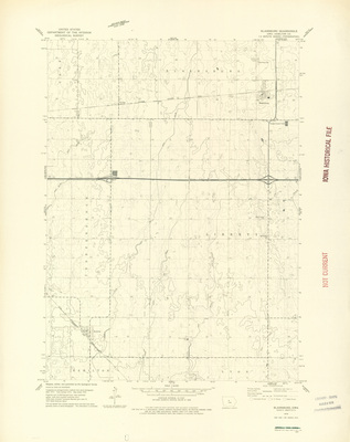
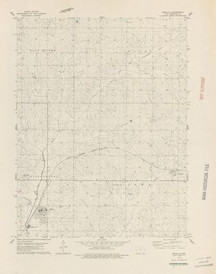
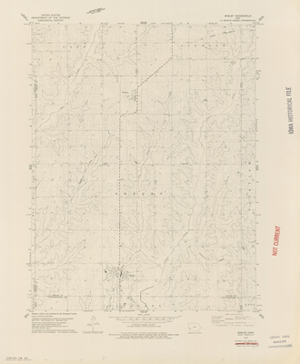
Milo Quadrangle by USGS 1910 side 1
1910
Topographical map of the area around Milo, Iowa showcasing townships, cities, roads, railroads, elevations, rivers, and landmarks. Side one.
-
")
Milo Quadrangle by USGS 1910 side 2
1910
An essay on the topographic mapping being done by the United States Geological Survey. A legend of standard symbols is at the bottom of the page. Side two.
-

Automobile route and topical road map of SE Iowa
1909
Map of south-eastern Iowa showcasing counties, cities, rivers, railroads, roads, and other landmarks. Major roads highlighted in red.
-

Map of the City of Cedar Rapids 1909
1909
Map of Fort Madison showing streets, railroads, rivers, buildings, and landmarks. Below the map is an index to streets, public buildings, parks, etc.
-

Map of the City of Waterloo by Iowa Publ. 1908 sheet 1
1908
Part of a map of the city of Waterloo showcasing streets, buildings, plats, railroads, rivers, wards, and other landmarks. Sheet one.
-

Map of the City of Waterloo by Iowa Publ. 1908 sheet 2
1908
Part of a map of the city of Waterloo showcasing streets, buildings, plats, railroads, rivers, wards, and other landmarks. Sheet two.
-

Map of the City of Waterloo by Iowa Publ. 1908 sheet 3
1908
Part of a map of the city of Waterloo showcasing streets, buildings, plats, railroads, rivers, wards, and other landmarks. Sheet three.
-

Map of the City of Waterloo by Iowa Publ. 1908 sheet 4
1908
Part of a map of the city of Waterloo showcasing streets, buildings, plats, railroads, rivers, wards, and other landmarks. To the right of map is an index of plats, additions, and subdivisions. Sheet four.
-

Map of the City of Waterloo by Iowa Publ. 1908 sheet 5
1908
Part of a map of the city of Waterloo showcasing streets, buildings, plats, railroads, rivers, wards, and other landmarks. Sheet five.
-

Map of the City of Waterloo by Iowa Publ. 1908 sheet 6
1908
Part of a map of the city of Waterloo showcasing streets, buildings, plats, railroads, rivers, wards, and other landmarks. To the right of map is an index of plats, additions, and subdivisions. Sheet six.
-

Map of the City of Waterloo by Iowa Publ. 1908 sheet 7
1908
Part of a map of the city of Waterloo showcasing streets, buildings, plats, railroads, rivers, wards, and other landmarks. Sheet seven.
-

Map of the City of Waterloo by Iowa Publ. 1908 sheet 8
1908
Part of a map of the city of Waterloo showcasing streets, buildings, plats, railroads, rivers, wards, and other landmarks. Below the map is an index of streets and an index to public buildings and parks. Sheet eight.
-

Cram's superior map of Iowa 1908 side 1
1908
Map of the state of Iowa showcasing counties, cities, rivers, and railroads. Different counties are highlighted different colors. Side one.
-

Cram's superior map of Iowa 1908 side 2
1908
Index of Iowa railroads, electric railroads, steamship lines, counties, and towns. Side two.
-

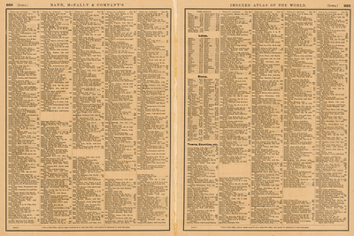
Iowa and Minnesota pages from Atlas of the World 1908
1908
Map of the state of Iowa showcasing counties, cities, rivers, and railroads. Different counties are highlighted different colors. To the top and left of the map is an index of Iowa counties and towns.
-
")
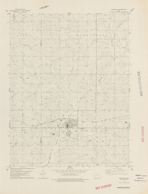
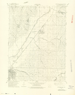
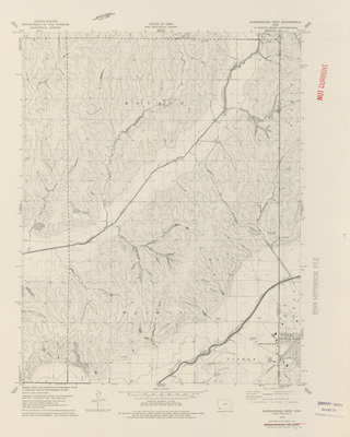
Waukee Quadrangle by USGS 1908 side 1
1908
Topographical map of the area around Waukee, Iowa showcasing townships, cities, roads, railroads, elevations, rivers, and landmarks. Side one.
-
")
Waukee Quadrangle by USGS 1908 side 2
1908
An essay on the topographic mapping being done by the United States Geological Survey. A legend of standard symbols is at the bottom of the page. Side two.
-

Map of Cedar Falls by Iowa Publ. 1908 sheet 1
1908
Part of a map of the city of Cedar Falls showcasing streets, buildings, plats, railroads, rivers, wards, and other landmarks. Sheet one.
-

Map of Cedar Falls by Iowa Publ. 1908 sheet 2
1908
Part of a map of the city of Cedar Falls showcasing streets, buildings, plats, railroads, rivers, wards, and other landmarks. Sheet two.
-

Map of Cedar Falls by Iowa Publ. 1908 sheet 3
1908
Part of a map of the city of Cedar Falls showcasing streets, buildings, plats, railroads, rivers, wards, and other landmarks. To the left of map is an index of plats, additions, and subdivisions. Sheet three.
-

Map of Cedar Falls by Iowa Publ. 1908 sheet 4
1908
Part of a map of the city of Cedar Falls showcasing streets, buildings, plats, railroads, rivers, wards, and other landmarks. To the right of the map is an index of streets and an index to public buildings. Sheet four.
-
")
Nebraska City Quadrangle by USGS 1907
1907
Topographical map of the area around Nebraska City, Nebraska showcasing townships, cities, roads, railroads, elevations, rivers, and landmarks. Side one.
-

Rand McNally vest pocket map of Iowa part 1
1907
Map of the state of Iowa showcasing counties, cities, rivers, and railroads. Different counties are highlighted different colors. Below the map is an index of Iowa railroads and to the left of the map is an index of chief Iowa cities. Side one.
-

Rand McNally vest pocket map of Iowa part 2
1907
An index of Iowa counties, creeks, lakes, rivers, and towns. Side two.
-

Floral areas of the State of Washington by Charles Piper 1906
1906
Map of the state of Washington showcasing counties, cities, rivers, and railroads. Different areas of the map are highlighted based on their floral area.
-

Map of the World 1905
1905
Map of the world with different countries highlighted different colors, and the international date line and sailing routes marked in red. Surrounding the map are various lists of global statistics, and at the top of the page is a world population index.
-

Iowa by George F. Cram 1904
1904
Map of the state of Iowa showcasing counties, cities, rivers, and railroads. Different counties are highlighted different colors.
-

Topographical map of Pottawattamie County 1904
1904
Topographical map of Pottawattamie County, Iowa showcasing townships, cities, roads, railroads, rivers, and landmarks.
-

Topographical map of Sioux County 1904
1904
Topographical map of Sioux County, Iowa showcasing townships, cities, roads, railroads, rivers, and landmarks.
-

Topographical map of Winnebago County Iowa 1904
1904
Topographical map of Winnebago County, Iowa showcasing townships, cities, roads, railroads, rivers, and landmarks.
-

Topographical map of Adair County Iowa 1904
1904
Topographical map of Adair County, Iowa showcasing townships, cities, roads, railroads, rivers, and landmarks.
-

Map of Iowa 1904 prepared & printed for the railroad commissioners
1904
Map of the state of Iowa showcasing counties, townships, cities, rivers, and railroads. Different railroads are highlighted different colors.
-

Iowa map by B. H. Welp
1904
Map of the state of Iowa showcasing counties, cities, rivers, and railroads. Different counties are highlighted different colors. To the left of the map is a list of 'Chief Cities' in Iowa.
-

Red Wing Adv. Companys map of Iowa
1904
Map of the state of Iowa showcasing counties, cities, rivers, and railroads. Different counties are highlighted different colors.
-

Iowa 1905
1904
Map of the state of Iowa showcasing counties, cities, towns, railroads, county seats, and the state capitol. Different counties are highlighted different colors.
-

Soil map Tama County 1904
1904
Map of Tama County, Iowa showcasing cities, roads, railroads, rivers, elevations, and soil profiles. Different soil profiles are highlighted different colors.
-

Fort Madison Iowa 1903
1903
Map of Fort Madison showing streets, railroads, rivers, landmarks, and districts.
-
")
Waukon Quadrangle by USGS 1903
1903
Topographical map of the area around Waukon, Iowa showcasing townships, cities, roads, railroads, elevations, rivers, and landmarks.
-
")
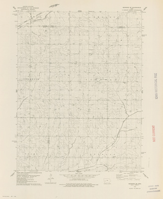
Winthrop Quadrangle by USGS 1903 side 1
1903
Topographical map of the area around Winthrop, Iowa showcasing townships, cities, roads, railroads, elevations, rivers, and landmarks. Side one.
-
")
Winthrop Quadrangle by USGS 1903 side 2
1903
An essay on the topographic mapping being done by the United States Geological Survey. A legend of standard symbols is at the bottom of the page. Side two.
-

Topographical map of Delaware County 1903
1903
Topographical map of Delaware County, Iowa showcasing townships, cities, roads, railroads, rivers, and landmarks.
-

Topographical map of Keokuk County 1903
1903
Topographical map of Keokuk County, Iowa showcasing townships, cities, roads, railroads, rivers, and landmarks.
-

Topographical map of Monona County Iowa 1903
1903
Topographical map of Monona County, Iowa showcasing townships, cities, roads, railroads, rivers, and landmarks.
-

Topographical map of Van Buren County Iowa 1903
1903
Topographical map of Van Buren County, Iowa showcasing townships, cities, roads, railroads, rivers, and landmarks.
-

Topographical map of Winneshiek County Iowa 1903
1903
Topographical map of Winneshiek County, Iowa showcasing townships, cities, roads, railroads, rivers, and landmarks.
-

Topographical map of Allamakee County 1903
1903
Topographical map of Allamakee County, Iowa showcasing townships, cities, roads, railroads, rivers, and landmarks.
-

Topographical map of Clayton County 1903
1903
Topographical map of Clayton County, Iowa showcasing townships, cities, roads, railroads, rivers, and landmarks.
-

Topographical map of Cerro Gordo County 1903
1903
Topographical map of Cerro Gordo County, Iowa showcasing townships, cities, roads, railroads, rivers, and landmarks.
-

Topographical map of Chickasaw County 1903
1903
Topographical map of Chickasaw County, Iowa showcasing townships, cities, roads, railroads, rivers, and landmarks.
-

Matthews-Northrup up-to-date map of Iowa
1903
Map of the state of Iowa showcasing counties, cities, rivers, and railroads.
-

Rand McNally and Co.'s Iowa part 1
1903
Map of the state of Iowa showcasing counties, cities, rivers, and railroads. Different counties are highlighted different colors. To the left of the map is a list of 'Chief Cities' in Iowa. Side one.
-

Rand McNally and Co.'s Iowa part 2
1903
An index of towns in Iowa, from 'Ab' to 'Ba' on the bottom right page and from 'Ba' to 'Fr' on the left page. On the right, an index of railroads in Iowa, and indexes of counties, creeks, lakes, and rivers in Iowa.
-

Dominion of Canada and Newfoundland 1902
1902
Map of Canada and Newfoundland showing rivers, provinces, territories, cities, railroads, steamship routes, and submarine cables.
-

North America 1902
1902
Map of the North American continent showcasing various explorers' routes throughout time. Different countries are highlighted different colors.
-

Allen rate map of Iowa
1902
Map of the state of Iowa showcasing railroads and shipping routes, with codes showing shipping rates marked at various cities. Surrounding the map of indexes of towns in Iowa and various rate charts.
-

Iowa by George F. Cram 1902 side 1
1902
Map of the state of Iowa showcasing counties, cities, rivers, and railroads. Different counties are highlighted different colors, and the state is outlined in red. Side one.
-

Iowa by George F. Cram 1902 side 2
1902
Map of the United States of America showcasing states and territories, rivers, mountains, railroads, and cities. Different states and territories highlighted different colors. Side two.
-

Topographical map of Clinton County 1902
1902
Topographical map of Clinton County, Iowa showcasing townships, cities, roads, railroads, rivers, and landmarks.
-

Topographical map of Des Moines County 1902
1902
Topographical map of Des Moines County, Iowa showcasing townships, cities, roads, railroads, rivers, and landmarks. Map is surrounded by local advertisements.
-

Topographical map of Humboldt County 1902
1902
Topographical map of Humboldt County, Iowa showcasing townships, cities, roads, railroads, rivers, and landmarks. Map is surrounded by local advertisements.
-

Topographical map of Jackson County 1902
1902
Topographical map of Jackson County, Iowa showcasing townships, cities, roads, railroads, rivers, and landmarks. Map is surrounded by local advertisements.
-

Topographical map of Linn County 1902
1902
Topographical map of Linn County, Iowa showcasing townships, cities, roads, railroads, rivers, and landmarks.
-

Topographical map of Muscatine & Louisa Counties 1902 by Iowa State Atlas Pub'l. Co.
1902
Topographical map of Muscatine and Lousia Counties, Iowa showcasing townships, cities, roads, railroads, rivers, and landmarks. The counties are highlighted two different colors.
-

Topographical map of Muscatine & Louisa Counties 1902 by Iowa State Atlas Pub'l. Co.
1902
Topographical map of Muscatine and Lousia Counties, Iowa showcasing townships, cities, roads, railroads, rivers, and landmarks. The counties are highlighted two different colors.
-

Topographical map of Ringgold County Iowa 1902
1902
Topographical map of Ringgold County, Iowa showcasing townships, cities, roads, railroads, rivers, and landmarks.
-

Iowa by R. S. Peale
1902
Map of the state of Iowa showcasing counties, cities, rivers, and railroads. Different counties are highlighted different colors.
-

Mendenhalls road map of Iowa side 1
1902
Map of the state of Iowa showcasing counties, cities, rivers, roads, and railroads. Main touring routes are outlined in red. In the top right, an expanded road map of Polk county. Side one.
-

Mendenhalls road map of Iowa side 2
1902
Advertisements for road maps of other states, including Missouri, Iowa, Minnesota, Kentucky, Indiana, and Ohio. Side two.
-

Iowa page from the Rand McNally Business Atlas side 1
1902
Map of the state of Iowa showcasing counties, cities, rivers, and railroads. Different counties are highlighted different colors. Below the map is an index of Iowa railroads. Side one.
-

Iowa page from the Rand McNally Business Atlas side 2
1902
Right side is the cover of the 'Rand McNally & Co's Enlarged Business Atlas Maps'. Left side is an advertisement for the 'Business Atlas and Shippers' Guide'. Side two.
-

Soil map Dubuque County 1902
1902
Map of Dubuque County, Iowa showcasing cities, roads, railroads, rivers, elevations, and soil profiles. Different soil profiles are highlighted different colors.
-
")
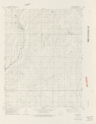
Peosta Quadrangle by USGS 1901 side 1
1901
Topographical map of the area around Peosta, Iowa showcasing townships, cities, roads, railroads, elevations, rivers, and landmarks. Side one.
-
")
Peosta Quadrangle by USGS 1901 side 2
1901
An essay on the topographic mapping being done by the United States Geological Survey. A legend of standard symbols is at the bottom of the page. Side two.
-
")
Stanwood Quadrangle by USGS 1901 side 1
1901
Topographical map of the area around Stanwood, Iowa showcasing townships, cities, roads, railroads, elevations, rivers, and landmarks. Side one.
-
")
Stanwood Quadrangle by USGS 1901 side 2
1901
An essay on the topographic mapping being done by the United States Geological Survey. A legend of standard symbols is at the bottom of the page. Side two.
-

Iowa by Kenyon Printing side 1
1-1901
Map of the state of Iowa showcasing counties, cities, rivers, and railroads. Different counties are highlighted different colors, and districts are outlined in red. To the left of the map is a population index of Iowa counties. Side one.
-

Iowa by Kenyon Printing side 2
1-1901
A population index of all towns over 200 people in Iowa. On the right side, there is a population index for states and territories in the United States and a table of general statistics for Iowa. Side two.
-

Iowa prepared for National Newspaper Directory
1900
Map of the state of Iowa showcasing counties, cities, rivers, and railroads. Different counties are highlighted different colors.
-

Iowa by George F. Cram 1899 side 1
1899
Map of the state of Iowa showcasing counties, cities, rivers, and railroads. Different railroad lines are highlighted different colors. Surrounding the map is an index of other maps. Side one.
-

Iowa by George F. Cram 1899 side 2
1899
An index of Iowa towns and their closest train station. Index runs from 'So' to 'Zw'. Side two.
-

Iowa by J. W. White side 1
1899
Map of the state of Iowa showcasing counties, cities, rivers, and railroads. Different counties are highlighted different colors. To the left of the map is an index of Iowa counties. Side one.
-

Iowa by J. W. White side 2
1899
Paragraphs of text explaining how the railroad lines are indicated on the front of the map. Side two.
-

Submarine cable connections of the world 1898
1898
Map of the world with submarine and some overland cables marked in red. Below the map is an index of the countries and companies who own the cables.
-
")
Omaha & Vicinity Quadrangle by USGS 1898
1898
Topographical map of Omaha, Nebraska and Council Bluffs, Iowa. Contour intervals are marked in red, roads are marked in grey, and water features are marked in blue.
-

Iowa page from Rand McNally Atlas of the World
1898
Map of the state of Iowa showcasing counties, cities, rivers, and railroads. Different counties are highlighted different colors.
-

Tate's map of Des Moines 1898
1898
Map of Des Moines showcasing rivers, railroads, streets, buildings, districts, wards, and various landmarks. Districts are outlined in red and wards are outlined in blue.
-

Map of the Des Moines Northern & Western RR 1897
1897
Map of the Des Moines Northern and Western railroad showcasing the arrival and departure times at each stop.
-

Galbraiths Railway Mail Service Maps Iowa 1897 side 1
1897
A map of the northwestern section of Iowa showcasing the different railroad routes and stops. Each city with a train station has a small illustration related to the name of the city. Side one.
-

Galbraiths Railway Mail Service Maps Iowa 1897 side 2
1897
Paragraphs of text relating to the "Galbraith's Railway Mail Service Maps" explaining how their maps and map rental system work. Side two.
-

Map showing the principal meridians and base lines in the U.S. side 2
1895
On the left side, paragraphs of text explaining the "Road Laws of Iowa, Illinois, and Nebraska". To the right, paragraphs of text explaining "The System of Government Surveys".
-

Map showing the principal meridians and base lines in the U.S. side 1
1895
Map of the United States featuring principle meridian lines highlighted in red showcasing different time zones. Different states and territories are highlighted different colors. To the left of the map are diagrams explaining how areas on a map are divided. Side one.
-

Iowa by Rand McNally 1895
1895
Map of the state of Iowa showcasing counties, cities, rivers, and railroads. Different counties are highlighted different colors. To the left of the map is an index of Iowa counties.
-

Iowa by Matthews-Northrup side 1
1895
Map of the state of Iowa showcasing counties, cities, rivers, and railroads. Different counties are highlighted different colors. To the top of the map is a small attached sheet of 'Explanatory' text. Side one.
-

Iowa by Matthews-Northrup side 2
1895
A population index of counties and towns in Iowa, an index of rivers in Iowa. In the bottom middle, the red cover for the map with title, explanatory information, and ads. Side two.
-

Pocket map and shipper's guide of Iowa
1894
Map of the state of Iowa showcasing counties, cities, rivers, and railroads. Different counties are highlighted different colors.
-

Rand McNally & Co.'s sectional map of Iowa 1894
1894
Map of the state of Iowa showcasing counties, townships, cities, rivers, and railroads. Different counties are highlighted different colors.
-

Cowell's time and longitude chart
1893
Map of the world featuring longitudes, information about the meridian line, and the international date line. Each continent is highlighted a different color.
-

Schreiner's map of Des Moines 1893 sheet 1
1893
Map of Des Moines showcasing rivers, railroads, streets, plats, buildings, wards, and various landmarks. Different subdivisions highlighted different colors. Sheet 1.
-

Schreiner's map of Des Moines 1893 sheet 2
1893
Map of Des Moines showcasing rivers, railroads, streets, plats, buildings, wards, and various landmarks. Different subdivisions highlighted different colors. Sheet 2.
-

Schreiner's map of Des Moines 1893 sheet 3
1893
Map of Des Moines showcasing rivers, railroads, streets, plats, buildings, wards, and various landmarks. Different subdivisions highlighted different colors. Sheet 3.
-

Schreiner's map of Des Moines 1893 sheet 4
1893
Map of Des Moines showcasing rivers, railroads, streets, plats, buildings, wards, and various landmarks. Different subdivisions highlighted different colors. Sheet 4.
-

Schreiner's map of Des Moines 1893 sheet 5
1893
Map of Des Moines showcasing rivers, railroads, streets, plats, buildings, wards, and various landmarks. Different subdivisions highlighted different colors. Sheet 5.
-

Schreiner's map of Des Moines 1893 sheet 6
1893
Map of Des Moines showcasing rivers, railroads, streets, plats, buildings, wards, and various landmarks. Different subdivisions highlighted different colors. Sheet 6.
-

Schreiner's map of Des Moines 1893 sheet 7
1893
Map of Des Moines showcasing rivers, railroads, streets, plats, buildings, wards, and various landmarks. Different subdivisions highlighted different colors. Sheet 7.
-

Schreiner's map of Des Moines 1893 sheet 8
1893
Map of Des Moines showcasing rivers, railroads, streets, plats, buildings, wards, and various landmarks. Different subdivisions highlighted different colors. Sheet 8.
-

Map of the City of Lyons 1892
1892
Map of Lyons showcasing rivers, railroads, streets, plats, buildings, wards, and various landmarks. Wards are outlined in blue. To the right of the map is the layout of the cemetery.
-

Map of Sioux City 1892 by John Newcomb sheet 1
1892
Map of Sioux City showcasing rivers, railroads, streets, plats, buildings, wards, and various landmarks. Different subdivisions highlighted different colors. Sheet 1.
-

Map of Sioux City 1892 by John Newcomb sheet 2
1892
Map of Sioux City showcasing rivers, railroads, streets, plats, buildings, wards, and various landmarks. Different subdivisions highlighted different colors. Sheet 2.
-

Map of Sioux City 1892 by John Newcomb sheet 3
1892
Map of Sioux City showcasing rivers, railroads, streets, plats, buildings, wards, and various landmarks. Different subdivisions highlighted different colors. Sheet 3.
-

Map of Sioux City 1892 by John Newcomb sheet 4
1892
Map of Sioux City showcasing rivers, railroads, streets, plats, buildings, wards, and various landmarks. Different subdivisions highlighted different colors. Sheet 4.
-

Map of Sioux City 1892 by John Newcomb sheet 5
1892
Map of Sioux City showcasing rivers, railroads, streets, plats, buildings, wards, and various landmarks. Different subdivisions highlighted different colors. Sheet 5.
-

Map of Sioux City 1892 by John Newcomb sheet 6
1892
Map of Sioux City showcasing rivers, railroads, streets, plats, buildings, wards, and various landmarks. Different subdivisions highlighted different colors. Sheet 6.
-

Rand McNally & Co's New Map of the Eastern Hemisphere 1892
1892
Map of the Eastern hemisphere showcasing Africa, Europe, Asia, Australia, and New Zealand. Below the map are smaller maps of the land hemisphere, water hemisphere, temperate zones, elevation chart, and river length chart.
-

Map of Cedar Rapids, Marion and Kenwood Park 1892
1892
Map of Cedar Rapids, Kenwood Park, and Marion showcasing rivers, railroads, streets, plats, buildings, wards, and various landmarks. Green spaces highlighted in green.
-

Map of Oskaloosa by C. R. Allen 1891 sheet 1
1891
Map of Oskaloosa showcasing rivers, railroads, streets, plats, buildings, wards, and various landmarks. Different subdivisions highlighted different colors. Ads to the left of the map. Sheet 1.
-

Map of Oskaloosa by C. R. Allen 1891 sheet 2
1891
Map of Oskaloosa showcasing rivers, railroads, streets, plats, buildings, wards, and various landmarks. Different subdivisions highlighted different colors. Sheet 2.
-

Map of Oskaloosa by C. R. Allen 1891 sheet 3
1891
Map of Oskaloosa showcasing rivers, railroads, streets, plats, buildings, wards, and various landmarks. Different subdivisions highlighted different colors. Sheet 3.
-

Map of Oskaloosa by C. R. Allen 1891 sheet 4
1891
Map of Oskaloosa showcasing rivers, railroads, streets, plats, buildings, wards, and various landmarks. Different subdivisions highlighted different colors. Ads for attorneys to the right of the map. Sheet 4.
-

Map of Oskaloosa by C. R. Allen 1891 sheet 5
1891
Map of Oskaloosa showcasing rivers, railroads, streets, plats, buildings, wards, and various landmarks. Different subdivisions highlighted different colors. Ads to the left of the map, and a smaller map of the Oskaloosa township below the map. Sheet 5.
-

Map of Oskaloosa by C. R. Allen 1891 sheet 6
1891
Map of Oskaloosa showcasing rivers, railroads, streets, plats, buildings, wards, and various landmarks. Different subdivisions highlighted different colors. Sheet 6.
-

Map of Oskaloosa by C. R. Allen 1891 sheet 7
1891
Map of Oskaloosa showcasing rivers, railroads, streets, plats, buildings, wards, and various landmarks. Different subdivisions highlighted different colors. Sheet 7.
-

Map of Oskaloosa by C. R. Allen 1891 sheet 8
1891
Map of Oskaloosa showcasing rivers, railroads, streets, plats, buildings, wards, and various landmarks. Different subdivisions highlighted different colors. Ads to the right of the map, and a smaller map of the southeastern Iowa below the map. Sheet 8.
-

Allen's suburban map of Council Bluffs 1890
1890
Map of Council Bluffs showcasing rivers, railroads, streets, plats, buildings, wards, and various landmarks. Different subdivisions highlighted different colors. Illustrations of various Council Bluff buildings below the map.
-

Colonial possessions throughout the World
1890
Map of the world with different counties highlighted different colors based on colonial possession.
-

Map of the City of Davenport 1890
1890
Map of Davenport showcasing rivers, railroads, streets, plats, buildings, wards, and various landmarks. City limits outlined in red. To the right of the map is a list of elevations of benchmarks.
-

Submarine cables of the world
1889
Map of the world with submarine and some overland cables marked in red. Surrounding the map are telegram and cablegram cost per word charts for several locations around the world.
-

Iowa by Mast, Crowell and Kirkpatrick
1889
Map of the state of Iowa showcasing counties, cities, rivers, and railroads. Different counties are highlighted different colors.
-

Iowa map by Rand McNally
1889
Map of the state of Iowa showcasing counties, cities, rivers, and railroads. Different counties are highlighted different colors.
-

Sioux City IA. & S. Sioux City Neb. by Wakefield, Hill & Wingeland 1888
1888
Map of the city of Sioux City showcasing streets, buildings, railroads, rivers, districts, and other landmarks.
-

Carey's radius map and shippers guide
1887
Map of the state of Iowa featuring counties, cities, railroads, and rivers, with red concentric lines overlaid on the map ten miles apart and centered on Des Moines. Around the map are a variety of ads for businesses, some with illustrations.
-

H. G. Chapman's map of Sioux City 1887 sheet 1
1887
Part of a map of the city of Sioux City showcasing streets, buildings, railroads, rivers, districts, and other landmarks. Sheet one.
-

H. G. Chapman's map of Sioux City 1887 sheet 2
1887
Part of a map of the city of Sioux City showcasing streets, buildings, railroads, rivers, districts, and other landmarks. Sheet two.
-

H. G. Chapman's map of Sioux City 1887 sheet 3
1887
Part of a map of the city of Sioux City showcasing streets, buildings, railroads, rivers, districts, and other landmarks. Sheet three.
-

H. G. Chapman's map of Sioux City 1887 sheet 4
1887
Part of a map of the city of Sioux City showcasing streets, buildings, railroads, rivers, districts, and other landmarks. Sheet four.
-

Iowa by the Dept. of the Interior 1885
1885
Map of the state of Iowa showcasing counties, cities, railroads, and rivers. Counties outlined in red.
-

Map of the City of Council Bluffs 1885 by C. R. Allen sheet 1
1885
Part of a map of the city of Council Bluffs showcasing streets, buildings, railroads, rivers, wards, and other landmarks. Sheet one.
-

Map of the City of Council Bluffs 1885 by C. R. Allen sheet 2
1885
Part of a map of the city of Council Bluffs showcasing streets, buildings, railroads, rivers, wards, and other landmarks. Sheet two.
-

Map of the City of Council Bluffs 1885 by C. R. Allen sheet 3
1885
Part of a map of the city of Council Bluffs showcasing streets, buildings, railroads, rivers, wards, and other landmarks. Sheet three.
-

Map of the City of Council Bluffs 1885 by C. R. Allen sheet 4
1885
Part of a map of the city of Council Bluffs showcasing streets, buildings, railroads, rivers, wards, and other landmarks. Sheet four.
-

Map of the City of Council Bluffs 1885 by C. R. Allen sheet 5
1885
Part of a map of the city of Council Bluffs showcasing streets, buildings, railroads, rivers, wards, and other landmarks. Sheet five.
-

Map of the City of Council Bluffs 1885 by C. R. Allen sheet 6
1885
Part of a map of the city of Council Bluffs showcasing streets, buildings, railroads, rivers, wards, and other landmarks. Sheet six.
-

Map of the City of Council Bluffs 1885 by C. R. Allen sheet 7
1885
Part of a map of the city of Council Bluffs showcasing streets, buildings, railroads, rivers, wards, and other landmarks. Sheet seven.
-

Map of the City of Council Bluffs 1885 by C. R. Allen sheet 8
1885
Part of a map of the city of Council Bluffs showcasing streets, buildings, railroads, rivers, wards, and other landmarks. Sheet eight.
-

Topographical map of the northern part of the Lake of the Woods by A. C. Lawson 1885
1885
Topographical map of the northern end of Lake of the Woods in Canada showcasing the location of different geological features. The map is surrounded by various notes printed in red ink.
-

Map of Sioux City c.1884 Geo. M. Pardoe
1884
Map of the city of Sioux City showcasing streets, buildings, railroads, rivers, districts, and other landmarks.
-

Rand McNally's new sectional map of Iowa part 1
1884
Map of the state of Iowa, western half, showcasing counties, townships, cities, rivers, and railroads. Different counties highlighted different colors. Sheet one.
-

Rand McNally's new sectional map of Iowa part 2
1884
Map of the state of Iowa, eastern half, showcasing counties, townships, cities, rivers, and railroads. Different counties highlighted different colors. Sheet two.
-

New school map of Iowa part 1
1880
Part of a map of the state of Iowa showcasing counties, cities, rivers, and railroads. Different counties are highlighted different colors. Sheet one.
-

New school map of Iowa part 2
1880
Part of a map of the state of Iowa showcasing counties, cities, rivers, and railroads. Different counties are highlighted different colors. Sheet two.
-

New school map of Iowa part 3
1880
Part of a map of the state of Iowa showcasing counties, cities, rivers, and railroads. Different counties are highlighted different colors. Sheet three.
-

New school map of Iowa part 4
1880
Part of a map of the state of Iowa showcasing counties, cities, rivers, and railroads. Different counties are highlighted different colors. Sheet four.
-

New school map of Iowa part 5
1880
Part of a map of the state of Iowa showcasing counties, cities, rivers, and railroads. Different counties are highlighted different colors. Sheet five.
-

New school map of Iowa part 6
1880
Part of a map of the state of Iowa showcasing counties, cities, rivers, and railroads. Different counties are highlighted different colors. Sheet six.
-

New school map of Iowa part 7
1880
Part of a map of the state of Iowa showcasing counties, cities, rivers, and railroads. Different counties are highlighted different colors. Sheet seven.
-

New school map of Iowa part 8
1880
Part of a map of the state of Iowa showcasing counties, cities, rivers, and railroads. Different counties are highlighted different colors. Sheet eight.
-

Cram's Rail Road & Township Map of Iowa
1879
Map of the state of Iowa showcasing counties, cities, rivers, and railroads. Counties are highlighted different colors and outlined in red.
-

Map of Iowa by H. R. Page & Co. 1879 side 1
1879
Map of the state of Iowa showcasing counties, cities, rivers, and railroads. Different counties are highlighted different colors. Cover of map booklet sticks out to the left of the map. Side one.
-

Map of Iowa by H. R. Page & Co. 1879 side 2
1879
Plain back side of map. Map cover with title "Indexed Map of Iowa" sticks out to the right of the page. Side two.
-

Iowa by the U.S. Dept. of the Interior 1878
1878
Map of the state of Iowa showcasing counties, cities, rivers, and railroads. Counties are outlined in red.
-

Rand McNally & Co. indexed railroad, township & county map of Iowa 1878
1878
Map of the state of Iowa showcasing counties, townships, cities, rivers, and railroads. Counties are outlined in yellow and railroads are drawn in red. Surrounding the map are indexes of railroads and townships.
-

New sectional map of Iowa part 1
1878
Map of the state of Iowa, western half, showcasing counties, townships, cities, rivers, and railroads. Different counties highlighted different colors. Map surrounded by illustrated ads for farm equipment. Sheet one.
-

New sectional map of Iowa part 2
1878
Map of the state of Iowa, eastern half, showcasing counties, townships, cities, rivers, and railroads. Different counties highlighted different colors. Map surrounded by illustrated ads for farm equipment. Sheet two.
-

Map of Iowa by Iowa Loan and Trust side 1
1877
Map of the state of Iowa showcasing counties, cities, rivers, and railroads. Different counties highlighted different colors. Side one.
-

Map of Iowa by Iowa Loan and Trust side 2
1877
Plain backside of map with "Iowa. Prepared for the Iowa Loan and Trust Co. of Des Moines by Gay and Son." written in pencil. Side two.
-

Haskells new sectional and township map of Iowa 1876
1876
Map of the state of Iowa showcasing counties, townships, cities, rivers, and railroads. Different townships are highlighted different colors with counties outlined in red. Small illustrations related to Iowa in the four corners.
-

Western and Eastern Hemispheres
1875
Map of the Western and Eastern Hemispheres showcasing oceans, continents, rivers, mountains, countries, and cities.
-
 Andreas")
Map of Black Hawk County 1875
1875
Black Hawk County, with townships separated by blue lines, and depicting churches, schools, farms, cemeteries, roads, railroads, and other features via illustrations. The map was taken from the A.T. Andreas' Illustrated historical atlas of the state of Iowa published by Chas. Shober & Co., Chicago Lith. Co.
-
 Andreas")
Map of Bulter County 1875
1875
Butler County, with townships separated by green lines, and depicting churches, schools, farms, cemeteries, roads, railroads, and other features via illustrations. The map was on the back of the Map of Black Hawk County 1875 from the A.T. Andreas' Illustrated historical atlas of the state of Iowa published by Chas. Shober & Co., Chicago Lith. Co.
-

Watsons New County, Railroad and Distance Map of Iowa
1875
Map of the state of Iowa showcasing counties, cities, rivers, and railroads. Different counties highlighted different colors.
-

Lloyds new map of the State of Iowa 1874
1874
Map of the state of Iowa showcasing counties, townships, cities, rivers, and railroads. Different townships are highlighted different colors. Population index of Iowa counties to the left of the map and population index of the United States to the right.
-

Gray's New Map of the United States 1874
1874
Map of the United States showcasing rivers, lakes, mountains, railroads, and cities of different populations. Different states are highlighted different colors.
-

Coltons official state map of Iowa 1874
1874
Map of the state of Iowa showcasing counties, townships, cities, rivers, and railroads. Surrounding the map are several indexes: population by county; county, city, town, railroad station location; population by cities; and other historical Iowa information.
-

Official state map of Iowa 1873 side 1
1873
Map of the state of Iowa showcasing counties, townships, cities, rivers, and railroads. Surrounding the map are several indexes: population by county; county, city, town, railroad station location; population by cities; and other historical Iowa information. Side one.
-

Official state map of Iowa 1873 side 2
1873
Index of railroads, stations, and distances in Iowa surrounded by several paragraphs with information on townships, public surveys, and reading maps. Side two.
-

Mills & Co. map Iowa 1873 sheet 1
1873
Part of a map of the state of Iowa showcasing counties, townships, cities, rivers, and railroads. Different townships are highlighted different colors. Sheet one.
-

Mills & Co. map Iowa 1873 sheet 2
1873
Part of a map of the state of Iowa showcasing counties, townships, cities, rivers, and railroads. Different townships are highlighted different colors. Sheet two.
-

Mills & Co. map Iowa 1873 sheet 3
1873
Part of a map of the state of Iowa showcasing counties, townships, cities, rivers, and railroads. Different townships are highlighted different colors. Sheet three.
-

Mills & Co. map Iowa 1873 sheet 4
1873
Part of a map of the state of Iowa showcasing counties, townships, cities, rivers, and railroads. Different townships are highlighted different colors. Sheet four.
-

Mills & Co. map Iowa 1873 sheet 5
1873
Part of a map of the state of Iowa showcasing counties, townships, cities, rivers, and railroads. Different townships are highlighted different colors. Sheet five.
-

Mills & Co. map Iowa 1873 sheet 6
1873
Part of a map of the state of Iowa showcasing counties, townships, cities, rivers, and railroads. Different townships are highlighted different colors. Sheet six.
-

Mills & Co. map Iowa 1873 sheet 7
1873
Part of a map of the state of Iowa showcasing counties, townships, cities, rivers, and railroads. Different townships are highlighted different colors. Sheet seven.
-

Mills & Co. map Iowa 1873 sheet 8
1873
Part of a map of the state of Iowa showcasing counties, townships, cities, rivers, and railroads. Different townships are highlighted different colors. Sheet eight.
-

Asher & Adams Iowa 1872
1872
Map of the state of Iowa showcasing counties, cities, railroads, and rivers. Different counties are highlighted in different colors.
-

Political, physical & commercial map of the World 1872
1872
World map showcasing the different ocean drainages, different winds and ocean currents, common shipping routes, and port cities.
-

Coltons Iowa 1871
1871
Map of the state of Iowa showcasing counties, townships, cities, railroads, and rivers.
-

Fort Dodge 1871 by J. M. Wing & Co.
1871
Map of Fort Dodge showcasing plats, streets, railroads, rivers, and landmarks. Below the map is a small map of Iowa showing the distance between Fort Dodge and other cities.
-

Asher & Adams civil & congressional township map Iowa 1870 sheet 1
1870
Part of a map of the state of Iowa showcasing counties, townships, cities, rivers, roads, railroads, and natural landmarks. Different townships are highlighted different colors. Sheet one.
-

Asher & Adams civil & congressional township map Iowa 1870 sheet 2
1870
Part of a map of the state of Iowa showcasing counties, townships, cities, rivers, roads, railroads, and natural landmarks. Different townships are highlighted different colors. Sheet two.
-

Asher & Adams civil & congressional township map Iowa 1870 sheet 3
1870
Part of a map of the state of Iowa showcasing counties, townships, cities, rivers, roads, railroads, and natural landmarks. Different townships are highlighted different colors. Sheet three.
-

Asher & Adams civil & congressional township map Iowa 1870 sheet 4
1870
Part of a map of the state of Iowa showcasing counties, townships, cities, rivers, roads, railroads, and natural landmarks. Different townships are highlighted different colors. Sheet four.
-

Map of Ottumwa Wapello Co. by Harrison & Warner 1870
1870
Map of the city of Ottumwa showcasing streets, buildings, railroads, rivers, districts, and other landmarks. Below the map is a business directory.
-

Johnsons Iowa and Nebraska 1870 side 1
1870
Map of Iowa and part of Nebraska showcasing counties, cities, rivers, roads, and railroads. Different counties are highlighted different colors, and the states are outlined in red. Side one.
-

Johnsons Iowa and Nebraska 1870 side 2
1870
Index of counties populations in the states and territories of: Vermont, Virginia, Wisconsin, Colorado, Dakota, Nevada, Rhode Island, South Carolina, Tennessee, and Texas. Side two.
-

Diagram of the public surveys in Iowa 1866
1866
Map of Iowa featuring public surveys, counties, townships, rivers, lakes, mineral deposits, and railroads. Different counties are outlined in different colors.
-

Johnsons Iowa and Nebraska 1864 side 1
1864
Map of Iowa and part of Nebraska featuring counties, cities, railroads, and rivers. Different counties are highlighted different colors and the states are outlined in red. Side one.
-

Johnsons Iowa and Nebraska 1864 side 2
1864
Index of counties populations in the states and territories of: Vermont, Virginia, Wisconsin, Colorado, Dakota, Nevada, Rhode Island, South Carolina, Tennessee, and Texas. Side two.
-

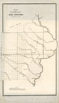
Sketch of the public surveys in Iowa & Dakota no.2 1862
1862
Map of Iowa featuring public surveys, townships, rivers, and lakes.
-

Coltons Iowa 1862
1862
Map of the state of Iowa showcasing counties, townships, cities, railroads, and rivers. Different counties are highlighted different colors.
-

Sketch of the public surveys in Iowa & Dakota no.2 1861
1861
Map of Iowa featuring public surveys, townships, rivers, and lakes.
-

Johnson's Iowa & Nebraska 1861
1861
Map of Iowa and part of Nebraska featuring counties, cities, railroads, and rivers. Different counties are highlighted different colors and the states are outlined in red.
-

Sketch of the public surveys in Iowa & Dakota no.2 1860
1860
Map of Iowa featuring public surveys, townships, rivers, and lakes.
-

Map of the mineral region of Dubuque and vicinity 1858
1858
Map of Dubuque and surrounding area featuring towns, rivers, railroads, roads, mineral deposits, and other landmarks.
-

Explorations and surveys for a rail road route from the Mississippi River to the Pacific Ocean 1854-6 map and profile
1856
Map of the path from the Red River to the Rio Grande, showcasing rivers, lakes, elevations, and landmarks. Below the map is an elevation profile of the area.
-

Township map of the State of Iowa 1856
1856
Map of the state of Iowa showcasing counties, towns, railroads, roads, and rivers.
-

Explorations and surveys for a rail road route from the Mississippi River to the Pacific Ocean 1854-5 map 1
1855
Map of the path from San Francisco Bay to the Plains of Los Angeles, showcasing rivers, lakes, elevations, and landmarks. The solid black line marks potential railroad routes. Map one.
-

Explorations and surveys for a rail road route from the Mississippi River to the Pacific Ocean 1854-5 map 2
1855
Map of the path from the Pimas Village to Fort Fillmore, showcasing rivers, lakes, elevations, and landmarks. The solid black line marks potential railroad routes. Map two.
-

Explorations and surveys for a rail road route from the Mississippi River to the Pacific Ocean 1854-5 profiles
1855
Elevation profiles of the routes from San Francisco Bay to Los Angeles and from Pimas Villages to Fort Fillmore. Map three.
-

Explorations and surveys for a rail road route from the Mississippi River to the Pacific Ocean 1855 map 1
1855
Map of the path from Missouri to Trap Creek, showcasing rivers, lakes, towns, railroads, and landmarks. The double black lines mark potential railroad routes. Map one.
-

Explorations and surveys for a rail road route from the Mississippi River to the Pacific Ocean 1855 map 2
1855
Map of the path from Trap Creek to the Santa Fe crossing, showcasing rivers, lakes, elevations, and landmarks. The double black lines mark potential railroad routes. Map two.
-

Explorations and surveys for a rail road route from the Mississippi River to the Pacific Ocean 1855 map 3
1855
Map of the path from the Santa Fe crossing to the Coo-Chie-To-Pa pass, showcasing rivers, lakes, elevations, and landmarks. The double black lines mark potential railroad routes. Map three.
-

Explorations and surveys for a rail road route from the Mississippi River to the Pacific Ocean 1855 map 4
1855
Map of the path from the Coo-Chie-To-Pa pass to the Wahsatch Mountains, showcasing rivers, lakes, elevations, and landmarks. The double black lines mark potential railroad routes. Map four.
-

Iowa published by J. H. Colton
1855
Map of the state of Iowa showcasing counties, towns, rivers, roads, and railroads. Different counties are highlighted different colors.
-

United States of America 1855 side 1
1855
Map of the United States showcasing rivers, lakes, mountains, railroads, State capitols, cities and towns. Different states and territories are highlighted different colors. Side one.
-

United States of America 1855 side 2
1855
Index of the population of the United States featured on the left, and general information about the United States on the right. Side two.
-

Explorations and surveys for a rail road route from the Mississippi River to the Pacific Ocean 1853-4 general profile
1854
General elevation profile of the area from Fort Smith Arkansas to Martinez near San Francisco California.
-

Explorations and surveys for a rail road route from the Mississippi River to the Pacific Ocean 1853-4 map 1
1854
Map of the path from St Paul to Riviere Des Lacs, showcasing rivers, lakes, elevations, and landmarks. The solid black line marks a potential railroad route. Map one.
-

Explorations and surveys for a rail road route from the Mississippi River to the Pacific Ocean 1853-4 map 2
1854
Map of the path from Riviere Des Lacs to the Rocky Mountains, showcasing rivers, lakes, elevations, and landmarks. The solid black line marks a potential railroad route. Map two.
-

Explorations and surveys for a rail road route from the Mississippi River to the Pacific Ocean 1853-4 map 3
1854
Map of the path from the Rocky Mountains to Puget Sound, showcasing rivers, lakes, elevations, and landmarks. The solid black line marks a potential railroad route. Map three.
-

Explorations and surveys for a rail road route from the Mississippi River to the Pacific Ocean 1853-4 map profiles
1854
Elevation profiles of routes near the 47th and 49th parallels.
-

Sketch of the public surveys in Iowa no.2 1854
1854
Map of the state of Iowa featuring rivers, lakes, and townships.
-

Township map of the State of Iowa 1854
1854
Map of the state of Iowa showcasing counties, towns, railroads, roads, and rivers. Different counties are highlighted different colors. To the left of the map is the red cover of the map booklet.
-

Explorations and surveys for a rail road route from the Mississippi River to the Pacific Ocean 1853 sheet 1
1853
Elevation profiles of mountain passes in the Sierra Nevada. Elevation profile charts for the Walker's, Hum-pah-ya-mup, Tah-ee-chay-pah, and San Fernando passes. Sheet one.
-

Explorations and surveys for a rail road route from the Mississippi River to the Pacific Ocean 1853 sheet 2
1853
Elevation profiles of mountain passes in the Sierra Nevada. Elevation profile charts for the San Francisquito, Cajon, San Gorgonio, and Warner's passes. Sheet two.
-

Explorations and surveys for a rail road route from the Mississippi River to the Pacific Ocean 1853 sheet 3
1853
Map of the passes in the Sierra Nevada showcasing elevations, rivers, and landmarks. Sheet three.
-

Map and profile of the Canada de las Uvas CA 1853
1853
Map of the Cañada de las Uvas showing rivers, elevations, and landmarks. Below the map is an elevation profile of the same area.
-

Map and profile of the Tejon Pass 1853
1853
Map of the Tejon Pass showing rivers, elevations, and landmarks. Below the map is an elevation profile of the pass.
-

Sketch of the public surveys in Iowa no.2 1853
1853
Map of the state of Iowa featuring rivers and townships.
-

Coltons township map of the State of Iowa 1853
1853
Map of the state of Iowa showcasing counties, townships, rivers, railroads, and roads. To the left of the map is an index of the population of Iowa.
-

Karte von Iowa
1852
Map of the state of Iowa featuring counties, cities, rivers, and lakes. Text on the map is in German.
-

Sketch of the public surveys in Iowa 1851
1851
Map of the state of Iowa featuring rivers and townships.
-

Whale chart 1851
1851
Map of the Oceans with illustrations marking where specific whale breeds are frequently seen, and in what season they're seen there. Continents and some countries labeled on the map.
-

Township map of the State of Iowa 1851 side 1
1851
Map of the state of Iowa showcasing counties, townships, and rivers. Roads and railroads are also featured in red. Side one.
-

Township map of the State of Iowa 1851 side 2
1851
Cover image for "A Township Map of the State of Iowa", several illustrations related to Iowa, ads for local Iowa businesses, and several paragraphs of helpful travel tips related to Iowa. Side two.
-

Topographical map of the road 1846 section 1
1846
Topographical map of the route from Missouri to Oregon, showcasing elevations, rivers, and natural landmarks. Section one. Below the map is a chart of 'Meteorological Observations' from the journey.
-

Topographical map of the road 1846 section 2
1846
Topographical map of the route from Missouri to Oregon, showcasing elevations, rivers, and natural landmarks. Section Two. Below the map is a list of 'Remarks' about the journey.
-

Topographical map of the road 1846 section 6
1846
Topographical map of the route from Missouri to Oregon, showcasing elevations, rivers, and natural landmarks. Section six. Below the map is a chart of 'Meteorological Observations', and around the map are excerpts related to the journey.
-

Topographical map of the road 1846 section 7
1846
Topographical map of the route from Missouri to Oregon, showcasing elevations, rivers, and natural landmarks. Section seven. Below the map is a chart of 'Meteorological Observations', and around the map are excerpts related to the journey.
-

United States by Henry Teesdale 1843
1843
Map of the United States showcasing states, territories, cities, rivers, mountains, and railroads. Different states and territories are highlighted different colors.
