


Rod Library Maps
This collection contains maps owned by the Rod Library at the University of Northern Iowa.
There are three subcollections:
| Iowa Maps | United States Maps | World Maps |
-
")
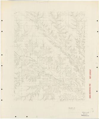
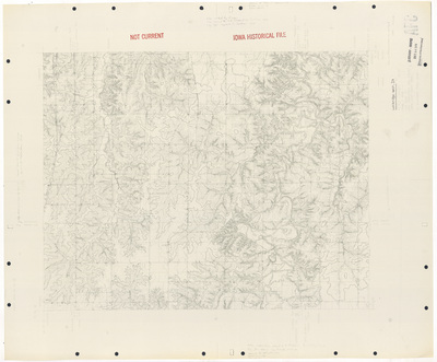
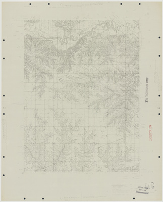
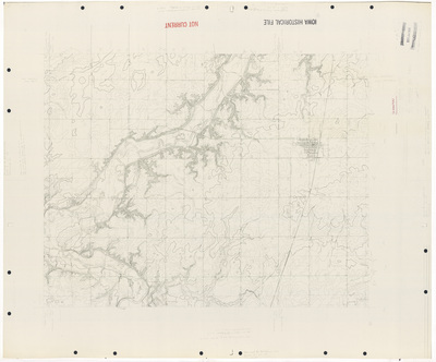
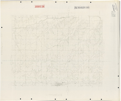
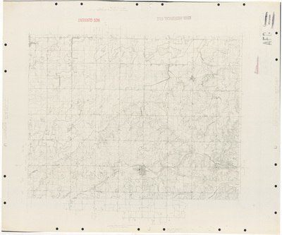
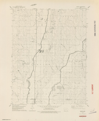
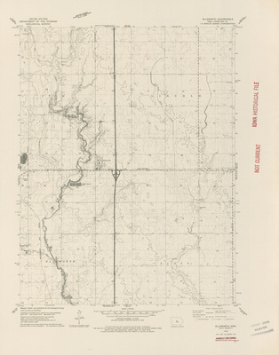
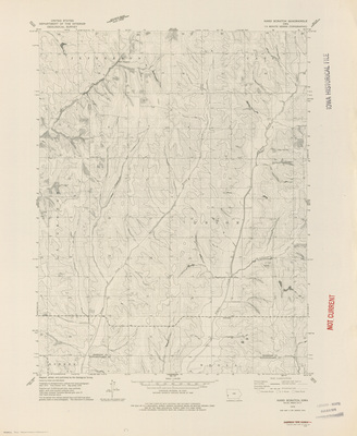
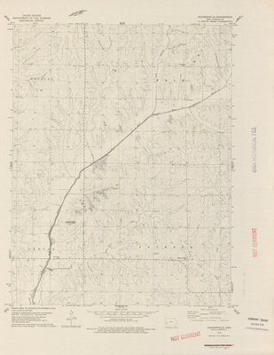
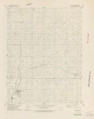
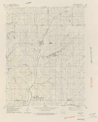
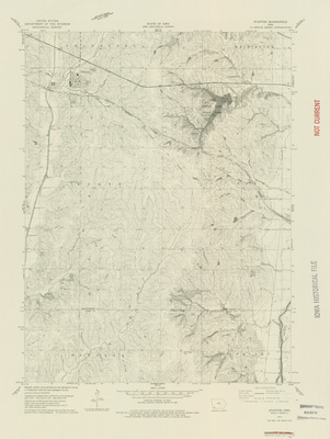
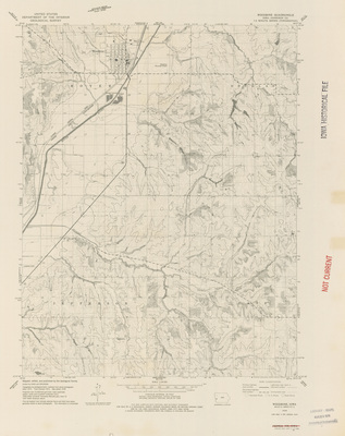
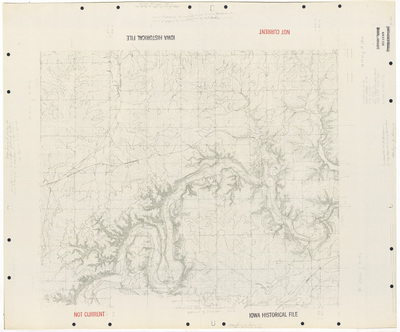
Knoxville Quadrangle by USGS 1965
1965
Topographical map of the area around Knoxville, Iowa showcasing townships, cities, roads, railroads, elevations, rivers, and landmarks.
-
")
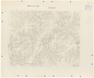
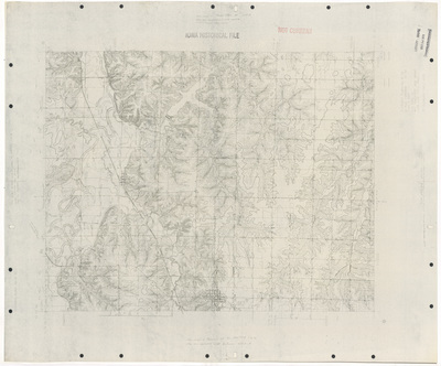
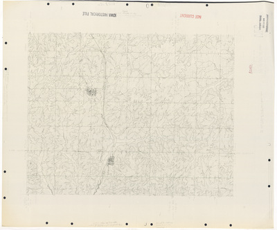
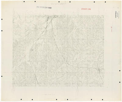
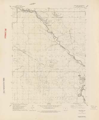
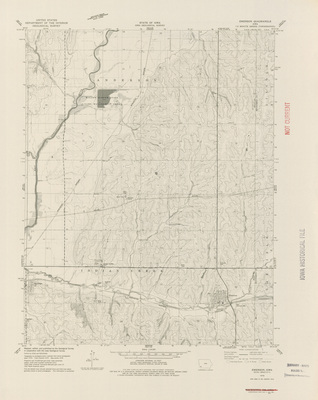
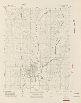
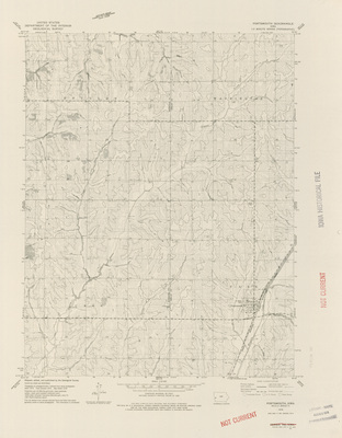
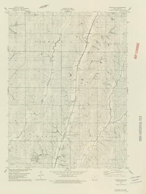
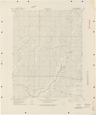
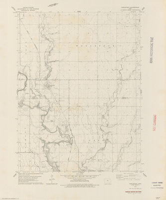
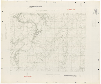
Knoxville SW Quadrangle by USGS 1965
1965
Topographical map of the area around Knoxville SW, Iowa showcasing townships, roads, railroads, elevations, rivers, and landmarks.
-
")
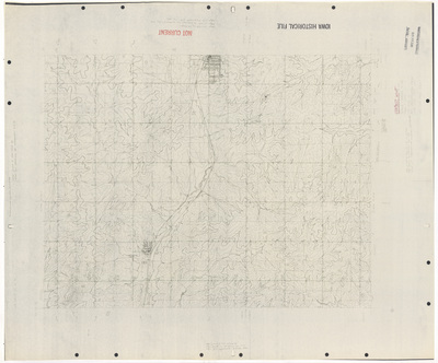
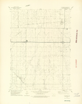
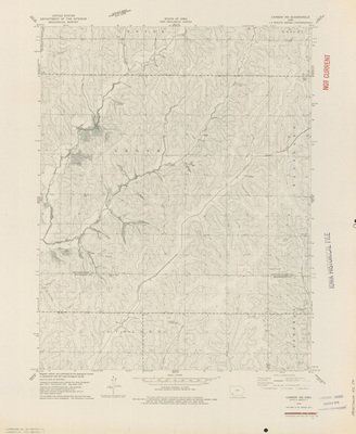
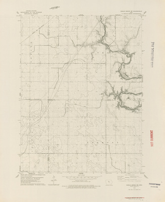
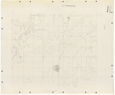
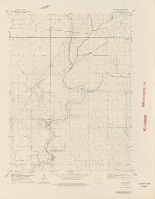
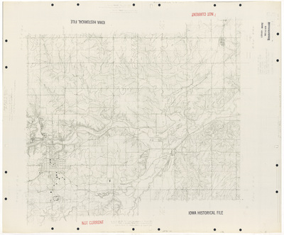
Ladora Quadrangle by USGS 1965
1965
Topographical map of the area around Ladora, Iowa showcasing townships, cities, roads, railroads, elevations, rivers, and landmarks.
-
")
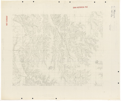
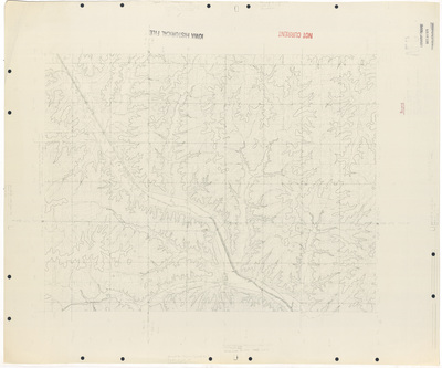
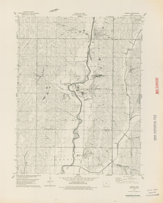
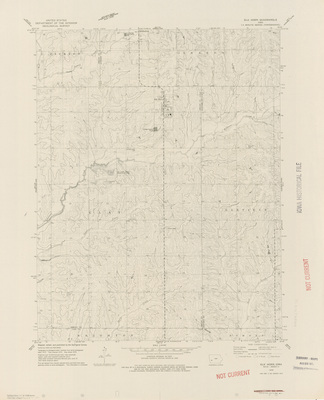
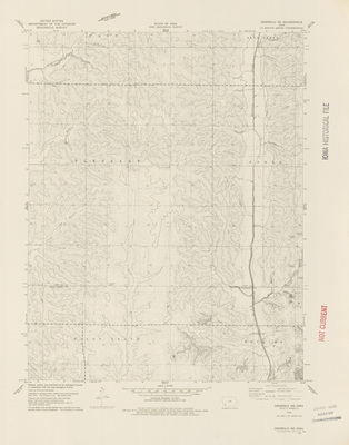
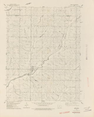
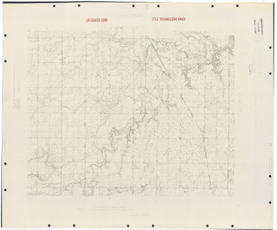
LeHigh Quadrangle by USGS 1965
1965
Topographical map of the area around LeHigh, Iowa showcasing townships, cities, roads, railroads, elevations, rivers, and landmarks.
-
")
Le Roy Quadrangle by USGS 1965
1965
Topographical map of the area around Le Roy, Iowa showcasing townships, cities, roads, elevations, rivers, and landmarks.
-
")
Letts Quadrangle by USGS 1965
1965
Topographical map of the area around Letts, Iowa showcasing townships, cities, roads, railroads, elevations, rivers, and landmarks.
-
")
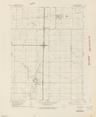
Libertyville Quadrangle by USGS 1965
1965
Topographical map of the area around Libertyville, Iowa showcasing townships, cities, roads, railroads, elevations, rivers, and landmarks.
-
")
Luther Quadrangle by USGS 1965
1965
Topographical map of the area around Luther, Iowa showcasing townships, cities, roads, railroads, elevations, rivers, and landmarks.
-
")
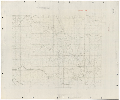
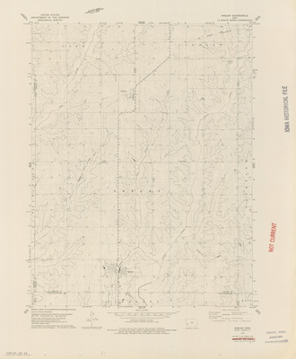
Mackey Quadrangle by USGS 1965
1965
Topographical map of the area around Mackey, Iowa showcasing townships, roads, elevations, rivers, and landmarks.
-
")
Madrid NW Quadrangle by US 1965
1965
Topographical map of the area around Madrid NW, Iowa showcasing townships, roads, elevations, rivers, and landmarks.
-
")
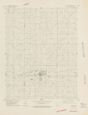
Marengo Quadrangle by USGS 1965
1965
Topographical map of the area around Marengo, Iowa showcasing townships, cities, roads, railroads, elevations, rivers, and landmarks.
-
")
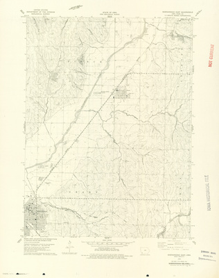
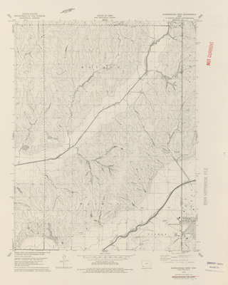
Mechanicsville Quadrangle by USGS 1965
1965
Topographical map of the area around Mechanicsville, Iowa showcasing townships, cities, roads, railroads, elevations, rivers, and landmarks.
-
")
Mediapolis Quadrangle by USGS 1965
1965
Topographical map of the area around Mediapolis, Iowa showcasing townships, cities, roads, railroads, elevations, rivers, and landmarks.
-
")
Milo Quadrangle by USGS 1965
1965
Topographical map of the area around Milo, Iowa showcasing townships, cities, roads, railroads, elevations, rivers, and landmarks.
-
")
Monroe Quadrangle by USGS 1965
1965
Topographical map of the area around Monroe, Iowa showcasing townships, cities, roads, railroads, elevations, rivers, and landmarks.
-
")
Moorland Quadrangle by USGS 1965
1965
Topographical map of the area around Moorland, Iowa showcasing townships, cities, roads, railroads, elevations, rivers, and landmarks.
-
")
Mt. Vernon Quadrangle by USGS 1965
1965
Topographical map of the area around Mt. Vernon, Iowa showcasing townships, cities, roads, railroads, elevations, rivers, and landmarks.
-
")
Muscatine NW Quadrangle by USGS 1965
1965
Topographical map of the area around Muscatine NW, Iowa showcasing townships, roads, railroads, elevations, rivers, and landmarks.
-
")
Newton Quadrangle by USGS 1965
1965
Topographical map of the area around Newton, Iowa showcasing townships, cities, roads, railroads, elevations, rivers, and landmarks.
-
")
Oakville Quadrangle by USGS 1965
1965
Topographical map of the area around Oakville, Iowa showcasing townships, cities, roads, railroads, elevations, rivers, and landmarks.
-
")
Otley Quadrangle by USGS 1965
1965
Topographical map of the area around Otley, Iowa showcasing townships, cities, roads, railroads, elevations, rivers, and landmarks.
-
")
Pleasantville Quadrangle by USGS 1965
1965
Topographical map of the area around Pleasantville, Iowa showcasing townships, cities, roads, railroads, elevations, rivers, and landmarks.
-
")
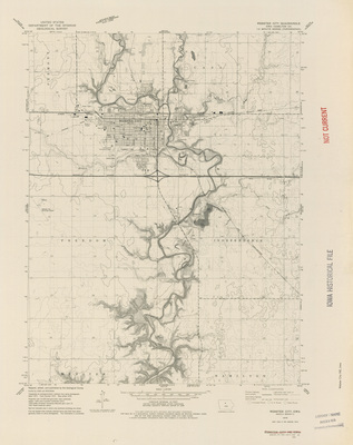
Prairie City Quadrangle by USGS 1965
1965
Topographical map of the area around Prairie City, Iowa showcasing townships, cities, roads, railroads, elevations, rivers, and landmarks.
-
")
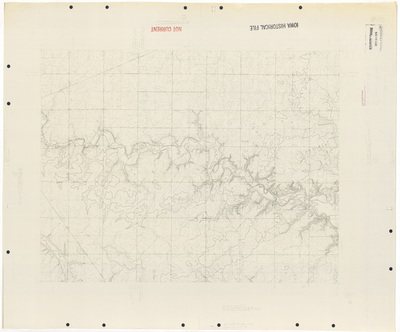
Rose Hill Quadrangle by USGS 1965
1965
Topographical map of the area around Rose Hill, Iowa showcasing townships, cities, roads, railroads, elevations, rivers, and landmarks.
-
")
Selma Quadrangle by USGS 1965
1965
Topographical map of the area around Selma, Iowa showcasing townships, cities, roads, railroads, elevations, rivers, and landmarks.
-
")
Sigourney Quadrangle by USGS 1965
1965
Topographical map of the area around Sigourney, Iowa showcasing townships, cities, roads, railroads, elevations, rivers, and landmarks.
-
")
Solon Quadrangle by USGS 1965
1965
Topographical map of the area around Solon, Iowa showcasing townships, cities, roads, railroads, elevations, rivers, and landmarks.
-
")
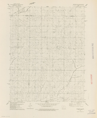
South English Quadrangle by USGS 1965
1965
Topographical map of the area around South English, Iowa showcasing townships, cities, roads, railroads, elevations, rivers, and landmarks.
-
")
Stanwood Quadrangle by USGS 1965
1965
Topographical map of the area around Stanwood, Iowa showcasing townships, cities, roads, railroads, elevations, rivers, and landmarks.
-
")
Tiffin Quadrangle by USGS 1965
1965
Topographical map of the area around Tiffin, Iowa showcasing townships, cities, roads, railroads, elevations, rivers, and landmarks.
-
")
Tipton West Quadrangle by USGS 1965
1965
Topographical map of the area around Tipton, Iowa showcasing townships, cities, roads, railroads, elevations, rivers, and landmarks.
-
")
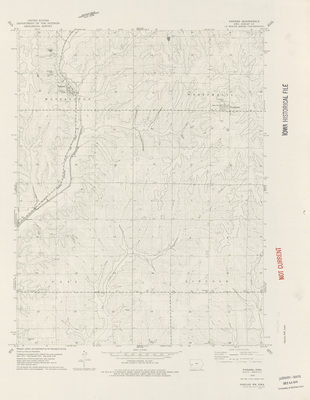
Wapello Quadrangle by USGS 1965
1965
Topographical map of the area around Wapello, Iowa showcasing townships, cities, roads, railroads, elevations, rivers, and landmarks.
-
")
Waukee Quadrangle by USGS 1965
1965
Topographical map of the area around Waukee, Iowa showcasing townships, cities, roads, railroads, elevations, rivers, and landmarks.
-
")
Weldon Quadrangle by USGS 1965
1965
Topographical map of the area around Weldon, Iowa showcasing townships, cities, roads, railroads, elevations, rivers, and landmarks.
-
")
West Branch Quadrangle by USGS 1965
1965
Topographical map of the area around West Branch, Iowa showcasing townships, cities, roads, railroads, elevations, rivers, and landmarks.
-
")
West Liberty SW Quadrangle by USGS 1965
1965
Topographical map of the area around West Liberty SW, Iowa showcasing townships, cities, roads, railroads, elevations, rivers, and landmarks.
-
")
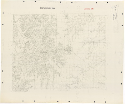
What Cheer Quadrangle by USGS 1965
1965
Topographical map of the area around What Cheer, Iowa showcasing townships, cities, roads, railroads, elevations, rivers, and landmarks.
-
")
Woodward Quadrangle by USGS 1965
1965
Topographical map of the area around Woodward, Iowa showcasing townships, cities, roads, railroads, elevations, rivers, and landmarks.
-
")
Allerton Quadrangle by USGS 1964
1964
Topographical map of the area around Allerton, Iowa showcasing townships, cities, roads, railroads, elevations, rivers, and landmarks.
-
")
Burlington Quadrangle by USGS 1964
1964
Topographical map of the area around Burlington, Iowa showcasing townships, cities, roads, railroads, elevations, rivers, and landmarks.
-
")
Climbing Hill Quadrangle by USGS 1964
1964
Topographical map of the area around Climbing Hill, Iowa showcasing townships, cities, roads, elevations, rivers, and landmarks.
-
")
Clio Quadrangle by USGS 1964
1964
Topographical map of the area around Clio, Iowa showcasing townships, cities, roads, railroads, elevations, rivers, and landmarks.
-
")
Dallas City Quadrangle by USGS 1964
1964
Topographical map of the area around Dallas City, Iowa showcasing townships, cities, roads, railroads, elevations, rivers, and landmarks.
-
")
Edgewood Quadrangle by USGS 1964
1964
Topographical map of the area around Edgewood, Iowa showcasing townships, cities, roads, railroads, elevations, rivers, and landmarks.
-
")
Fort Madison Quadrangle by USGS 1964
1964
Topographical map of the area around Fort Madison, Iowa showcasing townships, cities, roads, railroads, elevations, rivers, and landmarks.
-
")
Gaza Quadrangle by USGS 1964
1964
Topographical map of the area around Gaza, Iowa showcasing townships, cities, roads, railroads, elevations, rivers, and landmarks.
-
")
Hinton Quadrangle by USGS 1964
1964
Topographical map of the area around Hinton, Iowa showcasing townships, cities, roads, railroads, elevations, rivers, and landmarks.
-
")
Homer Quadrangle by USGS 1964
1964
Topographical map of the area around Homer, Nebraska showcasing townships, cities, roads, railroads, elevations, rivers, and landmarks.
-
")
Hospers Quadrangle by USGS 1964
1964
Topographical map of the area around Hospers, Iowa showcasing townships, cities, roads, railroads, elevations, rivers, and landmarks.
-
")
Hull Quadrangle by USGS 1964
1964
Topographical map of the area around Hull, Iowa showcasing townships, cities, roads, railroads, elevations, rivers, and landmarks.
-
")
Keokuk Quadrangle by USGS 1964
1964
Topographical map of the area around Keokuk, Iowa showcasing townships, cities, roads, railroads, elevations, rivers, and landmarks.
-
")
Lawton Quadrangle by USGS 1964
1964
Topographical map of the area around Lawton, Iowa showcasing townships, cities, roads, railroads, elevations, rivers, and landmarks.
-
")
Leon Quadrangle by USGS 1964
1964
Topographical map of the area around Leon, Iowa showcasing townships, cities, roads, railroads, elevations, rivers, and landmarks.
-
")
Luton Quadrangle by USGS 1964
1964
Topographical map of the area around Luton, Iowa showcasing townships, cities, roads, railroads, elevations, rivers, and landmarks.
-
")
Matlock Quadrangle by USGS 1964
1964
Topographical map of the area around Matlock, Iowa showcasing townships, cities, roads, railroads, elevations, rivers, and landmarks.
-
")
Millnerville Quadrangle by USGS 1964
1964
Topographical map of the area around Millnerville, Iowa showcasing townships, roads, elevations, rivers, and landmarks.
-
")
Moville Quadrangle by USGS 1964
1964
Topographical map of the area around Moville, Iowa showcasing townships, cities, roads, railroads, elevations, rivers, and landmarks.
-
")
Nauvoo Quadrangle by USGS 1964
1964
Topographical map of the area around Nauvoo, Iowa showcasing townships, cities, roads, railroads, elevations, rivers, and landmarks.
-
")
Orange City Quadrangle by USGS 1964
1964
Topographical map of the area around Orange City, Iowa showcasing townships, cities, roads, elevations, rivers, and landmarks.
-
")
Plessis Quadrangle by USGS 1964
1964
Topographical map of the area around Plessis, Iowa showcasing townships, roads, railroads, elevations, rivers, and landmarks.
-
")
Primghar Quadrangle by USGS 1964
1964
Topographical map of the area around Primghar, Iowa showcasing townships, cities, roads, railroads, elevations, rivers, and landmarks.
-
")
Salix Quadrangle by USGS 1964
1964
Topographical map of the area around Salix, Iowa showcasing townships, cities, roads, railroads, elevations, rivers, and landmarks.
-
")
Sanborn Quadrangle by USGS 1964
1964
Topographical map of the area around Sanborn, Iowa showcasing townships, cities, roads, railroads, elevations, rivers, and landmarks.
-
")
Sheldon Quadrangle by USGS 1964
1964
Topographical map of the area around Sheldon, Iowa showcasing townships, cities, roads, railroads, elevations, rivers, and landmarks.
-
")
Sheldon SE Quadrangle by USGS 1964
1964
Topographical map of the area around Sheldon SE, Iowa showcasing townships, roads, railroads, elevations, rivers, and landmarks.
-
")
Sioux Center Quadrangle by USGS 1964
1964
Topographical map of the area around Sioux Center, Iowa showcasing townships, cities, roads, railroads, elevations, rivers, and landmarks.
-
")
Sperry Quadrangle by USGS 1964
1964
Topographical map of the area around Sperry, Iowa showcasing townships, cities, roads, railroads, elevations, rivers, and landmarks.
-
")
West Burlington Quadrangle by USGS 1964
1964
Topographical map of the area around West Burlington, Iowa showcasing townships, cities, roads, railroads, elevations, rivers, and landmarks.
-
")
West Point Quadrangle by USGS 1964
1964
Topographical map of the area around West Point, Iowa showcasing townships, cities, roads, railroads, elevations, rivers, and landmarks.
-
")
Woodland Quadrangle by USGS 1964
1964
Topographical map of the area around Woodland, Iowa showcasing townships, cities, roads, elevations, rivers, and landmarks.
-

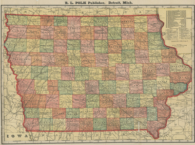
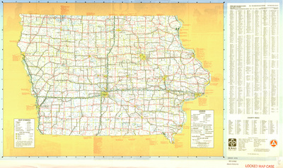
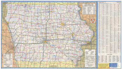
Iowa railroad map 1964
1964
Map of the state of Iowa showcasing counties, cities, rivers, landmarks, and railroads. To the left of the map is a county index.
-
![Aerial survey [Black Hawk County] by General Aerial Surveys 1964 sheet 1 by United States. Agricultural Stabilization and Conservation Service](https://scholarworks.uni.edu/rodmaps/1041/thumbnail.jpg "Aerial survey [Black Hawk County] by General Aerial Surveys 1964 sheet 1 by United States. Agricultural Stabilization and Conservation Service")
Aerial survey [Black Hawk County] by General Aerial Surveys 1964 sheet 1
1964
Photomosaic map of Black Hawk County, Iowa done for the U.S. Department of Agriculture Agricultural Stabilization and Conservation Service by General Aerial Surveys. Overlapped black and white images create the map. Sheet one.
-
![Aerial survey [Black Hawk County] by General Aerial Surveys 1964 sheet 2 by United States. Agricultural Stabilization and Conservation Service](https://scholarworks.uni.edu/rodmaps/1042/thumbnail.jpg "Aerial survey [Black Hawk County] by General Aerial Surveys 1964 sheet 2 by United States. Agricultural Stabilization and Conservation Service")
Aerial survey [Black Hawk County] by General Aerial Surveys 1964 sheet 2
1964
Photomosaic map of Black Hawk County, Iowa done for the U.S. Department of Agriculture Agricultural Stabilization and Conservation Service by General Aerial Surveys. Overlapped black and white images create the map. Sheet two.
-
![Aerial survey [Black Hawk County] by General Aerial Surveys 1964 sheet 3 by United States. Agricultural Stabilization and Conservation Service](https://scholarworks.uni.edu/rodmaps/1043/thumbnail.jpg "Aerial survey [Black Hawk County] by General Aerial Surveys 1964 sheet 3 by United States. Agricultural Stabilization and Conservation Service")
Aerial survey [Black Hawk County] by General Aerial Surveys 1964 sheet 3
1964
Photomosaic map of Black Hawk County, Iowa done for the U.S. Department of Agriculture Agricultural Stabilization and Conservation Service by General Aerial Surveys. Overlapped black and white images create the map. Sheet three.
-
![Aerial survey [Black Hawk County] by General Aerial Surveys 1964 sheet 4 by United States. Agricultural Stabilization and Conservation Service](https://scholarworks.uni.edu/rodmaps/1044/thumbnail.jpg "Aerial survey [Black Hawk County] by General Aerial Surveys 1964 sheet 4 by United States. Agricultural Stabilization and Conservation Service")
Aerial survey [Black Hawk County] by General Aerial Surveys 1964 sheet 4
1964
Photomosaic map of Black Hawk County, Iowa done for the U.S. Department of Agriculture Agricultural Stabilization and Conservation Service by General Aerial Surveys. Overlapped black and white images create the map. Sheet four.
-

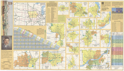
Official AAA road map of Iowa 1963 side 1
1963
Map of the state of Iowa featuring counties, cities, highways, roads, rivers, and landmarks. To the right of the map is the cover image. Side one.
-

Official AAA road map of Iowa 1963 side 2
1963
Advertisements, toll facilities, milage chart, and expanded city maps on the left side. An index to cities and villages in Iowa to the right. Side two.
-
")
Avoca NW Quadrangle by USGS 1963
1963
Topographical map of the area around Avoca NW, Iowa showcasing townships, roads, railroads, elevations, rivers, and landmarks.
-
")
Avoca Quadrangle by USGS 1963
1963
Topographical map of the area around Avoca, Iowa showcasing townships, cities, roads, railroads, elevations, rivers, and landmarks.
-
")
Avoca SE Quadrangle by USGS 1963
1963
Topographical map of the area around Avoca SE, Iowa showcasing townships, roads, railroads, elevations, rivers, and landmarks.
-
")
Buckingham Quadrangle by USGS 1963
1963
Topographical map of the area around Buckingham, Iowa showcasing townships, cities, roads, railroads, elevations, rivers, and landmarks.
-
")
Denver Quadrangle by USGS 1963
1963
Topographical map of the area around Denver, Iowa showcasing townships, cities, roads, railroads, elevations, rivers, and landmarks.
-
")
Eagle Center Quadrangle by USGS 1963
1963
Topographical map of the area around Eagle Center, Iowa showcasing townships, cities, roads, elevations, rivers, and landmarks.
-
")
Elk Point NE Quadrangle by USGS 1963
1963
Topographical map of the area around Elk Point NE, Iowa showcasing townships, roads, railroads, elevations, rivers, and landmarks.
-
")
Hudson Quadrangle by USGS 1963
1963
Topographical map of the area around Hudson, Iowa showcasing townships, cities, roads, railroads, elevations, rivers, and landmarks.
-
")
Oakland Quadrangle by USGS 1963
1963
Topographical map of the area around Oakland, Iowa showcasing townships, cities, roads, railroads, elevations, rivers, and landmarks.
-
")
Waterloo North Quadrangle by USGS 1963
1963
Topographical map of the area around Waterloo North, Iowa showcasing townships, cities, roads, railroads, elevations, rivers, and landmarks.
-
")
Waterloo South Quadrangle by USGS 1963
1963
Topographical map of the area around Waterloo South, Iowa showcasing townships, cities, roads, railroads, elevations, rivers, and landmarks.
-
")
Waverly Quadrangle by USGS 1963
1963
Topographical map of the area around Waverly, Iowa showcasing townships, cities, roads, railroads, elevations, rivers, and landmarks.
-
")
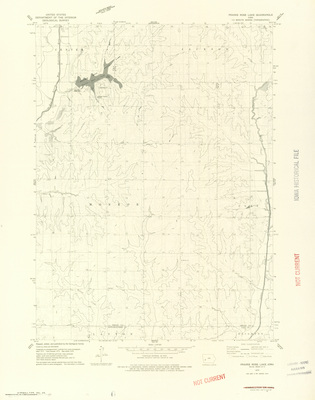
Klondike Quadrangle by USGS 1962
1962
Topographical map of the area around Klondike, Iowa showcasing townships, roads, railroads, elevations, rivers, and landmarks.
-
")
La Motte Quadrangle by USGS 1962
1962
Topographical map of the area around La Motte, Iowa showcasing townships, cities, roads, railroads, elevations, rivers, and landmarks.
-
")
Zwingle Quadrangle by USGS 1972
1962
Topographical map of the area around Zwingle, Iowa showcasing townships, cities, roads, railroads, elevations, rivers, and landmarks.
-

Official AAA road map of Iowa 1961 side 1
1961
Map of the state of Iowa featuring counties, cities, highways, roads, rivers, and landmarks. To the right of the map is the cover image. Side one.
-

Official AAA road map of Iowa 1961 side 2
1961
Advertisements, toll facilities, milage chart, and expanded city maps on the left side. An index to cities and villages in Iowa to the right. Side two.
-

Official AAA road map of Iowa 1960 side 1
1960
Map of the state of Iowa featuring counties, cities, highways, roads, rivers, and landmarks. To the right of the map is the cover image and advertisements. Side one.
-

Official AAA road map of Iowa 1960 side 2
1960
Advertisements, toll facilities, milage chart, and expanded city maps on the left side. An index to cities and villages in Iowa to the right. Side two.
-
")
Conrad West Quadrangle by USGS 1960
1960
Topographical map of the area around Conrad West, Iowa showcasing townships, cities, roads, railroads, elevations, rivers, and landmarks.
-
")
Marshalltown Quadrangle by USGS 1960
1960
Topographical map of the area around Marshalltown, Iowa showcasing townships, cities, roads, railroads, elevations, rivers, and landmarks.
-

Official AAA road map of Iowa 1959 side 1
1959
Map of the state of Iowa featuring counties, cities, highways, roads, rivers, and landmarks. To the right of the map is the cover image and advertisements. Side one.
-

Official AAA road map of Iowa 1959 side 2
1959
Advertisements, toll facilities, milage chart, and expanded city maps on the left side. An index to cities and villages, and state recreation areas in Iowa to the right. Side two.
-
")
Dubuque area topographic map by USGS 1959
1959
Topographical map of the area around Dubuque, Iowa showcasing counties, townships, cities, roads, railroads, elevations, rivers, and landmarks.
-
")
Hanford Quadrangle by USGS 1959
1959
Topographical map of the area around Hanford, Iowa showcasing townships, cities, roads, railroads, elevations, rivers, and landmarks.
-
")
Mason City Quadrangle by USGS 1959
1959
Topographical map of the area around Mason City, Iowa showcasing townships, cities, roads, railroads, elevations, rivers, and landmarks.
-
")
Mason City SE Quadrangle by USGS 1959
1959
Topographical map of the area around Mason City SE, Iowa showcasing townships, roads, railroads, elevations, rivers, and landmarks.
-
")
Nora Springs Quadrangle by USGS 1959
1959
Topographical map of the area around Nora Springs, Iowa showcasing townships, cities, roads, railroads, elevations, rivers, and landmarks.
-

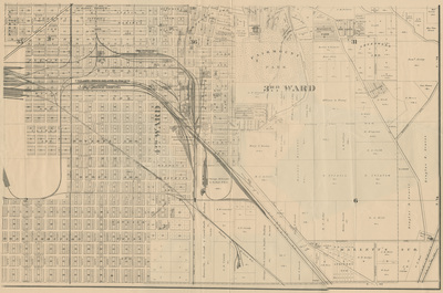
Fort Madison Iowa 1958
1958
Map of Fort Madison showing streets, railroads, rivers, wards, and landmarks.
-

Official AAA road map of Iowa 1958 side 1
1958
Map of the state of Iowa featuring counties, cities, highways, roads, rivers, and landmarks. To the right of the map is the cover image and advertisements. Side one.
-

Official AAA road map of Iowa 1958 side 2
1958
Advertisements, toll facilities, milage chart, and an index of state recreation areas in Iowa on the left side. Expanded city maps and an index to cities and villages in Iowa to the right. Side two.
-
")
Colesburg Quadrangle by USGS 1957
1957
Topographical map of the area around Colesburg, Iowa showcasing townships, cities, roads, railroads, elevations, rivers, and landmarks.
-
")
Honey Creek Quadrangle by USGS 1957
1957
Topographical map of the area around Honey Creek, Iowa showcasing townships, cities, roads, railroads, elevations, rivers, and landmarks.
-
")
Randolph Quadrangle by USGS 1957
1957
Topographical map of the area around Randolph, Iowa showcasing townships, cities, roads, railroads, elevations, rivers, and landmarks.
-
")
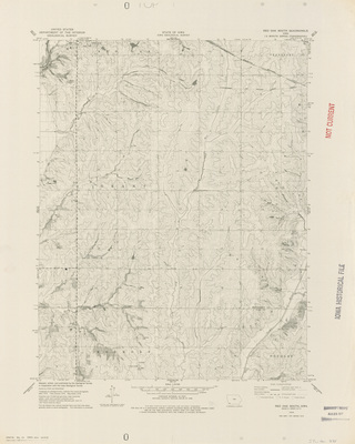
Tabor NE Quadrangle by USGS 1957
1957
Topographical map of the area around Tabor NE, Iowa showcasing townships, cities, roads, railroads, elevations, rivers, and landmarks.
-
")
Tabor Quadrangle by USGS 1957
1957
Topographical map of the area around Tabor, Iowa showcasing townships, cities, roads, railroads, elevations, rivers, and landmarks.
-
")
Tabor SW Quadrangle by USGS 1957
1957
Topographical map of the area around Tabor SW, Iowa showcasing townships, cities, roads, railroads, elevations, rivers, and landmarks.
-
")
Taylor Quadrangle by USGS 1957
1957
Topographical map of the area around Taylor, Iowa showcasing townships, roads, railroads, elevations, rivers, and landmarks.
-
")
Turkey River Quadrangle by USGS 1957
1957
Topographical map of the area around Turkey River in Iowa showcasing townships, roads, railroads, elevations, rivers, and landmarks.
-

Official highway map of Iowa 1957 side 1
1957
Map of the state of Iowa showcasing counties, cities, rivers, highways, and roads. To the left of the map is the cover image. Below the map is a population index of cities and villages in Iowa. Side one.
-

Official highway map of Iowa 1957 side 2
1957
Expanded city road maps surrounded by photographs of Iowa. Side two.
-
![Aerial survey [Black Hawk County] by Robinson Aerial Surveys 1957 by United States. Commodity Stabilization Service](https://scholarworks.uni.edu/rodmaps/1027/thumbnail.jpg "Aerial survey [Black Hawk County] by Robinson Aerial Surveys 1957 by United States. Commodity Stabilization Service")
Aerial survey [Black Hawk County] by Robinson Aerial Surveys 1957
1957
Photomosaic map of Black Hawk County, Iowa done for the U.S. Department of Agriculture Commodity Stabilization Service by Robinson Aerial Surveys, Inc. Overlapped black and white images create the map.
-
![Commodity Stabilization Serv. [Black Hawk County] 1957 by United States. Commodity Stabilization Service](https://scholarworks.uni.edu/rodmaps/1016/thumbnail.jpg "Commodity Stabilization Serv. [Black Hawk County] 1957 by United States. Commodity Stabilization Service")
Commodity Stabilization Serv. [Black Hawk County] 1957
1957
Photomosaic map of Black Hawk County, Iowa. Overlapped black and white images create the map.
-

Official Map of Woodbury County by American Lithographing 1956
1956
Map of Woodbury County with townships seperated by green lines, and school and taxing districts seperated by red lines. Churches, schools, cemeteries, rivers, roads, railroads, and other features depicted via illustrations.
-
")
Agency Quadrangle by USGS 1956
1956
Topographical map of the area around Agency, Iowa showcasing townships, cities, roads, railroads, elevations, rivers, and landmarks.
-
")
Dubuque North Quadrangle by USGS 1956
1956
Topographical map of the area around Dubuque North, Iowa showcasing townships, cities, roads, railroads, elevations, rivers, and landmarks.
-
")
Farson Quadrangle by USGS 1956
1956
Topographical map of the area around Farson, Iowa showcasing townships, cities, roads, railroads, elevations, rivers, and landmarks.
-
")
Glenwood Quadrangle by USGS 1956
1956
Topographical map of the area around Glenwood, Iowa showcasing townships, cities, roads, railroads, elevations, rivers, and landmarks.
-
")
McClelland Quadrangle by USGS 1956
1956
Topographical map of the area around McClelland, Iowa showcasing townships, cities, roads, railroads, elevations, rivers, and landmarks.
-
")
Mineola Quadrangle by USGS 1956
1956
Topographical map of the area around Mineola, Iowa showcasing townships, cities, roads, railroads, elevations, rivers, and landmarks.
-
")
Neola Quadrangle by USGS 1956
1956
Topographical map of the area around Neola, Iowa showcasing townships, cities, roads, railroads, elevations, rivers, and landmarks.
-
")
Ottumwa North Quadrangle by USGS 1956
1956
Topographical map of the area around Ottumwa North, Iowa showcasing townships, cities, roads, railroads, elevations, rivers, and landmarks.
-
")
Ottumwa South Quadrangle by USGS 1956
1956
Topographical map of the area around Ottumwa South, Iowa showcasing townships, cities, roads, railroads, elevations, rivers, and landmarks.
-
")
Pacific Junction Quadrangle by USGS 1969
1956
Topographical map of the area around Pacific Junction, Iowa showcasing townships, cities, roads, railroads, elevations, rivers, and landmarks.
-
")
Plattsmouth Quadrangle by USGS 1956
1956
Topographical map of the area around Plattsmouth, Nebraska showcasing townships, cities, roads, railroads, elevations, rivers, and landmarks.
-
")
Rock Bluff Quadrangle by USGS 1956
1956
Topographical map of the area around Rock Bluff, Iowa showcasing townships, cities, roads, railroads, elevations, rivers, and landmarks.
-
")
Sherrill Quadrangle by USGS 1956
1956
Topographical map of the area around Sherrill, Iowa showcasing townships, cities, roads, railroads, elevations, rivers, and landmarks.
-
")
Treynor Quadrangle by USGS 1956
1956
Topographical map of the area around Treynor, Iowa showcasing townships, cities, roads, railroads, elevations, rivers, and landmarks.
-
")
Underwood Quadrangle by USGS 1956
1956
Topographical map of the area around Underwood, Iowa showcasing townships, cities, roads, railroads, elevations, rivers, and landmarks.
-

Official highway map of Iowa 1956 side 1
1956
Map of the state of Iowa showcasing counties, cities, rivers, highways, and roads. To the left of the map is the cover image. Below the map is a population index of cities and villages in Iowa. Side one.
-

Official highway map of Iowa 1956 side 2
1956
Expanded city road maps and a list of points of interest in Iowa to the right of the page. Side two.
-

Official Map of Polk County 1955
1955
Map of Polk County with townships seperated by green lines, and school and taxing districts seperated by red lines. Map also shows cities, rivers, roads, railroads, and other landmarks.
-
")
Dubuque South Quadrangle by USGS 1955
1955
Topographical map of the area around Dubuque South, Iowa showcasing townships, cities, roads, railroads, elevations, rivers, and landmarks.
-
![General Highway and Transportation Map [Washington County] 1955 by Iowa. Highway Commission](https://scholarworks.uni.edu/rodmaps/1478/thumbnail.jpg "General Highway and Transportation Map [Washington County] 1955 by Iowa. Highway Commission")
General Highway and Transportation Map [Washington County] 1955
1955
Map of Washington County, Iowa showcasing roads, highways, railroads, townships, cities, rivers, buildings, and other landmarks. School and taxing districts are outlined in red.
-

Official highway map of Iowa 1955 side 1
1955
Map of the state of Iowa showcasing counties, cities, rivers, highways, and roads. To the left of the map is the cover image. Below the map is a population index of cities and villages in Iowa. Side one.
-

Official highway map of Iowa 1955 side 2
1955
Expanded city road maps and a list of points of interest in Iowa to the right of the page. Side two.
-
")
Des Moines area topographic map by USGS 1954
1954
Topographical map of the area around Des Moines, Iowa showcasing rivers, elevations, counties, cities, highways, roads, railroads, and landmarks.
-

Official AAA road map of Iowa 1953 side 1
1953
Map of the state of Iowa featuring counties, cities, highways, roads, rivers, and landmarks. To the right of the map is the cover image and advertisements. Side one.
-

Official AAA road map of Iowa 1953 side 2
1953
Toll facilities, and an index of state recreation areas in Iowa on the left side. Expanded city maps, a landmark map of Iowa, and a milage chart in the middle. An index to cities and villages in Iowa to the right. Side two.
-
")
Camanche Quadrangle by USGS 1953
1953
Topographical map of the area around Camanche, Iowa showcasing townships, cities, roads, railroads, elevations, rivers, and landmarks.
-
")
Davenport, Rock Island, Moline and vicinity 1953
1953
Topographical map of the area around Davenport, Iowa & Rock Island and Moline, Illinois showcasing rivers, elevations, counties, cities, highways, roads, railroads, and landmarks.
-
")
De Witt Quadrangle by USGS 1953
1953
Topographical map of the area around De Witt, Iowa showcasing townships, cities, roads, railroads, elevations, rivers, and landmarks.
-
")
Grand Mound Quadrangle by USGS 1953
1953
Topographical map of the area around Ground Mound, Iowa showcasing townships, cities, roads, railroads, elevations, rivers, and landmarks.
-
")
Green Island Quadrangle by USGS 1953
1953
Topographical map of the area around Green Island, Iowa showcasing townships, roads, railroads, elevations, rivers, and landmarks.
-
")
Joy Quadrangle by USGS 1953
1953
Topographical map of the area around Joy, Illinois showcasing townships, cities, roads, railroads, elevations, rivers, and landmarks.
-
")
Muscatine Quadrangle by USGS 1953
1953
Topographical map of the area around Muscatine, Iowa showcasing townships, cities, roads, railroads, elevations, rivers, and landmarks.
-
")
Tipton East Quadrangle by USGS 1953
1953
Topographical map of the area around Tipton, Iowa showcasing townships, cities, roads, railroads, elevations, rivers, and landmarks.
-
")
Toolesboro Quadrangle by USGS 1953
1953
Topographical map of the area around Toolesboro, Iowa showcasing townships, cities, roads, railroads, elevations, rivers, and landmarks.
-
")
Wheatland Quadrangle by USGS 1953
1953
Topographical map of the area around Wheatland, Iowa showcasing townships, cities, roads, railroads, elevations, rivers, and landmarks.
-

Official highway map of Iowa 1953 side 1
1953
Map of the state of Iowa showcasing counties, cities, rivers, highways, and roads. To the left of the map is the cover image. Below the map is a population index of cities and villages in Iowa. Side one.
-

Official highway map of Iowa 1953 side 2
1953
Expanded city road maps and a list of points of interest in Iowa to the right of the page. Side two.
-

Literary map of Iowa 1952
1952
Outline of the state of Iowa filled with various illustrations. Locations where different writers resided are marked on the map along with the writer's name. Below the map is a list of additional writers.
-

Cedar Rapids 1952 Nirenstein's Nat'l. Realty Map Co. sheet 1
1952
Photographs of downtown Cedar Rapids interspersed with paragraphs of text and statistics related to Cedar Rapids. Side one.
-

Cedar Rapids 1952 Nirenstein's Nat'l. Realty Map Co. sheet 2
1952
Map of downtown Cedar Rapids showcasing streets, rivers, bus stops, plats, landmarks, and business names. Side two.
-

Davenport 1952 Nirenstein's Nat'l. Realty Map Co. sheet 1
1952
Map of downtown Davenport showcasing streets, bus stops, plats, landmarks, and business names. Side two.
-

Davenport 1952 Nirenstein's Nat'l. Realty Map Co. sheet 2
1952
Photographs of downtown Davenport interspersed with paragraphs of text and statistics related to Davenport. Side one.
-

Des Moines 1952 Nirenstein's Nat'l. Realty Map Co. sheet 1
1952
Photographs of downtown Des Moines interspersed with paragraphs of text and statistics related to Des Moines. Side one.
-

Des Moines 1952 Nirenstein's Nat'l. Realty Map Co. sheet 2
1952
Map of downtown Des Moines showcasing streets, bus stops, plats, landmarks, and business names. Side two.
-

Sioux City Nirensteins Nat'l. Realty Map Co. 1952 sheet 1
1952
Photographs of downtown Sioux City interspersed with paragraphs of text and statistics related to Sioux City. Side one.
-

Sioux City Nirensteins Nat'l. Realty Map Co. 1952 sheet 2
1952
Map of downtown Sioux City showcasing streets, bus stops, plats, landmarks, and business names. Side two.
-

Waterloo Nirenstein's Nat'l. Realty Map 1952 sheet 1
1952
Photographs of downtown Waterloo interspersed with paragraphs of text and statistics related to Waterloo. Side one.
-

Waterloo Nirenstein's Nat'l. Realty Map 1952 sheet 2
1952
Map of downtown Waterloo showcasing streets, rivers, bus stops, plats, landmarks, and business names. Side two.
-
![Production and Marketing Adm. [Black Hawk County] 1952 by United States. Commodity Stabilization Service](https://scholarworks.uni.edu/rodmaps/1019/thumbnail.jpg "Production and Marketing Adm. [Black Hawk County] 1952 by United States. Commodity Stabilization Service")
Production and Marketing Adm. [Black Hawk County] 1952
1952
Photomosaic map of Black Hawk County, Iowa. Overlapped black and white images create the map.
-
![Aerial survey [Black Hawk County] by Aero Exploration 1952 by United States. Department of Agriculture. Production and Marketing Administration.](https://scholarworks.uni.edu/rodmaps/1025/thumbnail.jpg "Aerial survey [Black Hawk County] by Aero Exploration 1952 by United States. Department of Agriculture. Production and Marketing Administration.")
Aerial survey [Black Hawk County] by Aero Exploration 1952
1952
Photomosaic map of Black Hawk County, Iowa done for the U.S.Department of Agriculture Production and Marketing Administration by the Aero Exploration Company. Overlapped black and white images create the map.
-

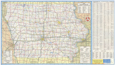
Official highway map of Iowa 1950 side 1
1950
Map of the state of Iowa showcasing counties, cities, rivers, highways, and roads. To the left of the map is a population index of cities and villages in Iowa. Below the map is a list of points of interest. Side one.
-

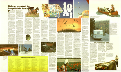
Official highway map of Iowa 1950 side 2
1950
Various images and illustrations of Iowa with "Iowa The Nation's Magic Garden" written at top. To the right of the page is the cover image for the map. Side two.
-

Official AAA road map of Iowa 1949 side 1
1949
Map of the state of Iowa featuring counties, cities, highways, roads, rivers, and landmarks. To the left of the map is the cover image and advertisements. Side one.
-

Official AAA road map of Iowa 1949 side 2
1949
Hotels inns resorts, toll facilities, advertisements, and an index to cities and villages in Iowa on the left side. A milage chart, expanded city maps, and a landmark map of Iowa to the right. Side two.
-
")
Davenport Quadrangle by USGS 1949 side 1
1949
Topographical map of the area around Davenport, Iowa showcasing cities, roads, railroads, elevations, rivers, landmarks, and unmarked area. Side one.
-
")
Davenport Quadrangle by USGS 1949 side 2
1949
An essay on the topographic mapping being done by the United States Geological Survey. A legend of standard symbols is at the bottom of the page. Side two.
-
")
Silvis Quadrangle by USGS 1949
1949
Topographical map of the area around Silvis, Iowa showcasing cities, roads, railroads, elevations, rivers, landmarks, and unmarked area.
-
")
Wayland Quadrangle by USGS 1949
1949
Topographical map of the area around Wayland, Iowa showcasing townships, cities, roads, railroads, elevations, rivers, and landmarks.
-

Iowa highway map 1949 side 1
1949
Map of the state of Iowa showcasing counties, cities, rivers, highways, and roads. Below the map are cover images for the map. Side one.
-

Iowa highway map 1949 side 2
1949
Photographs and illustrations of Iowa shaped like a heart in the middle of the page. Surrounding the heart are an index of cities and towns in Iowa and various paragraphs of text related to Iowa. Side two.
-
")
Muscatine Quadrangle by USGS 1948
1948
Topographical map of the area around Muscatine, Iowa showcasing cities, roads, elevations, rivers, landmarks, and unsurveyed area.
-

Mineral resources of Iowa 1947 by H. Garland Hershey
1947
Map of the state of Iowa featuring counties, cities, rivers, pipelines, mineral deposits, and other natural features. Different mineral deposits are highlighted different colors.
-

Official AAA road map of Iowa 1947 side 1
1947
Map of the state of Iowa featuring counties, cities, highways, roads, rivers, and landmarks. To the left of the map is the cover image and advertisements. Side one.
-

Official AAA road map of Iowa 1947 side 2
1947
Hotels inns resorts, bridges ferries, advertisements, a milage chart, and expanded city maps on the left side. An index to cities and villages in Iowa to the right. Side two.
-

Hammonds highway and railway map of Iowa 1947
1947
Map of the state of Iowa showcasing counties, cities, rivers, landmarks, roads, and railroads. Roads are marked in red, railroads are marked in blue. To the left of the map is an index of counties, cities, and towns.
-

Official Hearne Bros. polyconic projection map of greater Cedar Rapids 1947 side 1
1947
Map of Cedar Rapids and surrounding area showcasing streets, railroads, rivers, and landmarks. Different towns are outlined in red. Above the map are smaller expanded county maps. Side one.
-

Official Hearne Bros. polyconic projection map of greater Cedar Rapids 1947 side 2
1947
Street directory for Cedar Rapids and other towns in the area. Side two.
-

Highway map of Iowa 1947 side 1
1947
Map of the state of Iowa showcasing counties, cities, rivers, highways, and roads. Below the map is an index of cities and villages in Iowa. To the right of the map is an index of Iowa counties. Side one.
-

Highway map of Iowa 1947 side 2
1947
Cover image for the map, expanded city road maps, and a transcontinental milage chart to the left of the page. To the right, a highway map for the United States of America. Side two.
-

Iowa highway map 1947 side 1
1947
Map of the state of Iowa showcasing counties, cities, rivers, highways, and roads. Below the map are cover images for the map. Side one.
-

Iowa highway map 1947 side 2
1947
Photographs of Iowa on the top of the page. Bottom of page has an index of cities and towns in Iowa and various paragraphs of text related to Iowa. Side two.
-

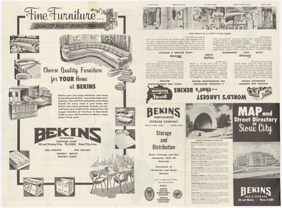
Metropolitan Sioux City 1947 by Journal Tribune Publishing
1947
Map of Sioux City showcasing streets, rivers, and landmarks. Concentric circles are overlaid on the map showing the distance in miles from the Journal-Tribune location. Below the map is a street directory.
-

Iowa by Socony-Vacuum Oil Co. 1947 side 1
1947
Map of the state of Iowa showcasing counties, cities, rivers, highways, and roads. Interstate highways are marked in red. Below the map is an index of towns in Iowa. Side one.
-

Iowa by Socony-Vacuum Oil Co. 1947 side 2
1947
Expanded road map of the midwest region with the state of Iowa outlined in red at the top of the page. Bottom of the page has the cover image for the map and various expanded city road maps. Side two.
-

World around Alaska 1946
1946
Map of the world showcasing continents, oceans, and cities. The map is centered on Alaska. Below the map are paragraphs of information about maps.
-

World around Australia 1946
1946
Map of the world showcasing continents, oceans, and cities. The map is centered on Australia. Below the map are paragraphs of information about maps.
-

World around China 1946
1946
Map of the world showcasing continents, oceans, and cities. The map is centered on China. Below the map are paragraphs of information about maps.
-

World around Europe 1946
1946
Map of the world showcasing continents, oceans, and cities. The map is centered on Europe. Below the map are paragraphs of information about maps.
-

World around India 1946
1946
Map of the world showcasing continents, oceans, and cities. The map is centered on India. Below the map are paragraphs of information about maps.
-

World around South Africa 1946
1946
Map of the world showcasing continents, oceans, and cities. The map is centered on South Africa. Below the map are paragraphs of information about maps.
-

World around the U.S.S.R. 1946
1946
Map of the world showcasing continents, oceans, and cities. The map is centered on the USSR. Below the map are paragraphs of information about maps.
-

Official AAA road map of Iowa 1946 side 1
1946
Map of the state of Iowa featuring counties, cities, highways, roads, rivers, and landmarks. To the left of the map is the cover image and advertisements. Side one.
-

Official AAA road map of Iowa 1946 side 2
1946
Hotels inns resorts, attractions, parks, hunting fishing, bridges ferries, advertisements, a milage chart, and expanded city maps on the left side. An index to cities and villages in Iowa to the right. Side two.
-

Map of mankind 1946
1946
Map of the world showcasing continents and countries. Different continents are highlighted different colors. Surrounding the map are statues of various ethnicities of people, with a number marking where on the map that ethnicity is indigenous to.
-

Campus Iowa State Teachers College 1946
1946
Map of campus showcasing streets, sidewalks, creeks, buildings, and landmarks. To the right of the map is a building index. To the left of the map is a list of campus changes.
-
")
Wapello Quadrangle by USGS 1946
1946
Topographical map of the area around Wapello, Iowa showcasing cities, roads, elevations, rivers, landmarks, and unsurveyed area.
-

Conoco official road map of Iowa 1946 side 1
1946
Map of the state of Iowa showcasing counties, cities, rivers, highways, and roads. Below the map is an index of cities and towns in Iowa. Side one.
-

Conoco official road map of Iowa 1946 side 2
1946
Expanded city road maps and a cover image for the map titled "Travel Iowa with Conoco" to the bottom right of the page. Side two.
-

Iowa highway map 1946 side 1
1946
Map of the state of Iowa showcasing counties, cities, rivers, highways, and roads. Below the map are cover images for the map. Side one.
-

Iowa highway map 1946 side 2
1946
Photographs of Iowa on the top of the page. Bottom of page has an index of cities and towns in Iowa and various paragraphs of text related to Iowa. Side two.
-

Map of great adventures
1946
Map of the world with various exploration routes, historical events, and fictional story locations marked via text and illustrations.
-

Official AAA road map of Iowa 1945 side 1
1945
Map of the state of Iowa featuring counties, cities, highways, roads, rivers, and landmarks. To the left of the map is the cover image and advertisements. Side one.
-

Official AAA road map of Iowa 1945 side 2
1945
Hotels inns resorts, attractions, parks, hunting fishing, bridges ferries, advertisements, a milage chart, and expanded city maps on the left side. An index to cities and villages in Iowa to the right. Side two.
-

Hearne Bros. polyconic projection map of greater Des Moines 1945 side 1
1945
Map of Des Moines and surrounding area showcasing streets, railroads, rivers, and landmarks. Different towns are outlined in red. Above the map are smaller expanded county maps. Side one.
-

Hearne Bros. polyconic projection map of greater Des Moines 1945 side 2
1945
Street directory for Des Moines and other towns in the area. Side two.
-

Official AAA road map of Iowa 1944 side 1
1944
Map of the state of Iowa featuring counties, cities, highways, roads, rivers, and landmarks. To the left of the map is the cover image and advertisements. Side one.
-

Official AAA road map of Iowa 1944 side 2
1944
Hotels inns resorts, bridges ferries, attractions, parks, hunting fishing, advertisements, a milage chart, and expanded city maps on the left side. An index to cities and villages in Iowa to the right. Side two.
-

Rand McNally polar map of the world 1943 side 1
1943
Map of the world, centered on the North Pole. Different countries are highlighted different colors. Below the map are paragraphs of information regarding air travel. Side one.
-

Rand McNally polar map of the world 1943 side 2
1943
Milage charts for air travel and steamship travel on the top of the page. Paragraphs of information regarding air travel on the bottom of the page. Side two.
-
")
Mystic Quadrangle by USGS 1942
1942
Topographical map of the area around Mystic, Iowa showcasing townships, cities, roads, railroads, elevations, rivers, and landmarks.
-

Official AAA road map of Iowa 1941 side 1
1941
Map of the state of Iowa featuring counties, cities, highways, roads, rivers, and landmarks. To the left of the map is the cover image and advertisements. Side one.
-

Official AAA road map of Iowa 1941 side 2
1941
Hotels inns resorts, principal attractions, bridges ferries, advertisements, a milage chart, and expanded city maps on the left side. An index to cities and villages in Iowa to the right. Side two.
-

Iowa highway map 1941 side 1
1941
Map of the state of Iowa showcasing counties, cities, rivers, highways, and roads. Below the map are cover images for the map. Side one.
-

Iowa highway map 1941 side 2
1941
Paragraphs about Iowa interspersed with photographs of Iowa on the top of the page. Bottom of page has various indexes related to Iowa. Side two.
-
![Aerial survey [Black Hawk County] by Park Aerial Surveys 1941 by United States. Agricultural Adjustment Administration](https://scholarworks.uni.edu/rodmaps/1026/thumbnail.jpg "Aerial survey [Black Hawk County] by Park Aerial Surveys 1941 by United States. Agricultural Adjustment Administration")
Aerial survey [Black Hawk County] by Park Aerial Surveys 1941
1941
Photomosaic map of Black Hawk County, Iowa done for the U.S. Department of Agriculture Agricultural Adjustment Administration by Park Aerial Surveys. Overlapped black and white images create the map.
-
![Agricultural Adjustment Adm. [Black Hawk County] 1941 by United States. Agricultural Adjustment Administration](https://scholarworks.uni.edu/rodmaps/1014/thumbnail.jpg "Agricultural Adjustment Adm. [Black Hawk County] 1941 by United States. Agricultural Adjustment Administration")
Agricultural Adjustment Adm. [Black Hawk County] 1941
1941
Photomosaic map of Black Hawk County, Iowa. Overlapped black and white images create the map.
-

New York by NY State Historical Ass'n. 1940 side 1
1940
Map of New York showcasing cities, rivers, highways, historic sites, natural landmarks, and points of interest. Below the map is a list of points of interest. Side one.
-

New York by NY State Historical Ass'n. 1940 side 2
1940
Expanded city maps showcasing rivers, highways, historic sites, natural landmarks, and points of interest. Below the map is a list of points of interest. Side two.
-

Iowa highway map 1940 side 1
1940
Map of the state of Iowa showcasing counties, cities, rivers, highways, and roads. Below the map are cover images for the map. Side one.
-

Iowa highway map 1940 side 2
1940
Paragraphs about Iowa interspersed with photographs of Iowa on the top of the page. Bottom of page has various indexes related to Iowa. Side two.
-

Official AAA road map of Iowa 1938 side 1
1938
Map of the state of Iowa featuring cities, paved roads, unpaved roads, rivers, and landmarks. To the left of the map is the cover image and advertisements. Side one.
-

Official AAA road map of Iowa 1938 side 2
1938
Recommended hotels, points of interest, expanded city maps, and advertisements on the left side. An index to cities and villages in Iowa to the right. Side two.
-

Iowa highway map 1938 side 1
1938
Map of the state of Iowa showcasing counties, cities, rivers, highways, and roads. Bottom left and right corners show the cover image of the map. Side one.
-

Iowa highway map 1938 side 2
1938
Paragraphs about the Iowa Centennial interspersed with photographs of Iowa on the top of the page. Bottom of page has various indexes related to Iowa. Side two.
-

Official AAA road map of Iowa 1937 side 1
1937
Map of the state of Iowa featuring cities, paved roads, unpaved roads, rivers, and landmarks. To the left of the map is the cover image and advertisements. Side one.
-

Official AAA road map of Iowa 1937 side 2
1937
Recommended hotels, points of interest, expanded city maps, and advertisements on the left side. An index to cities and villages in Iowa to the right. Side two.
-

Iowa highway map 1937 side 1
1937
Map of the state of Iowa showcasing counties, cities, rivers, highways, and roads. Bottom left and right corners show the cover image of the map. Side one.
-

Iowa highway map 1937 side 2
1937
Paragraphs about Iowa interspersed with photographs of Iowa on the top of the page. In the middle of the page are charts of "Where to Go, What to Do". Bottom of page has various indexes related to Iowa. Side two.
-

Origin & destination through traffic Cedar Falls 1937
1937
Map of the major roads in Cedar Falls showing how much origin, destination, and through traffic they receive. The roads are sized relative to the amount of traffic they receive. Background of the map is gray and the ink is white.
-

Vehicular flow Cedar Falls 1937
1937
Street map of Cedar Falls with the streets sized relative to the amount of traffic they receive. Background of the map is gray and the ink is white.
-

Standard Oil Co. 1937 road map side 1
1937
Map of the state of Iowa featuring cities, rivers, highways, roads, and landmarks. Interstate highways are marked in red. Below the map is an index of counties, and cities and towns in Iowa. Side one.
-

Standard Oil Co. 1937 road map side 2
1937
Map of the United States showcasing cities and highways, and an index of national parks and monuments on the top. On the bottom is the map cover, and expanded city road maps. Side two.
-
![Aerial survey [Black Hawk County] by Gatschet 1937 sheet 1 by United States. Agricultural Adjustment Administration](https://scholarworks.uni.edu/rodmaps/1032/thumbnail.jpg "Aerial survey [Black Hawk County] by Gatschet 1937 sheet 1 by United States. Agricultural Adjustment Administration")
Aerial survey [Black Hawk County] by Gatschet 1937 sheet 1
1937
Photomosaic map of Black Hawk County, Iowa done for the U.S. Department of Agriculture Agricultural Adjustment Administration by Gatschet Aerial Surveys. Overlapped black and white images create the map. Sheet one.
-
![Aerial survey [Black Hawk County] by Gatschet 1937 sheet 2 by United States. Agricultural Adjustment Administration](https://scholarworks.uni.edu/rodmaps/1033/thumbnail.jpg "Aerial survey [Black Hawk County] by Gatschet 1937 sheet 2 by United States. Agricultural Adjustment Administration")
Aerial survey [Black Hawk County] by Gatschet 1937 sheet 2
1937
Photomosaic map of Black Hawk County, Iowa done for the U.S. Department of Agriculture Agricultural Adjustment Administration by Gatschet Aerial Surveys. Overlapped black and white images create the map. Sheet two.
-
![Aerial survey [Black Hawk County] by Gatschet 1937 sheet 3 by United States. Agricultural Adjustment Administration](https://scholarworks.uni.edu/rodmaps/1034/thumbnail.jpg "Aerial survey [Black Hawk County] by Gatschet 1937 sheet 3 by United States. Agricultural Adjustment Administration")
Aerial survey [Black Hawk County] by Gatschet 1937 sheet 3
1937
Photomosaic map of Black Hawk County, Iowa done for the U.S. Department of Agriculture Agricultural Adjustment Administration by Gatschet Aerial Surveys. Overlapped black and white images create the map. Sheet three.
-
![Aerial survey [Black Hawk County] by Gatschet 1937 sheet 4 by United States. Agricultural Adjustment Administration](https://scholarworks.uni.edu/rodmaps/1035/thumbnail.jpg "Aerial survey [Black Hawk County] by Gatschet 1937 sheet 4 by United States. Agricultural Adjustment Administration")
Aerial survey [Black Hawk County] by Gatschet 1937 sheet 4
1937
Photomosaic map of Black Hawk County, Iowa done for the U.S. Department of Agriculture Agricultural Adjustment Administration by Gatschet Aerial Surveys. Overlapped black and white images create the map. Sheet four.
-
![Aerial survey [Black Hawk County] by Gatschet 1937 sheet 5 by United States. Agricultural Adjustment Administration](https://scholarworks.uni.edu/rodmaps/1036/thumbnail.jpg "Aerial survey [Black Hawk County] by Gatschet 1937 sheet 5 by United States. Agricultural Adjustment Administration")
Aerial survey [Black Hawk County] by Gatschet 1937 sheet 5
1937
Photomosaic map of Black Hawk County, Iowa done for the U.S. Department of Agriculture Agricultural Adjustment Administration by Gatschet Aerial Surveys. Overlapped black and white images create the map. Sheet five.
-
![Aerial survey [Black Hawk County] by Gatschet 1937 sheet 6 by United States. Agricultural Adjustment Administration](https://scholarworks.uni.edu/rodmaps/1037/thumbnail.jpg "Aerial survey [Black Hawk County] by Gatschet 1937 sheet 6 by United States. Agricultural Adjustment Administration")
Aerial survey [Black Hawk County] by Gatschet 1937 sheet 6
1937
Photomosaic map of Black Hawk County, Iowa done for the U.S. Department of Agriculture Agricultural Adjustment Administration by Gatschet Aerial Surveys. Overlapped black and white images create the map. Sheet six.
-
![Aerial survey [Black Hawk County] by Gatschet 1937 sheet 7 by United States. Agricultural Adjustment Administration](https://scholarworks.uni.edu/rodmaps/1038/thumbnail.jpg "Aerial survey [Black Hawk County] by Gatschet 1937 sheet 7 by United States. Agricultural Adjustment Administration")
Aerial survey [Black Hawk County] by Gatschet 1937 sheet 7
1937
Photomosaic map of Black Hawk County, Iowa done for the U.S. Department of Agriculture Agricultural Adjustment Administration by Gatschet Aerial Surveys. Overlapped black and white images create the map. Sheet seven.
-
![Aerial survey [Black Hawk County] by Gatschet 1937 sheet 8 by United States. Agricultural Adjustment Administration](https://scholarworks.uni.edu/rodmaps/1039/thumbnail.jpg "Aerial survey [Black Hawk County] by Gatschet 1937 sheet 8 by United States. Agricultural Adjustment Administration")
Aerial survey [Black Hawk County] by Gatschet 1937 sheet 8
1937
Photomosaic map of Black Hawk County, Iowa done for the U.S. Department of Agriculture Agricultural Adjustment Administration by Gatschet Aerial Surveys. Overlapped black and white images create the map. Sheet eight.
-
![Aerial survey [Black Hawk County] by Gatschet 1937 sheet 9 by United States. Agricultural Adjustment Administration](https://scholarworks.uni.edu/rodmaps/1040/thumbnail.jpg "Aerial survey [Black Hawk County] by Gatschet 1937 sheet 9 by United States. Agricultural Adjustment Administration")
Aerial survey [Black Hawk County] by Gatschet 1937 sheet 9
1937
Photomosaic map of Black Hawk County, Iowa done for the U.S. Department of Agriculture Agricultural Adjustment Administration by Gatschet Aerial Surveys. Overlapped black and white images create the map. Sheet nine.
-

Traffic flow chart of the United States 1937
1937
Map of the United States featuring states, cities, and highways. The highways are sized relative to the amount of traffic they receive.
-

City of Cedar Falls 1935
1936
Map of Cedar Falls showing streets, railroads, rivers, and landmarks. Background of the map is blue and the ink is white.
-

Official AAA road map of Iowa 1936 side 1
1936
Map of the state of Iowa featuring cities, paved roads, unpaved roads, rivers, and landmarks. To the left of the map is the cover image and advertisements. Side one.
-

Official AAA road map of Iowa 1936 side 2
1936
Recommended hotels, points of interest, expanded city maps, and advertisements on the left side. An index to cities and villages in Iowa to the right. Side two.
-

Official Conoco road map of Iowa 1936 side 1
1936
Map of the state of Iowa featuring cities, rivers, highways, roads, and landmarks. Highways are marked in red. Below the map is an index of cities and towns in Iowa. Side one.
-

Official Conoco road map of Iowa 1936 side 2
1936
Cover image for the "Travel Iowa with Conoco" map in the bottom right of page surrounded by expanded city road maps. Side two.
-

Texaco road map Iowa 1936 side 1
1936
Map of the state of Iowa featuring cities, rivers, highways, roads, and landmarks. Interstate highways are marked in red. Chart of state and federal gasoline taxes below map. Side one.
-

Texaco road map Iowa 1936 side 2
1936
Map of the United States showcasing cities and highways, and an index to Iowa cities and towns on the bottom. On the top is the map cover, expanded city road maps, and a mileage chart. Side two.
-

Sioux City Ia. & vicinity by W. R. Webb 1936
1936
Map of Sioux City showing streets, railroads, rivers, and landmarks. Below the map is a directory of streets.
-

Official AAA road map of Iowa 1935 side 1
1935
Map of the state of Iowa featuring cities, paved roads, unpaved roads, rivers, and landmarks. To the left of the map is the cover image and advertisements. Side one.
-

Official AAA road map of Iowa 1935 side 2
1935
Recommended hotels, points of interest, expanded city maps, and advertisements on the left side. An index to cities and villages in Iowa to the right. Side two.
-

Iowa state highway map 1935 side 1
1935
Map of the state of Iowa showcasing counties, cities, rivers, highways, and roads. Side one.
-

Iowa state highway map 1935 side 2
1935
Cover image of the map in the top left corner surrounded by indexes, including one of cities and towns in Iowa. Bottom of page has paragraphs of information about Iowa along with local photographs. Side two.
-

Official AAA road map of Iowa 1934 side 1
1934
Map of the state of Iowa featuring cities, paved roads, unpaved roads, rivers, and landmarks. Through routes are marked in red. To the left of the map is the cover image and advertisements. Side one.
-

Official AAA road map of Iowa 1934 side 2
1934
Points of interest, expanded city maps, and advertisements on the left side. An index to cities and villages in Iowa to the right. Side two.
-

Official Map of Black Hawk County by American Lithographing 1934
1934
Map of Black Hawk County with townships seperated by green lines, and school and taxing districts seperated by blue lines. Churches, schools, cemeteries, rivers, roads, railroads, and other features depicted via illustrations.
-

Iowa state highway map 1934 side 1
1934
Map of the state of Iowa showcasing counties, cities, rivers, highways, and roads. Side one.
-

Iowa state highway map 1934 side 2
1934
Cover image of the map in the top left corner surrounded by indexes, including one of cities and towns in Iowa. Bottom of page has paragraphs of information about Iowa along with local photographs. Side two.
-

Official AAA road map of Iowa 1933 side 1
1933
Map of the state of Iowa featuring cities, paved roads, unpaved roads, rivers, and landmarks. Through routes are marked in red. To the left of the map is the cover image and advertisements. Side one.
-

Official AAA road map of Iowa 1933 side 2
1933
Points of interest, first aid tips, expanded city maps, and advertisements on the left side. An index to cities and villages in Iowa to the right. Side two.
-

Official road map of Iowa 1932 side 1
5-1-1932
Road map of the state of Iowa featuring paved, graveled, and graded roads, and highways. Around the outline of Iowa are several expanded view of large Iowa cities with more detailed road maps. Front side of map.
-

Official road map of Iowa 1932 side 2
5-1-1932
Left side includes information under the headers: Hotels, Inns, Resorts; Principal Attractions; Parks; Hunting, Fishing; and Bridges, Ferries. It also includes an Iowa Milage Map. Right side lists an 'Index to Cities and Villages Iowa'. Back side of map.
-

Pottawattamie County 1932
1932
Map of Pottawattamie County, Iowa showcasing townships, cities, rivers, and roads.
-

Official map primary road system 1932 side 1
1932
Map of the state of Iowa showcasing counties, cities, rivers, highways, and roads. Surrounding the map are expanded city road maps. Side one.
-

Official map primary road system 1932 side 2
1932
Cover image of the map in the top right corner surrounded by indexes, including one of cities and towns in Iowa. Bottom of page has paragraphs of information about Iowa along with local photographs. Side two.
-

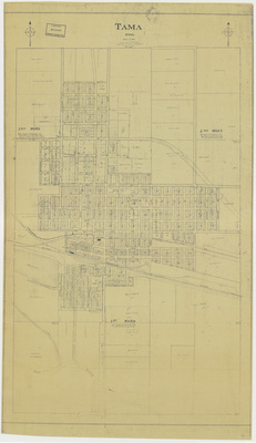
City map of Des Moines 1931 by Hyman's Book Store
1931
Map of Tama showing streets, railroads, rivers, landmarks, and street car lines. Street car lines are marked in red. Below the map is an expanded business district map and index and an index of streets.
-

Cities Service road map 1931 side 1
1931
Map of the state of Iowa featuring cities, paved roads, unpaved roads, rivers, and landmarks. Below the map is an index of towns in Iowa. Side one.
-

Cities Service road map 1931 side 2
1931
Cover image for the map is in the top right corner. Top left of page has a milage chart. Middle of the page has expanded city road maps for Iowa, and the bottom of the page has a road map for the north central United States. Side two.
-

Stacy's industrial & commercial map of Cedar Rapids 1931
1931
Map of Cedar Rapids showing streets, railroads, rivers, landmarks, and business names. To the left of the map is an industrial index and to the right is a street index.
-

Map of Cedar Rapids 1930 by City Engineer's Office
1930
Map of Tama showing streets, railroads, rivers, landmarks, and business names.
-

Official map primary road system 1930 side 1
1930
Map of the state of Iowa featuring counties, cities, rivers, highways, railroads, and landmarks. Major roads are marked in red. Expanded city road maps surround the map. Side one.
-

Official map primary road system 1930 side 2
1930
Cover of the "Iowa Primary Road Map" and indexes of primary roads, cities and towns, state parks, and road laws. Side two.
-

Texaco road map Iowa 1930 side 1
1930
Map of the state of Iowa featuring cities, rivers, highways, roads, and landmarks. Interstate highways are marked in red. Side one.
-

Texaco road map Iowa 1930 side 2
1930
Map of the United States showcasing cities and highways on the left. On the right is the map cover, an index to Iowa cities and towns, expanded city road maps, and a mileage chart. Side two.
-

Iowa City 1929 by College of Engineering
1929
Map of Iowa City showing streets, railroads, rivers, landmarks, and subdivisions. Background of the map is blue and the ink is white.
-

Highway map of Iowa 1929 side 1
1929
Map of the state of Iowa featuring cities, highways, and roads. Surrounding the map are advertisements and information about gas stations and rest stops. Side one.
-

Highway map of Iowa 1929 side 2
1929
The cover image for the "Highway map of Iowa" surrounded by various advertisements. Side two.
-

Des Moines downtown map 1929 c. Nathan Nirenstein
1929
Map of downtown Des Moines showing streets, plats, landmarks, and business names.
-

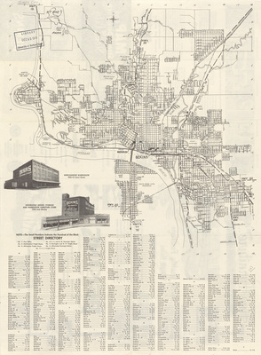
Argus map of Waterloo 1929 side 1
1929
Map of Waterloo showing streets, street car lines, railroads, rivers, landmarks, and wards. To the left and right of the map is an index of streets. Side one.
-

Argus map of Waterloo 1929 side 2
1929
A small map of and index to the Business District, featuring streets, buildings, railroads, and street car lines. Below the map is the cover of the map booklet, "Indexed Map of Waterloo Iowa". Side two.
-

Soil map Crawford County 1928
1928
Map of Crawford County, Iowa showcasing cities, roads, railroads, rivers, landmarks, and soil profiles. Different soil profiles are highlighted different colors.
-

Soil map Sac County 1928
1928
Map of Sac County, Iowa showcasing cities, roads, railroads, rivers, landmarks, and soil profiles. Different soil profiles are highlighted different colors.
-

Iowa primary road system 1928
1928
Map of the state of Iowa featuring counties, cities, and major paved and unpaved roads. Background of map is dark and ink is light yellow.
-

Map of Iowa 1927 by A. J. Christiansen
1927
Map of the state of Iowa showcasing counties, cities, and railroads. Distance between train stations is marked on the map.
-

Soil map Chickasaw County 1927
1927
Map of Chickasaw County, Iowa showcasing cities, roads, railroads, rivers, landmarks, and soil profiles. Different soil profiles are highlighted different colors.
-

Union County Iowa
1927
Map of Union County showing cities, plats, streets, railroads, rivers, and landmarks. There are hand-drawn red lines on the map.
-

Official map primary road system 1926
1926
Map of the state of Iowa showcasing counties, cities, rivers, railroads, and major roadways. Major roadways are highlighted in red. Several expanded city road maps surround the main map.

