Rod Library Maps
Continent
North America
Country
United States
State/Province
Iowa
Description
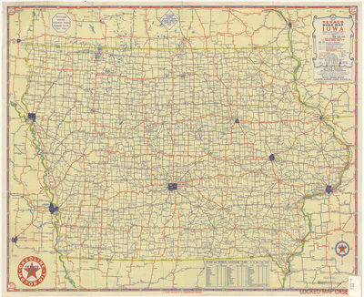
Map of the state of Iowa featuring cities, rivers, highways, roads, and landmarks. Interstate highways are marked in red. Chart of state and federal gasoline taxes below map. Side one.
Publication Date
1936
Publisher
Rand McNally & Co.
City of Publication
Chicago, Ill.
Object Description
1 JPEG file
Scale - Original
1:823,680
Rod Library Maps Subcollection
Iowa Maps
Physical Location
Special Collections & University Archives, Rod Library, University of Northern Iowa
Copyright
©1936 Rand McNally & Co.
Document Type
Map
Language
en
File Format
image/jpeg
Recommended Citation
Rand McNally & Co. and Texaco, "Texaco road map Iowa 1936 side 1" (1936). Rod Library Maps. 845.
https://scholarworks.uni.edu/rodmaps/845
Preview