Rod Library Maps
Continent
North America
Country
United States
State/Province
Iowa
Description
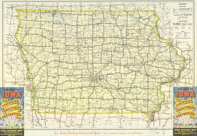
Map of the state of Iowa showcasing counties, cities, rivers, highways, and roads. Bottom left and right corners show the cover image of the map. Side one.
Publication Date
1938
Publisher
American Lithographing & Printing Co.
City of Publication
Des Moines, Iowa
Object Description
1 JPEG file
Rod Library Maps Subcollection
Iowa Maps
Physical Location
Special Collections & University Archives, Rod Library, University of Northern Iowa
Copyright
©1938 Iowa State Highway Commission
Document Type
Map
Language
en
File Format
image/jpeg
Recommended Citation
Iowa State Highway Commission, "Iowa highway map 1938 side 1" (1938). Rod Library Maps. 556.
https://scholarworks.uni.edu/rodmaps/556
Preview