


Rod Library Maps
This collection contains maps owned by the Rod Library at the University of Northern Iowa.
There are three subcollections:
| Iowa Maps | United States Maps | World Maps |
-

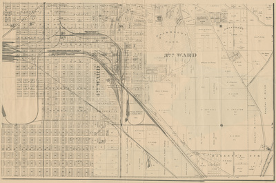
Council Bluffs Railway Grounds
April 2019
Plat map of the 3rd and 4th Ward of Council Bluffs, showing the Chicago Rock Island & Pacific railroad lines going through town.
-

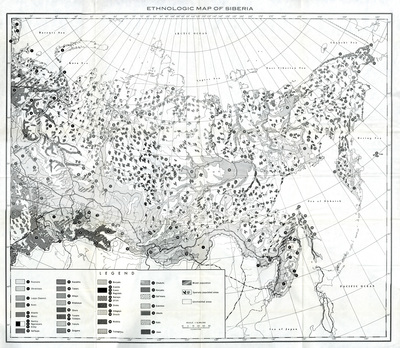
Ethnologic Map of Siberia
April 2019
Map of Siberia with the population of 37 different ethnicities mapped out using different black and white patterns and number markers to differentiate between them.
-

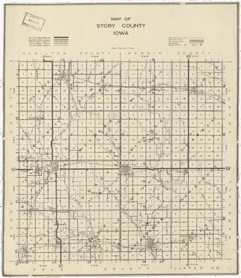
Map of Story County Iowa
April 2019
Map of Story County, Iowa with paved, gravel, and local roads differentiated. Rivers, townships, and railroads are also noted.
-

Map of the half breed Sac & Fox Reservation
April 2019
The Sac and Fox Reservation, with rivers, water features, and township lines marked.
-

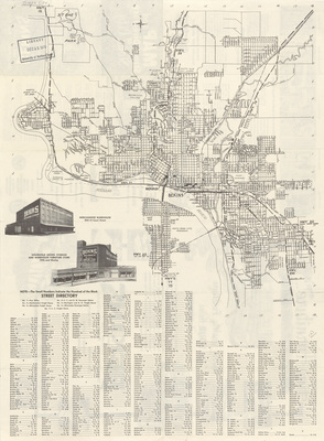
Map & street directory of Sioux City by Bekins side 1
April 2019
Sioux City with all street names and highways labeled. Bottom of the map includes a written Street Directory and two black and white drawings of the Bekins Warehouses. Front side of map.
-

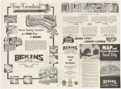
Map & street directory of Sioux City by Bekins side 2
April 2019
Left side is a full page Bekins 'Fine Furniture' ad with black and white drawings of their furniture. The right side has the cover for the "Map and Street Directory of Sioux City" and some points of interest for Sioux City along with two smaller Bekins ads. Back of Map.
-

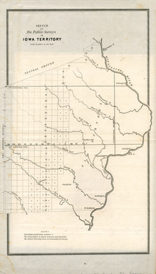
Sketch of the public surveys in Iowa Territory
April 2019
Map of the public surveys of Iowa Territory, featuring townships, subdivided townships, and rivers.
-

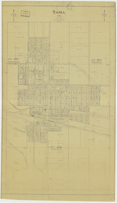
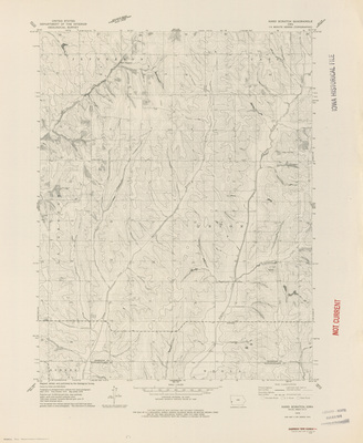
Tama Iowa by F. O. Nelson 1926
April 2019
Plat map of Tama, Iowa showing the wards, streets, railroads, and rivers.
-

Unorganized territory map by A. M. Sea
April 2019
The Iowa District and surrounding territories, with rivers and territory lines featured. Different territory boundaries are highlighted different colors.
-

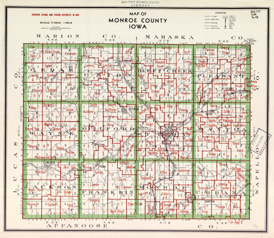
Map of Monroe County Iowa
April 2019
Monroe County, Iowa with townships outlined in green and school and taxing districts outlined in red. Legend includes U.S. Roads, Primary Roads, Trunk Roads, Local Roads, Drainage Ditches, Steam RRs, Electric RRs, District Schools, Churches, Cemeteries, Gravel Pits, Mines, and Quarries.
-

Official map of Tama County by American Lithographing
April 2019
Tama County, Iowa, with townships highlighted in green, and school districts highlighted in red. Railroads, schools, churches, cemeteries, mines, and more are marked via illustrations.
-

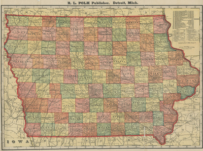
Iowa by R. L. Polk
April 2019
Map of the state of Iowa, showcasing county lines, rivers, railroads, and electric lines. Different counties are highlighted different colors.
-

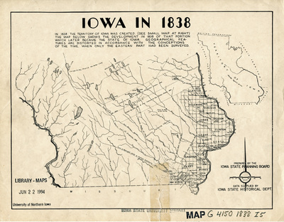
Iowa in 1838
April 2019
Map of the territory of Iowa, showcasing the surveyed eastern part and the unsurveyed western part. Features townships, purchase lines, select landmarks, and rivers.
-

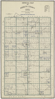
Official map of Kossuth County Iowa
April 2019
Kossuth County, with townships separated by blue lines, and depicting churches, schools, farms, cemeteries, roads, railroads, and other features via illustrations.
-

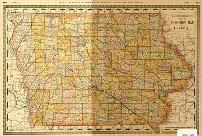
Rand McNallys new township map of Iowa side 1
April 2019
Township map of the state of Iowa, showcasing counties, townships, railroads, and rivers. Front side of map.
-

Rand McNallys new township map of Iowa side 2
April 2019
Indexed lists of Lakes, Rivers, and Towns and Counties in Iowa. Indexed list of towns runs from A to F, and an incomplete list for G.
-

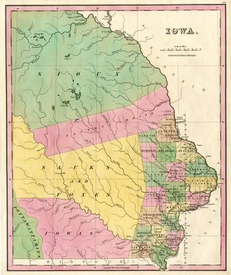
Iowa by H. S. Tanner
April 2019
The territory of Iowa featuring townships, territory lines, railroads, and rivers. Different townships and territories are highlighted different colors.
-

Ocean current map of the world by Cram 1947
April 2019
Map of the world showcasing hemispheres, continents, countries, oceans, and ocean currents. Different countries highlighted different colors.
-

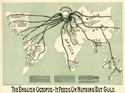
The English Octopus
April 2019
Roughly drawn world map with an octopus over the country of England, and tentacles extending to all the different countries that owe debts to England. The countries that owe debts have their names and amounts of debts listed. Bottom of the map reads, "The English Octopus - It Feeds on Nothing But Gold." and has a small explanatory paragraph.
-

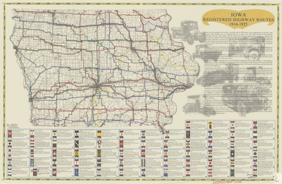
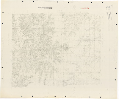
Iowa registered highway routes 1914-1925
1986
The state of Iowa with different highway routes highlighted in different colors. The routes are marked with numbers that correspond to the legend at the bottom of the map. The right hand side of the map includes several paragraphs about the history of highways in Iowa.
-

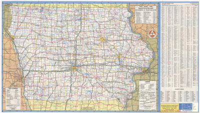
Iowa transportation map 1983 side 1
1983
Transportation map of the state of Iowa showing highways; access points and route markers; mileages; and air, rail and water markers. To the right of the map is an index of cities, villages, and counties. Side one of map.
-

Iowa transportation map 1983 side 2
1983
Includes the cover image for the 'Iowa Transportation Map', along with a milepost chart, an index of state parks and recreation areas, and several expanded city maps of larger Iowa cities. Side two of map.
-

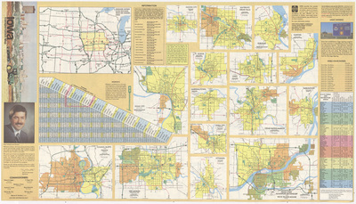
Iowa transportation map 1982 side 1
1982
Transportation map of the state of Iowa showing highways; access points and route markers; mileages; air, rail and water markers; recreation areas; and safety rest areas. To the right of the map is an index of cities, villages, and counties. Side one of map.
-

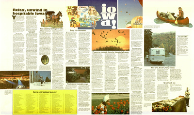
Iowa transportation map 1982 side 2
1982
"Relax, unwind in hospitable Iowa" Several images and illustrations related to Iowa interspersed throughout paragraphs of text related to different Iowa attractions. An 'Iowa Attraction Locater' is listed at the bottom of the page . Side two of map.
-

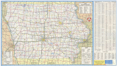
Iowa transportation map 1981-1982 side 1
1981
Transportation map of the state of Iowa showing highways; access points and route markers; mileages; air, rail and water markers; recreation areas; and safety rest areas. To the right of the map is an index of cities, villages, and counties. Side one of map.
-

Iowa transportation map 1981-1982 side 2
1981
Includes the cover image for the 'Iowa Official State Transportation Map', along with a milepost chart, an index of state parks and recreation areas, and several expanded city maps of larger Iowa cities. There is a collage of images related to Iowa attractions. Side two of map.
-

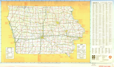
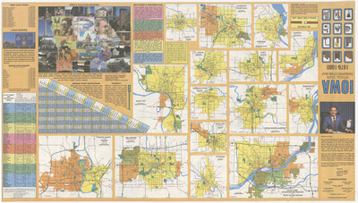
Iowa transportation map 1979-1980 side 1
1979
Map of the state of Iowa showcasing counties, cities, rivers, highways, and roads. Population index of cities and villages in Iowa to the right of the map. Side one.
-

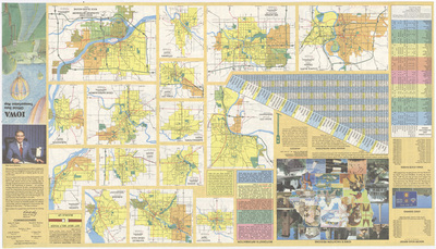
Iowa transportation map 1979-1980 side 2
1979
Various indexes related to Iowa, photographs of Iowa, and a milage chart on the left of the page. In the middle of the page are expanded city road maps. The right of page has the cover image for the map. Side two.
-

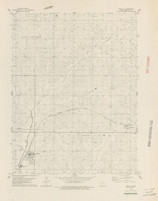
Abingdon topographical map 1978
1978
An advanced copy print of a topographical map of the area around Abingdon, Iowa showcasing rivers, elevations, cities, roads, railroads, and landmarks.
-

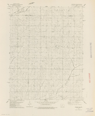
Lockridge W topographical map 1978
1978
An advanced copy print of a topographical map of the area around Lockridge W, Iowa showcasing rivers, elevations, roads, railroads, and landmarks.
-

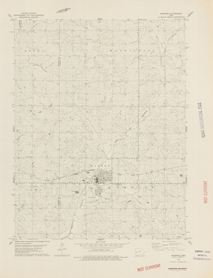
Mount Zion NW topographical map 1978
1978
An advanced copy print of a topographical map of the area around Mount Zion NW, Iowa showcasing rivers, elevations, cities, roads, railroads, and landmarks.
-

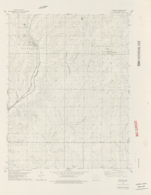
Odebolt West topographical map 1978
1978
An advanced copy print of a topographical map of the area around Odebolt West, Iowa showcasing rivers, elevations, cities, roads, railroads, and landmarks.
-

Ollie topographical map 1978
1978
An advanced copy print of a topographical map of the area around Ollie, Iowa showcasing rivers, elevations, cities, roads, railroads, and landmarks.
-

Ottumwa North NE topographical map 1978
1978
An advanced copy print of a topographical map of the area around Ottumwa North NE, Iowa showcasing rivers, elevations, cities, roads, railroads, and landmarks.
-

Packwood NW topographical map 1978
1978
An advanced copy print of a topographical map of the area around Packwood NW, Iowa showcasing rivers, elevations, cities, roads, railroads, and landmarks.
-

Pleasant Plain NW topographical map 1978
1978
An advanced copy print of a topographical map of the area around Pleasant Plain NW, Iowa showcasing rivers, elevations, cities, roads, railroads, and landmarks.
-

Schaller South topographical map 1978
1978
An advanced copy print of a topographical map of the area around Schaller, Iowa showcasing rivers, elevations, cities, roads, railroads, and landmarks.
-

Scranton topographical map 1978
1978
An advanced copy print of a topographical map of the area around Scranton, Iowa showcasing rivers, elevations, cities, roads, railroads, and landmarks.
-

Wall Lake NE topographical map 1978
1978
An advanced copy print of a topographical map of the area around Wall Lake NE, Iowa showcasing rivers, elevations, cities, roads, railroads, and landmarks.
-

Wall Lake NW topographical map 1978
1978
An advanced copy print of a topographical map of the area around Wall Lake NW, Iowa showcasing rivers, elevations, cities, roads, railroads, and landmarks.
-

Wall Lake SE topographical map 1978
1978
An advanced copy print of a topographical map of the area around Wall Lake SE, Iowa showcasing rivers, elevations, cities, roads, railroads, and landmarks.
-

Wall Lake SW topographical map 1978
1978
An advanced copy print of a topographical map of the area around Wall Lake SW, Iowa showcasing rivers, elevations, cities, roads, railroads, and landmarks.
-
")
Arcadia topographical map 1978
1978
An unedited advanced copy of a topographical map of the area around Arcadia, Iowa showcasing rivers, elevations, cities, roads, railroads, and landmarks.
-
")
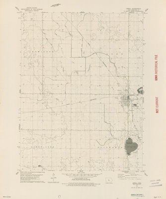
Blairsburg Quadrangle by USGS 1978
1978
Topographical map of the area around Blairsburg, Iowa showcasing townships, cities, roads, railroads, elevations, rivers, and landmarks.
-
![Boyer topographical map [Crawford County] 1978 by Geological Survey (U.S.)](https://scholarworks.uni.edu/rodmaps/1126/thumbnail.jpg "Boyer topographical map [Crawford County] 1978 by Geological Survey (U.S.)")
Boyer topographical map [Crawford County] 1978
1978
An advanced copy print of a topographical map of the area around Boyer, Iowa showcasing rivers, elevations, roads, railroads, and landmarks.
-
")
Breda topographical map 1978
1978
An unedited advanced copy of a topographical map of the area around Breda, Iowa showcasing rivers, elevations, cities, roads, railroads, and landmarks.
-
")
Carroll NE topographical map 1978
1978
An unedited advanced copy of a topographical map of the area around Carroll NE, Iowa showcasing rivers, elevations, cities, roads, railroads, and landmarks.
-
")
Carroll West topographical map 1978
1978
An unedited advanced copy of a topographical map of the area around Carroll, Iowa showcasing rivers, elevations, cities, roads, railroads, and landmarks.
-
")
Carson NE Quadrangle by USGS 1978
1978
Topographical map of the area around Carson NE, Iowa showcasing townships, cities, roads, railroads, elevations, rivers, and landmarks.
-
")
Carson Quadrangle by USGS 1978
1978
Topographical map of the area around Carson, Iowa showcasing townships, cities, roads, railroads, elevations, rivers, and landmarks.
-
")
Clarinda North Quadrangle by USGS 1978
1978
Topographical map of the area around Clarinda North, Iowa showcasing townships, cities, roads, railroads, elevations, rivers, and landmarks.
-
")
Clarion SW Quadrangle by USGS 1978
1978
Topographical map of the area around Clarion SW, Iowa showcasing townships, roads, elevations, rivers, and landmarks.
-
")
Corley Quadrangle by USGS 1978
1978
Topographical map of the area around Corley, Iowa showcasing townships, cities, roads, railroads, elevations, rivers, and landmarks.
-
")
Dows West Quadrangle by USGS 1978
1978
Topographical map of the area around Dows West, Iowa showcasing townships, cities, roads, railroads, elevations, rivers, and landmarks.
-
")
Eagle Grove SW Quadrangle by USGS 1978
1978
Topographical map of the area around Eagle Grove SW, Iowa showcasing townships, roads, railroads, elevations, rivers, and landmarks.
-
")
Elk Horn Quadrangle by USGS 1978
1978
Topographical map of the area around Elk Horn, Iowa showcasing townships, cities, roads, elevations, rivers, and landmarks.
-
")
Ellsworth Quadrangle by USGS 1978
1978
Topographical map of the area around Ellsworth, Iowa showcasing townships, cities, roads, railroads, elevations, rivers, and landmarks.
-
")
Emerson Quadrangle by USGS 1978
1978
Topographical map of the area around Emerson, Iowa showcasing townships, cities, roads, railroads, elevations, rivers, and landmarks.
-
")
Glidden SW topographical map 1978
1978
An unedited advanced copy of a topographical map of the area around Glidden, Iowa showcasing rivers, elevations, cities, roads, railroads, and landmarks.
-
")
Griswold NE Quadrangle by USGS 1978
1978
Topographical map of the area around Griswold NE, Iowa showcasing townships, roads, elevations, rivers, and landmarks.
-
")
Griswold Quadrangle by USGS 1978
1978
Topographical map of the area around Griswold, Iowa showcasing townships, cities, roads, railroads, elevations, rivers, and landmarks.
-
")
Hard Scratch Quadrangle by USGS 1978
1978
Topographical map of the area around Hard Scratch, Iowa showcasing townships, roads, elevations, rivers, and landmarks.
-
")
Harlan Quadrangle by USGS 1978
1978
Topographical map of the area around Harlan, Iowa showcasing townships, cities, roads, railroads, elevations, rivers, and landmarks.
-
")
Holmes Quadrangle by USGS 1978
1978
Topographical map of the area around Holmes, Iowa showcasing townships, roads, railroads, elevations, rivers, and landmarks.
-
")
Imogene Quadrangle by USGS 1978
1978
Topographical map of the area around Imogene, Iowa showcasing townships, cities, roads, railroads, elevations, rivers, and landmarks.
-
")
Irwin Quadrangle by USGS 1978
1978
Topographical map of the area around Irwin, Iowa showcasing townships, cities, roads, railroads, elevations, rivers, and landmarks.
-
")
Jacksonville Quadrangle by USGS 1978
1978
Topographical map of the area around Jacksonville, Iowa showcasing townships, roads, elevations, rivers, and landmarks.
-
")
Jewell Quadrangle by USGS 1978
1978
Topographical map of the area around Jewell, Iowa showcasing townships, cities, roads, railroads, elevations, rivers, and landmarks.
-
")
Lanesboro topographical map 1978
1978
An unedited advanced copy of a topographical map of the area around Lanesboro, Iowa showcasing rivers, elevations, cities, roads, railroads, and landmarks.
-
")
Lohrville topographical map 1978
1978
An unedited advanced copy of a topographical map of the area around Lohrville, Iowa showcasing rivers, elevations, cities, roads, railroads, and landmarks.
-
")
Manilla Quadrangle by USGS 1978
1978
Topographical map of the area around Manilla, Iowa showcasing townships, cities, roads, railroads, elevations, rivers, and landmarks.
-
")
Manning Quadrangle by USGS 1978
1978
Topographical map of the area around Manning, Iowa showcasing townships, cities, roads, railroads, elevations, rivers, and landmarks.
-
")
Manning SE Quadrangle by USGS 1978
1978
Topographical map of the area around Manning SE, Iowa showcasing townships, roads, railroads, elevations, rivers, and landmarks.
-
")
Panama Quadrangle by USGS 1978
1978
Topographical map of the area around Panama, Iowa showcasing townships, cities, roads, railroads, elevations, rivers, and landmarks.
-
")
Persia Quadrangle by USGS 1978
1978
Topographical map of the area around Persia, Iowa showcasing townships, cities, roads, railroads, elevations, rivers, and landmarks.
-
")
Portsmouth Quadrangle by USGS 1978
1978
Topographical map of the area around Portsmouth, Iowa showcasing townships, cities, roads, railroads, elevations, rivers, and landmarks.
-
")
Prairie Rose Lake Quadrangle by USGS 1978
1978
Topographical map of the area around Prairie Rose Lake, Iowa showcasing townships, roads, elevations, rivers, and landmarks.
-
")
Red Oak South Quadrangle by USGS 1978
1978
Topographical map of the area around Red Oak South, Iowa showcasing townships, roads, railroads, elevations, rivers, and landmarks.
-
")
Richard topographical map 1978
1978
An unedited advanced copy of a topographical map of the area around Richard, Iowa showcasing rivers, elevations, cities, roads, railroads, and landmarks.
-
")
Shelby Quadrangle by USGS 1978
1978
Topographical map of the area around Shelby, Iowa showcasing townships, cities, roads, railroads, elevations, rivers, and landmarks.
-
")
Shenandoah East Quadrangle by USGS 1978
1978
Topographical map of the area around Shenandoah East, Iowa showcasing townships, cities, roads, railroads, elevations, rivers, and landmarks.
-
")
Shenandoah West Quadrangle by USGS 1978
1978
Topographical map of the area around Shenandoah West, Iowa showcasing townships, cities, roads, railroads, elevations, rivers, and landmarks.
-
")
Stanton Quadrangle by USGS 1978
1978
Topographical map of the area around Stanton, Iowa showcasing townships, cities, roads, railroads, elevations, rivers, and landmarks.
-
")
Stanton SW Quadrangle by USGS 1978
1978
Topographical map of the area around Stanton SW, Iowa showcasing townships, roads, elevations, rivers, and landmarks.
-
")
Stratford Quadrangle by USGS 1978
1978
Topographical map of the area around Stratford, Iowa showcasing townships, cities, roads, railroads, elevations, rivers, and landmarks.
-
")
Vail NE topographical map 1978
1978
An advanced copy print of a topographical map of the area around Vail, Iowa showcasing rivers, elevations, roads, and landmarks.
-
")
Vail topographical map 1978
1978
An advanced copy print of a topographical map of the area around Vail, Iowa showcasing rivers, elevations, cities, roads, railroads, and landmarks.
-
")
Wales Quadrangle by USGS 1978
1978
Topographical map of the area around Wales, Iowa showcasing townships, roads, railroads, elevations, rivers, and landmarks.
-
")
Wallin Quadrangle by USGS 1978
1978
Topographical map of the area around Wallin, Iowa showcasing townships, roads, elevations, rivers, and landmarks.
-
")
Webster City Quadrangle by USGS 1978
1978
Topographical map of the area around Webster City, Iowa showcasing townships, cities, roads, railroads, elevations, rivers, and landmarks.
-
")
Wightman topographical map 1978
1978
An unedited advanced copy of a topographical map of the area around Wightman, Iowa showcasing rivers, elevations, roads, railroads, and landmarks.
-
")
Williams Quadrangle by USGS 1978
1978
Topographical map of the area around Williams, Iowa showcasing townships, cities, roads, railroads, elevations, rivers, and landmarks.
-
")
Woodbine Quadrangle by USGS 1978
1978
Topographical map of the area around Woodbine, Iowa showcasing townships, cities, roads, railroads, elevations, rivers, and landmarks.
-
")
Woolstock Quadrangle by USGS 1978
1978
Topographical map of the area around Woolstock, Iowa showcasing townships, cities, roads, railroads, elevations, rivers, and landmarks.
-

Ackley NW topographical map 1977
1977
An advanced copy print of a topographical map of the area around Ackley NW, Iowa showcasing rivers, elevations, cities, roads, railroads, and landmarks.
-

Ackley SW topographical map 1977
1977
An advanced copy print of a topographical map of the area around Ackley SW, Iowa showcasing rivers, elevations, cities, roads, railroads, and landmarks.
-

Eldora NE topographical map 1977
1977
An advanced copy print of a topographical map of the area around Eldora NE, Iowa showcasing rivers, elevations, roads, railroads, and landmarks.
-

Eldora NW topographical map 1977
1977
An advanced copy print of a topographical map of the area around Eldora NW, Iowa showcasing rivers, elevations, roads, railroads, and landmarks.
-

Eldora SE topographical map 1977
1977
An advanced copy print of a topographical map of the area around Eldora SE, Iowa showcasing rivers, elevations, cities, roads, railroads, and landmarks.
-

Grant City topographical map 1977
1977
An advanced copy print of a topographical map of the area around Grant City, Iowa showcasing rivers, elevations, cities, roads, railroads, and landmarks.
-

Grundy Center NW topographical map 1977
1977
An advanced copy print of a topographical map of the area around Grundy Center NW, Iowa showcasing rivers, elevations, cities, roads, railroads, and landmarks.
-

Grundy Center SW topographical map 1977
1977
An advanced copy print of a topographical map of the area around Grundy Center SW, Iowa showcasing rivers, elevations, roads, railroads, and landmarks.
-

Popejoy NW topographical map 1977
1977
An advanced copy print of a topographical map of the area around Popejoy NW, Iowa showcasing rivers, elevations, cities, roads, railroads, and landmarks.
-

Popejoy SE topographical map 1977
1977
An advanced copy print of a topographical map of the area around Popejoy SE, Iowa showcasing rivers, elevations, cities, roads, railroads, and landmarks.
-

Radcliffe NE topographical map 1977
1977
An advanced copy print of a topographical map of the area around Radcliffe NE, Iowa showcasing rivers, elevations, cities, roads, railroads, and landmarks.
-

Radcliffe NW topographical map 1977
1977
An advanced copy print of a topographical map of the area around Radcliffe NW, Iowa showcasing rivers, elevations, roads, and landmarks.
-

Radcliffe SE topographical map 1977
1977
An advanced copy print of a topographical map of the area around Radcliffe SE, Iowa showcasing rivers, elevations, cities, roads, railroads, and landmarks.
-

Radcliffe SW topographical map 1977
1977
An advanced copy print of a topographical map of the area around Radcliffe SW, Iowa showcasing rivers, elevations, cities, roads, railroads, and landmarks.
-

Sac City East topographical map 1977
1977
An advanced copy print of a topographical map of the area around Sac City East, Iowa showcasing rivers, elevations, cities, roads, railroads, and landmarks.
-
")
Carroll East topographical map 1977
1977
An unedited advanced copy of a topographical map of the area around Carroll, Iowa showcasing rivers, elevations, cities, roads, railroads, and landmarks.
-
")
Lake City topographical map 1977
1977
An unedited advanced copy of a topographical map of the area around Lake City, Iowa showcasing rivers, elevations, cities, roads, railroads, and landmarks.
-
")
Lytton topographical map 1977
1977
An unedited advanced copy of a topographical map of the area around Lytton, Iowa showcasing rivers, elevations, cities, roads, railroads, and landmarks.
-
")
Parkersburg NE topographical map 1977
1977
An unedited advanced copy of a topographical map of the area around Parkersburg NE, Iowa showcasing rivers, elevations, cities, roads, railroads, and landmarks.
-
")
Parkersburg NW topographical map 1977
1977
An unedited advanced copy of a topographical map of the area around Parkersburg NW, Iowa showcasing rivers, elevations, cities, roads, railroads, and landmarks.
-
")
Rockwell City topographical map 1977
1977
An unedited advanced copy of a topographical map of the area around Rockwell City, Iowa showcasing rivers, elevations, cities, roads, railroads, and landmarks.
-
")
Yetter topographical map 1977
1977
An unedited advanced copy of a topographical map of the area around Yetter, Iowa showcasing rivers, elevations, cities, roads, railroads, and landmarks.
-

Ackley NE topographical map 1976
1976
An advanced copy print of a topographical map of the area around Ackley NE, Iowa showcasing rivers, elevations, roads, railroads, and landmarks.
-

Ackley SE topographical map 1976
1976
An advanced copy print of a topographical map of the area around Ackley SE, Iowa showcasing rivers, elevations, cities, roads, railroads, and landmarks.
-

Eagle Grove NW topographical map 1976
1976
An advanced copy print of a topographical map of the area around Eagle Grove NW, Iowa showcasing rivers, elevations, cities, roads, railroads, and landmarks.
-

Eldora SW topographical map 1976
1976
An advanced copy print of a topographical map of the area around Eldora SW, Iowa showcasing rivers, elevations, cities, roads, railroads, and landmarks.
-

Fort Dodge SW topographical map 1976
1976
An advanced copy print of a topographical map of the area around Fort Dodge SW, Iowa showcasing rivers, elevations, cities, roads, railroads, and landmarks.
-

Grundy Center NE topographical map 1976
1976
An advanced copy print of a topographical map of the area around Grundy Center NE, Iowa showcasing rivers, elevations, cities, roads, railroads, and landmarks.
-

Grundy Center SE topographical map 1976
1976
An advanced copy print of a topographical map of the area around Grundy Center SE, Iowa showcasing rivers, elevations, cities, roads, railroads, and landmarks.
-

Popejoy NE topographical map 1976
1976
An advanced copy print of a topographical map of the area around Popejoy NE, Iowa showcasing rivers, elevations, cities, roads, railroads, and landmarks.
-

Popejoy SW topographical map 1976
1976
An advanced copy print of a topographical map of the area around Popejoy SW, Iowa showcasing rivers, elevations, cities, roads, railroads, and landmarks.
-
")
Lowden Quadrangle by USGS 1976
1976
Topographical map of the area around Lowden, Iowa showcasing townships, cities, roads, railroads, elevations, rivers, and landmarks.
-
")
Malone Quadrangle by USGS 1976
1976
Topographical map of the area around Malone, Iowa showcasing townships, cities, roads, railroads, elevations, rivers, and landmarks.
-
")
Parkersburg SE topographical map 1976
1976
An unedited advanced copy of a topographical map of the area around Parkersburg, Iowa showcasing rivers, elevations, cities, roads, railroads, and landmarks.
-
")
Parkersburg SW topographical map 1976
1976
An unedited advanced copy of a topographical map of the area around Parkersburg, Iowa showcasing rivers, elevations, cities, roads, railroads, and landmarks.
-
")
Wheatland Quadrangle by USGS 1976
1976
Topographical map of the area around Wheatland, Iowa showcasing townships, cities, roads, railroads, elevations, rivers, and landmarks.
-
")
Bertram Quadrangle by USGS 1975
1975
Topographical map of the area around Bertram, Iowa showcasing townships, cities, roads, railroads, elevations, rivers, and landmarks.
-
")
Cedar Rapids North Quadrangle by USGS 1975
1975
Topographical map of the area around Cedar Rapids North, Iowa showcasing townships, cities, roads, railroads, elevations, rivers, and landmarks.
-
")
Dixon Quadrangle by USGS 1975
1975
Topographical map of the area around Dixon, Iowa showcasing townships, cities, roads, railroads, elevations, rivers, and landmarks.
-
")
Marion Quadrangle by USGS 1975
1975
Topographical map of the area around Marion, Iowa showcasing townships, cities, roads, railroads, elevations, rivers, and landmarks.
-
")
McCausland Quadrangle by USGS 1975
1975
Topographical map of the area around McCausland, Iowa showcasing townships, cities, roads, elevations, rivers, and landmarks.
-
")
Omaha North Quadrangle by USGS 1975
1975
Topographical map of the area around Omaha, Nebraska showcasing townships, cities, roads, railroads, elevations, rivers, and landmarks.
-
")
Omaha South Quadrangle by USGS 1975
1975
Topographical map of the area around Omaha South, Nebraska showcasing townships, cities, roads, railroads, elevations, rivers, and landmarks.
-

Official highway map of Iowa 1975 side 1
1975
Map of the state of Iowa showcasing counties, cities, rivers, highways, and roads. To the left of the map is the cover image. Below the map is a population index of cities and villages in Iowa. Side one.
-

Official highway map of Iowa 1975 side 2
1975
Various indexes related to Iowa and a milage chart on the left of the page. The right of page has expanded city road maps placed within an outline of the state of Iowa. Side two.
-
![Aerial survey [Black Hawk County] by Walker and Assoc. 1974 by United States. Soil Conservation Service](https://scholarworks.uni.edu/rodmaps/1028/thumbnail.jpg "Aerial survey [Black Hawk County] by Walker and Assoc. 1974 by United States. Soil Conservation Service")
Aerial survey [Black Hawk County] by Walker and Assoc. 1974
1974
Photomosaic map of Black Hawk County, Iowa done for the United States Department of Agriculture, Soil Conservation Service by Walker & Associates. Overlapped black and white images create the map.
-
![Soil conservation aerial mosaic [Black Hawk County] 1974 by United States. Soil Conservation Service](https://scholarworks.uni.edu/rodmaps/1020/thumbnail.jpg "Soil conservation aerial mosaic [Black Hawk County] 1974 by United States. Soil Conservation Service")
Soil conservation aerial mosaic [Black Hawk County] 1974
1974
Photomosaic map of Black Hawk County, Iowa. Overlapped black and white images create the map.
-

City of Marshalltown by City Engineer's Office 1973
1973
Map of Marshalltown showing streets, railroads, rivers, and landmarks. The map shows wards and precincts.
-
")
Independence Quadrangle by USGS 1973
1973
Topographical map of the area around Independence, Iowa showcasing townships, cities, roads, railroads, elevations, rivers, and landmarks.
-
")
Quasqueton Quadrangle by USGS 1973
1973
Topographical map of the area around Quasqueton, Iowa showcasing townships, cities, roads, railroads, elevations, rivers, and landmarks.
-
")
Walker Quadrangle by USGS 1973
1973
Topographical map of the area around Walker, Iowa showcasing townships, cities, roads, railroads, elevations, rivers, and landmarks.
-
")
Winthrop Quadrangle by USGS 1973
1973
Topographical map of the area around Winthrop, Iowa showcasing townships, cities, roads, railroads, elevations, rivers, and landmarks.
-
")
Cedar Falls Quadrangle by USGS 1972
1972
Topographical map of the area around Cedar Falls, Iowa showcasing townships, cities, roads, railroads, elevations, rivers, and landmarks.
-
")
Alpha Quadrangle by USGS 1971
1971
Topographical map of the area around Alpha, Iowa showcasing townships, roads, railroads, elevations, rivers, and landmarks.
-
")
Alvord Quadrangle by USGS 1971
1971
Topographical map of the area around Alvord, Iowa showcasing townships, cities, roads, railroads, elevations, rivers, and landmarks.
-
")
Cherokee North Quadrangle by USGS 1971
1971
Topographical map of the area around Cherokee North, Iowa showcasing townships, cities, roads, railroads, elevations, rivers, and landmarks.
-
")
Doon Quadrangle by USGS 1971
1971
Topographical map of the area around Doon, Iowa showcasing townships, cities, roads, railroads, elevations, rivers, and landmarks.
-
")
George West Quadrangle by USGS 1971
1971
Topographical map of the area around George West, Iowa showcasing townships, cities, roads, railroads, elevations, rivers, and landmarks.
-
")
Gladbrook NE Quadrangle by USGS 1971
1971
Topographical map of the area around Gladbrook NE, Iowa showcasing townships, roads, railroads, elevations, rivers, and landmarks.
-
")
Inwood Quadrangle by USGS 1971
1971
Topographical map of the area around Inwood, Iowa showcasing townships, cities, roads, railroads, elevations, rivers, and landmarks.
-
")
James Quadrangle by USGS 1971
1971
Topographical map of the area around James, Iowa showcasing townships, cities, roads, railroads, elevations, rivers, and landmarks.
-
")
Larchwood Quadrangle by USGS 1971
1971
Topographical map of the area around Larchwood, Iowa showcasing townships, cities, roads, railroads, elevations, rivers, and landmarks.
-
")
Lester Quadrangle by USGS 1971
1971
Topographical map of the area around Lester, Iowa showcasing townships, cities, roads, railroads, elevations, rivers, and landmarks.
-
")
Mapleton SE Quadrangle by USGS 1971
1971
Topographical map of the area around Mapleton SE, Iowa showcasing township, roads, elevations, rivers, and landmarks.
-
")
Paullina Quadrangle by USGS 1971
1971
Topographical map of the area around Paullina, Iowa showcasing townships, cities, roads, railroads, elevations, rivers, and landmarks.
-
")
Rock Rapids Quadrangle by USGS 1971
1971
Topographical map of the area around Rock Rapids, Iowa showcasing townships, cities, roads, railroads, elevations, rivers, and landmarks.
-
")
Sergeant Bluff Quadrangle by USGS 1971
1971
Topographical map of the area around Sergeant Bluff, Iowa showcasing townships, cities, roads, railroads, elevations, rivers, and landmarks.
-
")
Sioux City North Quadrangle by USGS 1971
1971
Topographical map of the area around Sioux City North, Iowa showcasing townships, cities, roads, railroads, elevations, rivers, and landmarks.
-
")
Sioux City South Quadrangle by USGS 1971
1971
Topographical map of the area around Sioux City South, Nebraska showcasing townships, cities, roads, railroads, elevations, rivers, and landmarks.
-
")
Sutherland West Quadrangle by USGS 1971
1971
Topographical map of the area around Sutherland West, Iowa showcasing townships, cities, roads, railroads, elevations, rivers, and landmarks.
-
")
Traer Quadrangle by USGS 1971
1971
Topographical map of the area around Traer, Iowa showcasing townships, cities, roads, railroads, elevations, rivers, and landmarks.
-
")
Zaneta Quadrangle by USGS 1971
1971
Topographical map of the area around Zaneta, Iowa showcasing townships, cities, roads, railroads, elevations, rivers, and landmarks.
-
![General Highway and Transportation Map [Scott County] 1971 by Iowa. Highway Commission](https://scholarworks.uni.edu/rodmaps/1432/thumbnail.jpg "General Highway and Transportation Map [Scott County] 1971 by Iowa. Highway Commission")
General Highway and Transportation Map [Scott County] 1971
1971
Map of Scott County, Iowa showcasing roads, highways, railroads, townships, cities, rivers, buildings, and other landmarks. Surrounding the map are expanded city road maps.
-

Official highway map of Iowa 1971 side 1
1971
Map of the state of Iowa showcasing counties, cities, rivers, highways, and roads. To the left of the map is the cover image. Below the map is a population index of cities and villages in Iowa. Side one.
-

Official highway map of Iowa 1971 side 2
1971
Various indexes related to Iowa and a milage chart on the left of the page. The right of page has expanded city road maps placed within an outline of the state of Iowa. Side two.
-
")
Andalusia Quadrangle by USGS 1970
1970
Topographical map of the area around Andalusia, Illinois showcasing townships, cities, roads, railroads, elevations, rivers, and landmarks.
-
")
Beebeetown Quadrangle by USGS 1970
1970
Topographical map of the area around Beebeetown, Iowa showcasing townships, roads, railroads, elevations, rivers, and landmarks.
-
")
Bennett Quadrangle by USGS 1970
1970
Topographical map of the area around Bennett, Iowa showcasing townships, cities, roads, railroads, elevations, rivers, and landmarks.
-
")
Blencoe Quadrangle by USGS 1970
1970
Topographical map of the area around Blencoe, Iowa showcasing townships, cities, roads, railroads, elevations, rivers, and landmarks.
-
")
Cantril Quadrangle by USGS 1970
1970
Topographical map of the area around Cantril, Iowa showcasing townships, cities, roads, elevations, rivers, and landmarks.
-
")
Columbus Junction Quadrangle by USGS 1970
1970
Topographical map of the area around Columbus Junction, Iowa showcasing townships, cities, roads, railroads, elevations, rivers, and landmarks.
-
")
Cordova Quadrangle by USGS 1970
1970
Topographical map of the area around Cordova, Illinois showcasing townships, cities, roads, railroads, elevations, rivers, and landmarks.
-
")
Cotter Quadrangle by USGS 1970
1970
Topographical map of the area around Cotter, Iowa showcasing townships, cities, roads, railroads, elevations, rivers, and landmarks.
-
")
Davenport East Quadrangle by USGS 1970
1970
Topographical map of the area around Davenport East, Iowa showcasing townships, cities, roads, railroads, elevations, rivers, and landmarks.
-
")
Davenport West Quadrangle by USGS 1970
1970
Topographical map of the area around Davenport West, Iowa showcasing townships, cities, roads, railroads, elevations, rivers, and landmarks.
-
")
Donahue Quadrangle by USGS 1970
1970
Topographical map of the area around Donahue, Iowa showcasing townships, cities, roads, railroads, elevations, rivers, and landmarks.
-
")
Dunnell Quadrangle by USGS 1970
1970
Topographical map of the area around Dunnell, Minnesota showcasing townships, cities, roads, railroads, elevations, rivers, and landmarks.
-
")
Durant Quadrangle by USGS 1970
1970
Topographical map of the area around Durant, Iowa showcasing townships, cities, roads, railroads, elevations, rivers, and landmarks.
-
")
Eldridge Quadrangle by USGS 1970
1970
Topographical map of the area around Eldridge, Iowa showcasing townships, cities, roads, railroads, elevations, rivers, and landmarks.
-
")
Everly Quadrangle by USGS 1970
1970
Topographical map of the area around Everly, Iowa showcasing townships, cities, roads, railroads, elevations, rivers, and landmarks.
-
")
Harris Quadrangle by USGS 1970
1970
Topographical map of the area around Harris, Iowa showcasing townships, cities, roads, railroads, elevations, rivers, and landmarks.
-
")
Hartley Quadrangle by USGS 1970
1970
Topographical map of the area around Hartley, Iowa showcasing townships, cities, roads, railroads, elevations, rivers, and landmarks.
-
")
Hartley SW Quadrangle by USGS 1970
1970
Topographical map of the area around Hartley SW, Iowa showcasing townships, roads, elevations, rivers, and landmarks.
-
")
Illinois City Quadrangle by USGS 1970
1970
Topographical map of the area around Illinois City, Iowa showcasing townships, cities, roads, railroads, elevations, rivers, and landmarks.
-
")
Jackson Quadrangle by USGS 1970
1970
Topographical map of the area around Jackson, Minnesota showcasing townships, cities, roads, railroads, elevations, rivers, and landmarks.
-
")
Lake Park Quadrangle by USGS 1970
1970
Topographical map of the area around Lake Park, Iowa showcasing townships, cities, roads, railroads, elevations, rivers, and landmarks.
-
")
Lake Park SE Quadrangle by USGS 1970
1970
Topographical map of the area around Lake Park SE, Iowa showcasing townships, roads, elevations, rivers, and landmarks.
-
")
Lime City Quadrangle by USGS 1970
1970
Topographical map of the area around Lime City, Iowa showcasing townships, roads, elevations, rivers, and landmarks.
-
")
Little Sioux Quadrangle by USGS 1970
1970
Topographical map of the area around Little Sioux, Iowa showcasing townships, cities, roads, railroads, elevations, rivers, and landmarks.
-
")
Logan Quadrangle by USGS 1970
1970
Topographical map of the area around Logan, Iowa showcasing townships, cities, roads, railroads, elevations, rivers, and landmarks.
-
")
May City Quadrangle by USGS 1970
1970
Topographical map of the area around May City, Iowa showcasing townships, cities, roads, elevations, rivers, and landmarks.
-
")
Milford Quadrangle by USGS 1970
1970
Topographical map of the area around Milford, Iowa showcasing townships, cities, roads, railroads, elevations, rivers, and landmarks.
-
")
Milton Quadrangle by USGS 1970
1970
Topographical map of the area around Milton, Iowa showcasing townships, cities, roads, railroads, elevations, rivers, and landmarks.
-
")
Missouri Valley NW Quadrangle by USGS 1970
1970
Topographical map of the area around Missouri Valley NW, Iowa showcasing townships, cities, roads, elevations, rivers, and landmarks.
-
")
Missouri Valley Quadrangle by USGS 1970
1970
Topographical map of the area around Missouri Valley, Iowa showcasing townships, cities, roads, railroads, elevations, rivers, and landmarks.
-
")
Modale Quadrangle by USGS 1970
1970
Topographical map of the area around Modale, Iowa showcasing townships, cities, roads, railroads, elevations, rivers, and landmarks.
-
")
Mondamin Quadrangle by USGS 1970
1970
Topographical map of the area around Mondamin, Iowa showcasing townships, cities, roads, railroads, elevations, rivers, and landmarks.
-
")
Montpelier Quadrangle by USGS 1970
1970
Topographical map of the area around Montpelier, Illinois showcasing townships, cities, roads, railroads, elevations, rivers, and landmarks.
-
")
Okoboji Quadrangle by USGS 1970
1970
Topographical map of the area around Okoboji, Iowa showcasing townships, cities, roads, railroads, elevations, rivers, and landmarks.
-
")
Port Byron Quadrangle by USGS 1970
1970
Topographical map of the area around Port Byron, Illinois showcasing townships, cities, roads, railroads, elevations, rivers, and landmarks.
-
")
Royal Quadrangle by USGS 1970
1970
Topographical map of the area around Royal, Iowa showcasing townships, cities, roads, railroads, elevations, rivers, and landmarks.
-
")
Silvis Quadrangle by USGS 1970
1970
Topographical map of the area around Silvis, Iowa showcasing townships, cities, roads, railroads, elevations, rivers, and landmarks.
-
")
Spirit Lake Quadrangle by USGS 1970
1970
Topographical map of the area around Spirit Lake, Iowa showcasing townships, cities, roads, railroads, elevations, rivers, and landmarks.
-
")
Spirit Lake SE Quadrangle by USGS 1970
1970
Topographical map of the area around Spirit Lake SE, Iowa showcasing townships, roads, railroads, elevations, rivers, and landmarks.
-
")
Tekamah NW Quadrangle by USGS 1970
1970
Topographical map of the area around Tekamah NW, Nebraska showcasing townships, roads, elevations, rivers, and landmarks.
-
")
Tekamah Quadrangle by USGS 1970
1970
Topographical map of the area around Tekamah, Nebraska showcasing townships, cities, roads, railroads, elevations, rivers, and landmarks.
-
")
Walcott Quadrangle by USGS 1970
1970
Topographical map of the area around Walcott, Iowa showcasing townships, cities, roads, railroads, elevations, rivers, and landmarks.
-
")
Wilton Junction Quadrangle by USGS 1970
1970
Topographical map of the area around Wilton Junction, Iowa showcasing townships, cities, roads, railroads, elevations, rivers, and landmarks.
-
![General Highway and Transportation Map [Pottawattamie County] 1970 by Iowa. Highway Commission](https://scholarworks.uni.edu/rodmaps/1404/thumbnail.jpg "General Highway and Transportation Map [Pottawattamie County] 1970 by Iowa. Highway Commission")
General Highway and Transportation Map [Pottawattamie County] 1970
1970
Map of Pottawattamie County, Iowa showcasing roads, highways, railroads, townships, cities, rivers, buildings, and other landmarks. Surrounding the map are expanded city road maps.
-
![General Highway and Transportation Map [Story County] 1970 by Iowa. Highway Commission](https://scholarworks.uni.edu/rodmaps/1448/thumbnail.jpg "General Highway and Transportation Map [Story County] 1970 by Iowa. Highway Commission")
General Highway and Transportation Map [Story County] 1970
1970
Map of Story County, Iowa showcasing roads, highways, railroads, townships, cities, rivers, buildings, and other landmarks. Surrounding the map are expanded city road maps.
-
![General Highway and Transportation Map [Woodbury County] 1970 by Iowa. Highway Commission](https://scholarworks.uni.edu/rodmaps/1505/thumbnail.jpg "General Highway and Transportation Map [Woodbury County] 1970 by Iowa. Highway Commission")
General Highway and Transportation Map [Woodbury County] 1970
1970
Map of Woodbury County, Iowa showcasing roads, highways, railroads, townships, cities, rivers, buildings, and other landmarks. Surrounding the map are expanded city road maps.
-

Official highway map of Iowa 1970 side 1
1970
Map of the state of Iowa showcasing counties, cities, rivers, highways, and roads. To the left of the map is the cover image. Below the map is a population index of cities and villages in Iowa. Side one.
-

Official highway map of Iowa 1970 side 2
1970
Various indexes related to Iowa and a milage chart on the left of the page. The right of page has expanded city road maps placed within an outline of the state of Iowa. Side two.
-

City of Sioux City Precinct map
1969
Map of Sioux City showing streets, railroads, rivers, landmarks, and precincts. Below the map are an index of streets and an index of polling places.
-
")
Castana Quadrangle by USGS 1969
1969
Topographical map of the area around Castana, Iowa showcasing townships, cities, roads, railroads, elevations, rivers, and landmarks.
-
")
Council Bluffs North Quadrangle by USGS 1969
1969
Topographical map of the area around Council Bluffs North, Iowa showcasing townships, cities, roads, railroads, elevations, rivers, and landmarks.
-
")
Council Bluffs South Quadrangle by USGS 1969
1969
Topographical map of the area around Council Bluffs South, Iowa showcasing townships, cities, roads, railroads, elevations, rivers, and landmarks.
-
")
Danbury Quadrangle by USGS 1969
1969
Topographical map of the area around Danbury, Iowa showcasing townships, cities, roads, railroads, elevations, rivers, and landmarks.
-
")
Loveland Quadrangle by USGS 1969
1969
Topographical map of the area around Loveland, Iowa showcasing townships, cities, roads, railroads, elevations, rivers, and landmarks.
-
")
Mapleton Quadrangle by USGS 1969
1969
Topographical map of the area around Mapleton, Iowa showcasing townships, cities, roads, railroads, elevations, rivers, and landmarks.
-

Elements of a region, the Northern Plains 1969 side 1
1969
Map of the Northern Plains region showing rivers, lakes, mountains, badlands, and other landforms. The right side has written information titled 'Elements of a Region'. Side one.
-

Elements of a region, the Northern Plains 1969 side 2
1969
Various expanded maps, aerial photographs, charts, and paragraphs of text relating to the Northern Plain region. Side two.
-

Iowa City & Coralville by Mid America Publishers
1969
Map of Iowa City and Coralville showing streets, highways, railroads, rivers, and landmarks. To the left of the map is a directory of streets. Advertisements for local businesses surround the map.
-
![Aerial survey advance field sheet [Black Hawk County] by R. J. Kuehl 1969 by United States. Soil Conservation Service](https://scholarworks.uni.edu/rodmaps/1024/thumbnail.jpg "Aerial survey advance field sheet [Black Hawk County] by R. J. Kuehl 1969 by United States. Soil Conservation Service")
Aerial survey advance field sheet [Black Hawk County] by R. J. Kuehl 1969
1969
Aerial photo of Black Hawk County, Iowa flown for the U.S. Soil Conservation Service by R.J. Kuehl. Black and white image.
-
")
Argyle Quadrangle by USGS 1968
1968
Topographical map of the area around Argyle, Iowa showcasing townships, cities, roads, railroads, elevations, rivers, and landmarks.
-
")
Bonaparte Quadrangle by USGS 1968
1968
Topographical map of the area around Bonaparte, Iowa showcasing townships, cities, roads, railroads, elevations, rivers, and landmarks.
-
")
Center Point Quadrangle by USGS 1968
1968
Topographical map of the area around Center Point, Iowa showcasing townships, cities, roads, railroads, elevations, rivers, and landmarks.
-
")
Central City Quadrangle by USGS 1968
1968
Topographical map of the area around Central City, Iowa showcasing townships, cities, roads, railroads, elevations, rivers, and landmarks.
-
")
Croton Quadrangle by USGS 1968
1968
Topographical map of the area around Croton, Missouri showcasing townships, roads, railroads, elevations, rivers, and landmarks.
-
")
Donnellson Quadrangle by USGS 1968
1968
Topographical map of the area around Donnellson, Iowa showcasing townships, cities, roads, railroads, elevations, rivers, and landmarks.
-
")
Ely Quadrangle by USGS 1968
1968
Topographical map of the area around Ely, Iowa showcasing townships, cities, roads, railroads, elevations, rivers, and landmarks.
-
")
Farmington Quadrangle by USGS 1968
1968
Topographical map of the area around Farmington, Iowa showcasing townships, cities, roads, railroads, elevations, rivers, and landmarks.
-
")
Fort Calhoun Quadrangle by USGS 1968
1968
Topographical map of the area around Fort Calhoun, Nebraska showcasing townships, cities, roads, railroads, elevations, rivers, and landmarks.
-
")
Mount Sterling Quadrangle by USGS 1968
1968
Topographical map of the area around Mount Sterling, Missouri showcasing townships, cities, roads, railroads, elevations, rivers, and landmarks.
-
")
Shellsburg Quadrangle by USGS 1968
1968
Topographical map of the area around Shellsburg, Iowa showcasing townships, cities, roads, railroads, elevations, rivers, and landmarks.
-
")
Swisher Quadrangle by USGS 1968
1968
Topographical map of the area around Swisher, Iowa showcasing townships, cities, roads, railroads, elevations, rivers, and landmarks.
-
")
Andover Quadrangle by USGS 1967
1967
Topographical map of the area around Andover, Iowa showcasing townships, cities, roads, elevations, rivers, and landmarks.
-
")
Battle Creek Quadrangle by USGS 1967
1967
Topographical map of the area around Battle Creek, Iowa showcasing townships, cities, roads, railroads, elevations, rivers, and landmarks.
-
")
Cedar Rapids South Quadrangle by USGS 1967
1967
Topographical map of the area around Cedar Rapids South, Iowa showcasing townships, cities, roads, railroads, elevations, rivers, and landmarks.
-
")
Clinton NW Quadrangle by USGS 1967
1967
Topographical map of the area around Clinton NW, Iowa showcasing townships, cities, roads, railroads, elevations, rivers, and landmarks.
-
")
Davenport area topographic map revised 1967
1967
Topographical map of the area around Davenport, Iowa showcasing rivers, elevations, counties, cities, highways, roads, railroads, and landmarks.
-
")
Des Moines NE Quadrangle by USGS 1967
1967
Topographical map of the area around Des Moines NE, Iowa showcasing townships, cities, roads, railroads, elevations, rivers, and landmarks.
-
")
Des Moines NW Quadrangle by USGS 1967
1967
Topographical map of the area around Des Moines NW, Iowa showcasing townships, cities, roads, railroads, elevations, rivers, and landmarks.
-
")
Des Moines SE Quadrangle by USGS 1967
1967
Topographical map of the area around Des Moines SE, Iowa showcasing townships, cities, roads, railroads, elevations, rivers, and landmarks.
-
")
Des Moines SW Quadrangle by USGS 1967
1967
Topographical map of the area around Des Moines SW, Iowa showcasing townships, cities, roads, railroads, elevations, rivers, and landmarks.
-
")
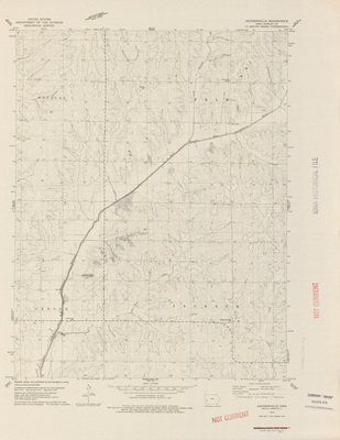
Hills Quadrangle by USGS 1967
1967
Topographical map of the area around Hills, Minnesota showcasing townships, cities, roads, railroads, elevations, rivers, and landmarks.
-
")
Holstein Quadrangle by USGS 1967
1967
Topographical map of the area around Holstein, Iowa showcasing townships, cities, roads, railroads, elevations, rivers, and landmarks.
-
")
Ida Grove NW Quadrangle by USGS 1967
1967
Topographical map of the area around Ida Grove NW, Iowa showcasing townships, roads, railroads, elevations, rivers, and landmarks.
-
")
Ida Grove Quadrangle by USGS 1967
1967
Topographical map of the area around Ida Grove, Iowa showcasing townships, cities, roads, railroads, elevations, rivers, and landmarks.
-
")
Mason City area topographic map by USGS 1967
1967
Topographical map of the area around Mason City, Iowa showcasing rivers, elevations, counties, cities, highways, roads, railroads, and landmarks.
-
")
Savanna Quadrangle by USGS 1967
1967
Topographical map of the area around Savanna, Iowa showcasing townships, cities, roads, railroads, elevations, rivers, and landmarks.
-
")
Waterloo area topographic map by USGS 1967
1967
Topographical map of the area around Waterloo, Iowa showcasing rivers, elevations, counties, cities, highways, roads, railroads, and landmarks.
-
")
Wilmert Lake Quadrangle by USGS 1967
1967
Topographical map of the area around Wilmert Lake, Minnesota showcasing townships, cities, roads, elevations, rivers, and landmarks.
-
![General Highway and Transportation Map [Boone County] 1967 by Iowa. Highway Commission](https://scholarworks.uni.edu/rodmaps/1051/thumbnail.jpg "General Highway and Transportation Map [Boone County] 1967 by Iowa. Highway Commission")
General Highway and Transportation Map [Boone County] 1967
1967
Map of Boone County, Iowa showcasing roads, highways, railroads, townships, cities, rivers, buildings, and other landmarks. Surrounding the map are expanded city road maps.
-

Russell Quadrangle by USGS 1966
1966
Russell Quadrangle, showcasing elevations, rivers, lakes, roads, railroads, counties, townships, and field lines.
-
")
Bernard Quadrangle by USGS 1966
1966
Topographical map of the area around Bernard, Iowa showcasing townships, cities, roads, elevations, rivers, and landmarks.
-
")
Confidence Quadrangle by USGS 1966
1966
Topographical map of the area around Confidence, Iowa showcasing townships, cities, roads, elevations, rivers, and landmarks.
-
")
Dickens Quadrangle by USGS 1966
1966
Topographical map of the area around Dickens, Iowa showcasing townships, cities, roads, railroads, elevations, rivers, and landmarks.
-
")
Fillmore Quadrangle by USGS 1966
1966
Topographical map of the area around Fillmore, Iowa showcasing townships, cities, roads, elevations, rivers, and landmarks.
-
")
Gillett Grove Quadrangle by USGS 1966
1966
Topographical map of the area around Gillett Grove, Iowa showcasing townships, cities, roads, railroads, elevations, rivers, and landmarks.
-
")
Greenville Quadrangle by USGS 1966
1966
Topographical map of the area around Greenville, Iowa showcasing townships, cities, roads, railroads, elevations, rivers, and landmarks.
-
")
Hiattsville Quadrangle by USGS 1966
1966
Topographical map of the area around Hiattsville, Iowa showcasing townships, roads, railroads, elevations, rivers, and landmarks.
-
")
McPaul Quadrangle by USGS 1966
1966
Topographical map of the area around McPaul, Iowa showcasing townships, cities, roads, railroads, elevations, rivers, and landmarks.
-
")
Mystic Quadrangle by USGS 1966
1966
Topographical map of the area around Mystic, Iowa showcasing townships, cities, roads, railroads, elevations, rivers, and landmarks.
-
")
Nebraska City Quadrangle by USGS 1966
1966
Topographical map of the area around Nebraska City, Nebraska showcasing townships, cities, roads, railroads, elevations, rivers, and landmarks.
-
")
Peosta Quadrangle by USGS 1966
1966
Topographical map of the area around Peosta, Iowa showcasing townships, cities, roads, railroads, elevations, rivers, and landmarks.
-
")
Plano Quadrangle by USGS 1966
1966
Topographical map of the area around Plano, Iowa showcasing townships, cities, roads, railroads, elevations, rivers, and landmarks.
-
")
Spencer Quadrangle by USGS 1966
1966
Topographical map of the area around Spencer, Iowa showcasing townships, cities, roads, railroads, elevations, rivers, and landmarks.
-
")
Atalissa Quadrangle by USGS 1965
1965
Topographical map of the area around Atalissa, Iowa showcasing townships, cities, roads, railroads, elevations, rivers, and landmarks.
-
")
Beech Quadrangle by USGS 1965
1965
Topographical map of the area around Beech, Iowa showcasing townships, cities, roads, railroads, elevations, rivers, and landmarks.
-
")
Blairstown Quadrangle by USGS 1965
1965
Topographical map of the area around Blairstown, Iowa showcasing townships, cities, roads, railroads, elevations, rivers, and landmarks.
-
")
Boone East Quadrangle by USGS 1965
1965
Topographical map of the area around Boone, Iowa showcasing townships, cities, roads, railroads, elevations, rivers, and landmarks.
-
")
Cedar Bluff Quadrangle by USGS 1965
1965
Topographical map of the area around Cedar Bluff, Iowa showcasing townships, cities, roads, railroads, elevations, rivers, and landmarks.
-
")
Colfax Quadrangle by USGS 1965
1965
Topographical map of the area around Colfax, Iowa showcasing townships, cities, roads, railroads, elevations, rivers, and landmarks.
-
")
Commerce Quadrangle by USGS 1965
1965
Topographical map of the area around Commerce, Iowa showcasing townships, cities, roads, railroads, elevations, rivers, and landmarks.
-
")
Dallas Center Quadrangle by USGS 1965
1965
Topographical map of the area around Dallas Center, Iowa showcasing townships, cities, roads, railroads, elevations, rivers, and landmarks.
-
")
Delta Quadrangle by USGS 1965
1965
Topographical map of the area around Delta, Iowa showcasing townships, cities, roads, railroads, elevations, rivers, and landmarks.
-
")
Douds Quadrangle by USGS 1965
1965
Topographical map of the area around Douds, Iowa showcasing townships, cities, roads, railroads, elevations, rivers, and landmarks.
-
")
Eldon Quadrangle by USGS 1965
1965
Topographical map of the area around Eldon, Iowa showcasing townships, cities, roads, railroads, elevations, rivers, and landmarks.
-
")
Evanston Quadrangle by USGS 1965
1965
Topographical map of the area around Evanston, Iowa showcasing townships, roads, railroads, elevations, rivers, and landmarks.
-
")
Farnhamville Quadrangle by USGS 1965
1965
Topographical map of the area around Farnhamville, Iowa showcasing townships, cities, roads, railroads, elevations, rivers, and landmarks.
-
")
Fort Dodge South Quadrangle by USGS 1965
1965
Topographical map of the area around Fort Dodge South, Iowa showcasing townships, cities, roads, railroads, elevations, rivers, and landmarks.
-
")
Fraser Quadrangle by USGS 1965
1965
Topographical map of the area around Fraser, Iowa showcasing townships, cities, roads, railroads, elevations, rivers, and landmarks.
-
")
Garden Grove SW Quadrangle by USGS 1965
1965
Topographical map of the area around Garden Grove SW, Iowa showcasing townships, roads, railroads, elevations, rivers, and landmarks.
-
")
Gibson Quadrangle by USGS 1965
1965
Topographical map of the area around Gibson, Iowa showcasing townships, cities, roads, railroads, elevations, rivers, and landmarks.
-
")
Gowrie Quadrangle by USGS 1965
1965
Topographical map of the area around Gowrie, Iowa showcasing townships, cities, roads, railroads, elevations, rivers, and landmarks.
-
")
Granger Quadrangle by USGS 1965
1965
Topographical map of the area around Granger, Iowa showcasing townships, cities, roads, railroads, elevations, rivers, and landmarks.
-
")
Grimes Quadrangle by USGS 1965
1965
Topographical map of the area around Grimes, Iowa showcasing townships, cities, roads, railroads, elevations, rivers, and landmarks.
-
")
Harcourt Quadrangle by USGS 1965
1965
Topographical map of the area around Harcourt, Iowa showcasing townships, cities, roads, railroads, elevations, rivers, and landmarks.
-
")
Harper Quadrangle by USGS 1965
1965
Topographical map of the area around Harper, Iowa showcasing townships, cities, roads, railroads, elevations, rivers, and landmarks.
-
")
Hartford Quadrangle by USGS 1965
1965
Topographical map of the area around Hartford, Iowa showcasing townships, cities, roads, railroads, elevations, rivers, and landmarks.
-
")
Hills Quadrangle by USGS 1965
1965
Topographical map of the area around Hills, Iowa showcasing townships, cities, roads, railroads, elevations, rivers, and landmarks.
-
")
Iowa City West Quadrangle by USGS 1965
1965
Topographical map of the area around Iowa City West, Iowa showcasing townships, cities, roads, railroads, elevations, rivers, and landmarks.
-
")
Keswick Quadrangle by USGS 1965
1965
Topographical map of the area around Keswick, Iowa showcasing townships, cities, roads, railroads, elevations, rivers, and landmarks.
-
")
Knierim Quadrangle by USGS 1965
1965
Topographical map of the area around Knierim, Iowa showcasing townships, cities, roads, railroads, elevations, rivers, and landmarks.
-
")
Knoxville NW Quadrangle by USGS 1965
1965
Topographical map of the area around Knoxvlle NW, Iowa showcasing townships, roads, railroads, elevations, rivers, and landmarks.
