Rod Library Maps
Continent
North America
Country
United States
State/Province
Iowa
Description
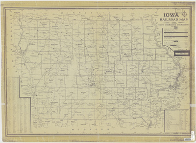
Map of the state of Iowa showcasing counties, cities, rivers, landmarks, and railroads. To the left of the map is a county index.
Publication Date
1964
Publisher
H.W. Schneider & Co.
City of Publication
Ames, Iowa
Object Description
1 JPEG file
Rod Library Maps Subcollection
Iowa Maps
Physical Location
Special Collections & University Archives, Rod Library, University of Northern Iowa
Copyright
©1964 Iowa State Commerce Commission
Document Type
Map
Language
en
File Format
image/jpeg
Recommended Citation
Iowa State Commerce Commission, "Iowa railroad map 1964" (1964). Rod Library Maps. 793.
https://scholarworks.uni.edu/rodmaps/793
Preview