Rod Library Maps
Continent
North America
Country
United States
Description
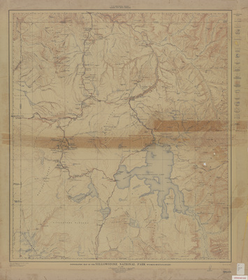
Topographic map of Yellowstone National Park showcasing roads, railroads, rivers, lakes, landmarks, and elevations. Water features marked in blue and elevations marked in red.
Publication Date
1-1912
Publisher
United States Geological Survey
City of Publication
Washington, D.C.?
Object Description
1 JPEG file
Scale - Original
1:250,000
Rod Library Maps Subcollection
United States Maps
Physical Location
Special Collections & University Archives, Rod Library, University of Northern Iowa
Copyright
©1912 U.S. Geological Survey
Document Type
Map
Language
en
File Format
image/jpeg
Recommended Citation
Geological Survey (U.S.), "Topographic map of the Yellowstone Nat'l. Park 1912" (1912). Rod Library Maps. 610.
https://scholarworks.uni.edu/rodmaps/610
Preview