Rod Library Maps
Description
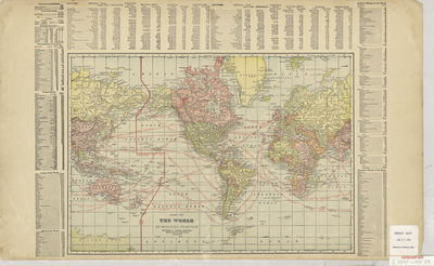
Map of the world with different countries highlighted different colors, and the international date line and sailing routes marked in red. Surrounding the map are various lists of global statistics, and at the top of the page is a world population index.
Publication Date
1905
Publisher
George F. Cram Company
City of Publication
Chicago, Ill.
Object Description
1 JPEG file
Rod Library Maps Subcollection
World Maps
Physical Location
Special Collections & University Archives, Rod Library, University of Northern Iowa
Copyright
©1905
Document Type
Map
Language
en
File Format
image/jpeg
Recommended Citation
"Map of the World 1905" (1905). Rod Library Maps. 419.
https://scholarworks.uni.edu/rodmaps/419
Preview