Rod Library Maps
Continent
North America
Country
United States
State/Province
Iowa
Description
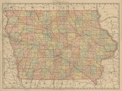
Map of the state of Iowa showcasing counties, cities, rivers, and railroads. Different counties are highlighted different colors.
Publication Date
1889
Publisher
Rand McNally & Co.
City of Publication
Chicago, Ill.
Object Description
1 JPEG file
Rod Library Maps Subcollection
Iowa Maps
Physical Location
Special Collections & University Archives, Rod Library, University of Northern Iowa
Copyright
©1889 Rand McNally & Co.
Document Type
Map
Language
en
File Format
image/jpeg
Recommended Citation
Rand McNally & Co., "Iowa map by Rand McNally" (1889). Rod Library Maps. 799.
https://scholarworks.uni.edu/rodmaps/799
Preview