

World Maps
This collection contains World maps owned by the Rod Library at the University of Northern Iowa.
To go to the Rod Library Maps home page, click here.
-

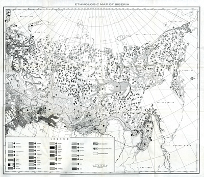
Ethnologic Map of Siberia
April 2019
Map of Siberia with the population of 37 different ethnicities mapped out using different black and white patterns and number markers to differentiate between them.
-

Ocean current map of the world by Cram 1947
April 2019
Map of the world showcasing hemispheres, continents, countries, oceans, and ocean currents. Different countries highlighted different colors.
-

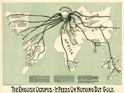
The English Octopus
April 2019
Roughly drawn world map with an octopus over the country of England, and tentacles extending to all the different countries that owe debts to England. The countries that owe debts have their names and amounts of debts listed. Bottom of the map reads, "The English Octopus - It Feeds on Nothing But Gold." and has a small explanatory paragraph.
-

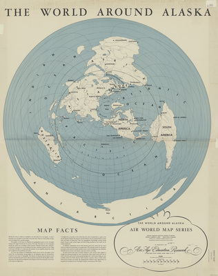
World around Alaska 1946
1946
Map of the world showcasing continents, oceans, and cities. The map is centered on Alaska. Below the map are paragraphs of information about maps.
-

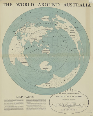
World around Australia 1946
1946
Map of the world showcasing continents, oceans, and cities. The map is centered on Australia. Below the map are paragraphs of information about maps.
-

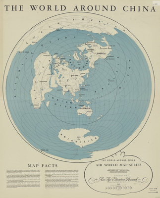
World around China 1946
1946
Map of the world showcasing continents, oceans, and cities. The map is centered on China. Below the map are paragraphs of information about maps.
-

World around Europe 1946
1946
Map of the world showcasing continents, oceans, and cities. The map is centered on Europe. Below the map are paragraphs of information about maps.
-

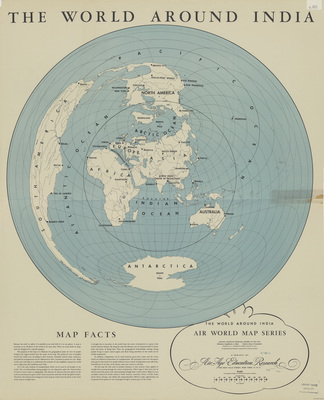
World around India 1946
1946
Map of the world showcasing continents, oceans, and cities. The map is centered on India. Below the map are paragraphs of information about maps.
-

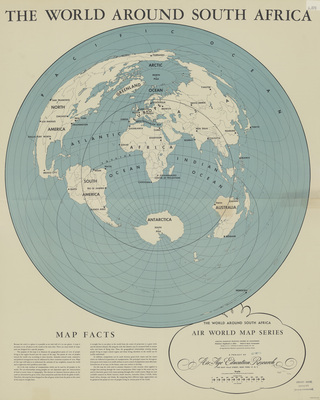
World around South Africa 1946
1946
Map of the world showcasing continents, oceans, and cities. The map is centered on South Africa. Below the map are paragraphs of information about maps.
-

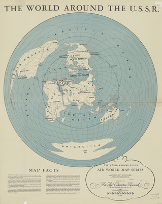
World around the U.S.S.R. 1946
1946
Map of the world showcasing continents, oceans, and cities. The map is centered on the USSR. Below the map are paragraphs of information about maps.
-

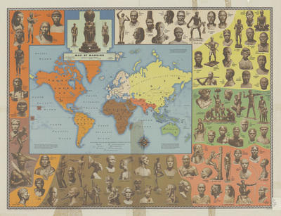
Map of mankind 1946
1946
Map of the world showcasing continents and countries. Different continents are highlighted different colors. Surrounding the map are statues of various ethnicities of people, with a number marking where on the map that ethnicity is indigenous to.
-

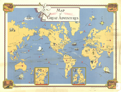
Map of great adventures
1946
Map of the world with various exploration routes, historical events, and fictional story locations marked via text and illustrations.
-

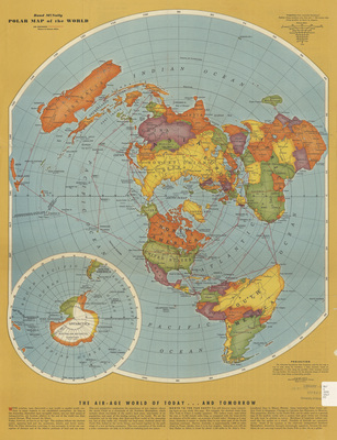
Rand McNally polar map of the world 1943 side 1
1943
Map of the world, centered on the North Pole. Different countries are highlighted different colors. Below the map are paragraphs of information regarding air travel. Side one.
-

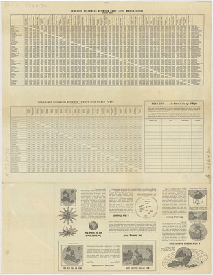
Rand McNally polar map of the world 1943 side 2
1943
Milage charts for air travel and steamship travel on the top of the page. Paragraphs of information regarding air travel on the bottom of the page. Side two.
-

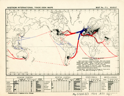
Nystrom international trade desk map wheat 1924
1924
Map of the world showing lines of import in blue, lines of export in red, and regions of productions. Below the map are charts comparing exporting and importing counties.
-

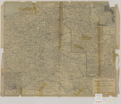
Map of the western theatre of war by A. H. Bumstead 1918
1918
Map of the Western theatre of war showcasing countries, cities, rivers, railroads, and tram lines. To the right of the map is a smaller, expanded view of the map.
-

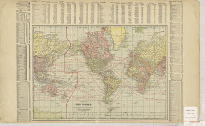
Map of the World 1905
1905
Map of the world with different countries highlighted different colors, and the international date line and sailing routes marked in red. Surrounding the map are various lists of global statistics, and at the top of the page is a world population index.
-

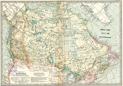
Dominion of Canada and Newfoundland 1902
1902
Map of Canada and Newfoundland showing rivers, provinces, territories, cities, railroads, steamship routes, and submarine cables.
-

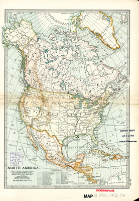
North America 1902
1902
Map of the North American continent showcasing various explorers' routes throughout time. Different countries are highlighted different colors.
-

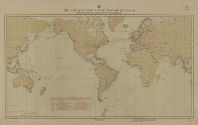
Submarine cable connections of the world 1898
1898
Map of the world with submarine and some overland cables marked in red. Below the map is an index of the countries and companies who own the cables.
-

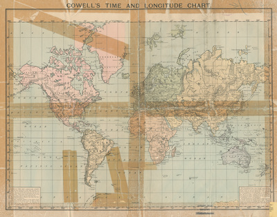
Cowell's time and longitude chart
1893
Map of the world featuring longitudes, information about the meridian line, and the international date line. Each continent is highlighted a different color.
-

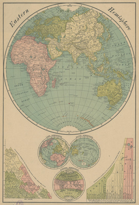
Rand McNally & Co's New Map of the Eastern Hemisphere 1892
1892
Map of the Eastern hemisphere showcasing Africa, Europe, Asia, Australia, and New Zealand. Below the map are smaller maps of the land hemisphere, water hemisphere, temperate zones, elevation chart, and river length chart.
-

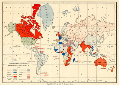
Colonial possessions throughout the World
1890
Map of the world with different counties highlighted different colors based on colonial possession.
-

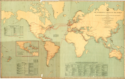
Submarine cables of the world
1889
Map of the world with submarine and some overland cables marked in red. Surrounding the map are telegram and cablegram cost per word charts for several locations around the world.
-

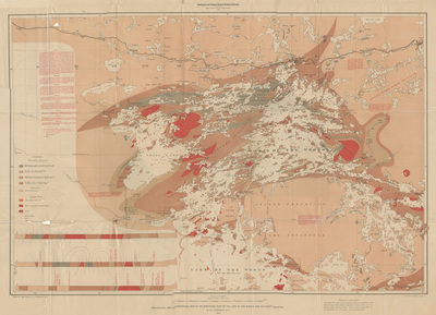
Topographical map of the northern part of the Lake of the Woods by A. C. Lawson 1885
1885
Topographical map of the northern end of Lake of the Woods in Canada showcasing the location of different geological features. The map is surrounded by various notes printed in red ink.
-

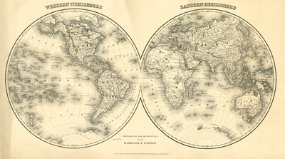
Western and Eastern Hemispheres
1875
Map of the Western and Eastern Hemispheres showcasing oceans, continents, rivers, mountains, countries, and cities.
-

Political, physical & commercial map of the World 1872
1872
World map showcasing the different ocean drainages, different winds and ocean currents, common shipping routes, and port cities.
-

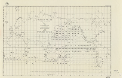
Whale chart 1851
1851
Map of the Oceans with illustrations marking where specific whale breeds are frequently seen, and in what season they're seen there. Continents and some countries labeled on the map.
